Saint-Paul (Vosges)
| Saint-Paul | ||
|---|---|---|
|
|
||
| region | Grand Est | |
| Department | Vosges | |
| Arrondissement | Neufchâteau | |
| Canton | Mirecourt | |
| Community association | Ouest Vosgien | |
| Coordinates | 48 ° 20 ' N , 5 ° 53' E | |
| height | 303-365 m | |
| surface | 4.9 km 2 | |
| Residents | 156 (January 1, 2017) | |
| Population density | 32 inhabitants / km 2 | |
| Post Code | 88170 | |
| INSEE code | 88431 | |
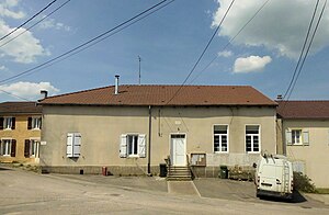
 Mairie Saint-Paul |
||
Saint-Paul is a commune in the French department of Vosges in the Grand Est region (until 2015 Lorraine ). It belongs to the canton of Mirecourt in the Neufchâteau arrondissement . It borders on Rainville to the north, Dommartin-sur-Vraine to the north-east, Morelmaison to the south-east, Viocourt to the south-west and Balléville to the north-west .
Population development
| year | 1962 | 1968 | 1975 | 1982 | 1990 | 1999 | 2008 | 2014 |
|---|---|---|---|---|---|---|---|---|
| Residents | 106 | 101 | 106 | 119 | 123 | 120 | 137 | 141 |

