Ruppes
| Ruppes | ||
|---|---|---|

|
|
|
| region | Grand Est | |
| Department | Vosges | |
| Arrondissement | Neufchâteau | |
| Canton | Neufchâteau | |
| Community association | Ouest Vosgien | |
| Coordinates | 48 ° 28 ' N , 5 ° 46' E | |
| height | 273-313 m | |
| surface | 7.44 km 2 | |
| Residents | 140 (January 1, 2017) | |
| Population density | 19 inhabitants / km 2 | |
| Post Code | 88630 | |
| INSEE code | 88407 | |
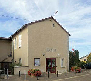
 Mairie Ruppes |
||
Ruppes is a municipality with 140 inhabitants (as of January 1, 2017) in the French department of Vosges in the Grand Est region (until 2015 Lorraine ). It belongs to the canton of Neufchâteau in the Arrondissement of Neufchâteau .
Ruppes borders in the north-west on Clérey-la-Côte , in the north-east on Mont-l'Étroit ( Département Meurthe-et-Moselle ), in the east on Punerot , in the south-east on Martigny-les-Gerbonvaux , in the south on Soulosse-sous-Saint -Élophe and to the west at Jubainville . The residents call themselves the Ruppin (ne) s.
Population development
| year | 1962 | 1968 | 1975 | 1982 | 1990 | 1999 | 2008 | 2014 |
|---|---|---|---|---|---|---|---|---|
| Residents | 191 | 172 | 140 | 121 | 111 | 131 | 126 | 129 |
Attractions
One of the places of interest is the Saint-Gengoult church. The bell tower is partly from the 12th century.
Web links
Commons : Ruppes - collection of images, videos and audio files


