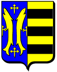
Tollaincourt
| Tollaincourt | ||
|---|---|---|

|
|
|
| region | Grand Est | |
| Department | Vosges | |
| Arrondissement | Neufchâteau | |
| Community association | Vosges Côté Sud Ouest | |
| Coordinates | 48 ° 6 ' N , 5 ° 44' E | |
| height | 333-458 m | |
| surface | 14.13 km 2 | |
| Residents | 127 (January 1, 2017) | |
| Population density | 9 inhabitants / km 2 | |
| Post Code | 88320 | |
| INSEE code | 88475 | |
 Mairie in the west wing of Tollaincourt Castle |
||
Tollaincourt is a French commune with 127 inhabitants (as of January 1, 2017) in the Vosges department in the Grand Est region (until 2015 Lorraine ). It belongs to the Arrondissement Neufchâteau and the municipality association Vosges Côté Sud Ouest . The residents call themselves Tollaincurtien (ne) s .
Population development
| District | former INSEE code |
Area (km²) |
Altitude (m) | Population (Census) | ||||||||||
|---|---|---|---|---|---|---|---|---|---|---|---|---|---|---|
| 1962 | 1968 | 1975 | 1982 | 1990 | 1999 | 2006 | 2008 | 2011 | 2013 | |||||
| Rocourt | 88392 | 1.86 | 336-433 | 60 | 57 | 56 | 51 | 39 | 27 | 23 | 24 | 27 | 27 | |
| Tollaincourt (administrative headquarters) | 88475 | 12.27 | 333-458 | 204 | 173 | 152 | 136 | 129 | 108 | 128 | 121 | 99 | 100 | |
| Tollaincourt | 88475 | 14.13 | 264 | 230 | 208 | 187 | 168 | 135 | 151 | 145 | 126 | 127 | ||
| Sources: Cassini and INSEE | ||||||||||||||
geography
The municipality is located on the upper reaches of the Mouzon River , about 23 kilometers southwest of Vittel . The 14.13 km² large municipal area includes a narrow section of land on the Mouzon bank and two large bulges in the west and south. To the west lies the Bois de l'Artembouchet forest , which borders the Langres plateau , while in the south of the municipality the area extends to the northwestern foothills of the Monts Faucilles . While the village of Tollaincourt is about 370 m above sea level, in the south in the forest Le Chênoi the highest point is reached with 454 m.
Neighboring municipalities of Tollaincourt are Rozières-sur-Mouzon and Rocourt in the north, Villotte in the northeast, Lamarche in the southeast, Romain-aux-Bois in the south, Damblain in the west and Blevaincourt in the northwest.
history
The village of Tollaincourt arose below a mountain spur near a ford on the Mouzon tributary of the Meuse. The history of the village is inextricably linked with that of the castle ( Château de Tollaincourt ). It belonged to the Tillancourt family , who came from the Meuse region. The last lord of the castle, Henry Tillancourt , was arrested and dispossessed during the French Revolution. A short time later he got the castle back and was released, but he left the castle, which had since been plundered. The castle grounds are now partially privately owned. The municipal administration ( Mairie ) is housed in the west wing . To the south of the castle are the remains of the old castle park.
In 1880, together with Lamarche , Tollaincourt got a station on the Nancy - Vézelise - Mirecourt - Contrexéville - Merrey - Chalindrey route (now line 06 of the TER Lorraine transport company ).
On January 1, 2017, the municipality of Rocourt was incorporated.
Attractions
- Church of St. Desiderius ( Église Saint-Didier )
- three lavoirs
Economy and Infrastructure
There are five farms in the community (cereal cultivation, dairy farming).
The D 1 trunk road from Lamarche to Rozières-sur-Mouzon runs through the municipality of Tollaincourt . Seven kilometers northwest of Tollaincourt there is a connection to the A 31 autoroute from Toul to Dijom . Rozières-sur-Mouzon station, three kilometers from Tollaincourt, is on the Merrey – Hymont-Mattaincourt railway .
supporting documents
- ↑ Tollaincourt on cassini.ehess.fr
- ↑ Tollaincourt on insee.fr
- ↑ Histoire à La Révolution du territoire du Saône & Mouzon on si-saonemouzon.com (French)
- ↑ Farms on annuaire-mairie.fr (French)
Web links
- Statistics on cassini.ehess.fr (French)


