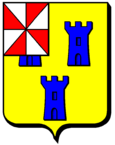
Aboncourt (Meurthe-et-Moselle)
| Aboncourt | ||
|---|---|---|

|
|
|
| region | Grand Est | |
| Department | Meurthe-et-Moselle | |
| Arrondissement | Toul | |
| Canton | My au Saintois | |
| Community association | Pays de Colombey et du Sud Toulois | |
| Coordinates | 48 ° 22 ′ N , 5 ° 58 ′ E | |
| height | 324-476 m | |
| surface | 6.93 km 2 | |
| Residents | 103 (January 1, 2017) | |
| Population density | 15 inhabitants / km 2 | |
| Post Code | 54115 | |
| INSEE code | 54003 | |
| Website | www.aboncourt.mairie54.fr | |
 Saint-Pierre-et-Saint-Paul church |
||
Aboncourt is a French commune with 103 inhabitants (as of January 1, 2017) in the Meurthe-et-Moselle department in the Grand Est region (until 2015 Lorraine ). It belongs to the arrondissement of Toul and the canton of Meine au Saintois ( canton Colombey-les-Belles until 2015 ). The inhabitants are called Aboncourtois .
geography
Aboncourt is on the border with the Vosges department , about ten kilometers south of Colombey-les-Belles , 35 kilometers southeast of Toul and 40 kilometers southwest of Nancy at an altitude between 324 and 476 m above sea level. The municipal area covers 6.93 km².
Neighboring communities are Maconcourt , Repel , Saint-Prancher , Beuvezin , Courcelles , Grimonviller and Chef-Haut .
Population development
| year | 1962 | 1968 | 1975 | 1982 | 1990 | 1999 | 2007 | 2015 |
| Residents | 149 | 133 | 136 | 137 | 120 | 123 | 128 | 104 |
| Source: Cassini and INSEE | ||||||||
Attractions
- Saint-Pierre-et-Saint-Paul church
Web links
Commons : Aboncourt - collection of images, videos and audio files
