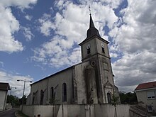
Colombey-les-Belles
| Colombey-les-Belles | ||
|---|---|---|

|
|
|
| region | Grand Est | |
| Department | Meurthe-et-Moselle | |
| Arrondissement | Toul | |
| Canton | My au Saintois | |
| Community association | Pays de Colombey et du Sud Toulois | |
| Coordinates | 48 ° 32 ' N , 5 ° 54' E | |
| height | 282-406 m | |
| surface | 17.59 km 2 | |
| Residents | 1,459 (January 1, 2017) | |
| Population density | 83 inhabitants / km 2 | |
| Post Code | 54170 | |
| INSEE code | 54135 | |
Colombey-les-Belles is a French commune with 1,459 inhabitants (as of January 1, 2017) in the Meurthe-et-Moselle department in the Grand Est region (until 2015 Lorraine ). It belongs to the arrondissement of Toul and until 2015 was the capital of the canton Colombey-les-Belles , since then the municipality has belonged to the canton Meine au Saintois .
geography
The municipality of Colombey-les-Belles is located in the southwest of the Meurthe-et-Moselle department, on the border with the Vosges department , about ten kilometers south of Toul . The A31 autoroute crosses the highway from Nancy to Chaumont here .
Population development
| year | 1962 | 1968 | 1975 | 1982 | 1990 | 1999 | 2007 | 2017 |
| Residents | 685 | 723 | 816 | 949 | 1080 | 1283 | 1367 | 1459 |
Web links
Commons : Colombey-les-Belles - Collection of images, videos and audio files

