Crézilles
| Crézilles | ||
|---|---|---|

|
|
|
| region | Grand Est | |
| Department | Meurthe-et-Moselle | |
| Arrondissement | Toul | |
| Canton | My au Saintois | |
| Community association | Pays de Colombey et du Sud Toulois | |
| Coordinates | 48 ° 35 ' N , 5 ° 53' E | |
| height | 230-288 m | |
| surface | 9.53 km 2 | |
| Residents | 282 (January 1, 2017) | |
| Population density | 30 inhabitants / km 2 | |
| Post Code | 54113 | |
| INSEE code | 54146 | |
| Website | http://www.crezilles.fr/ | |
Crézilles is a French commune with 282 inhabitants (as of January 1, 2017) in the Meurthe-et-Moselle department in Lorraine in the Grand Est region . It belongs to the Arrondissement of Toul and the Canton of Meine au Saintois (until 2015: Canton of Toul-Sud ). The inhabitants are called Crézillois .
geography
Crézilles is about 26 kilometers west-southwest of Nancy and about 14 kilometers south of Toul . Neighboring municipalities of Crézilles are Moutrot in the north, Ochey in the east, Allain in the southeast, Bagneux in the south, Bulligny in the west and Blénod-lès-Toul in the northwest.
Population development
| year | 1962 | 1968 | 1975 | 1982 | 1990 | 1999 | 2006 | 2013 |
| Residents | 221 | 185 | 163 | 166 | 199 | 224 | 276 | 279 |
| Source: Cassini and INSEE | ||||||||
Attractions
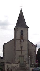
- Saint-Gengoult church from the 18th century
Web links
Commons : Crézilles - collection of images, videos and audio files

