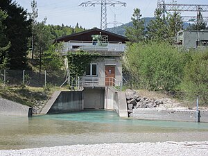
Krün weir
| Krün weir | ||
|---|---|---|
| Krün power station on the Isar weir | ||
| location | ||
|
|
||
| Coordinates | 47 ° 29 '42 " N , 11 ° 16' 43" E | |
| country |
|
|
| place | Krün | |
| Waters | Isar | |
| power plant | ||
| owner | Uniper power plants | |
| Start of operation | 1990 | |
| technology | ||
| Bottleneck performance | 0.2 megawatts | |
| Average height of fall |
5 m | |
| Others | ||
The Krün weir is a weir near Krün , a municipality in the Upper Bavarian district of Garmisch-Partenkirchen .
In Krün, most of the water from the Isar is branched off and fed to the Walchensee via the Isar overpass . This serves as the upper water basin of the Walchensee power plant . On the way to Walchensee, the water also passes the Obernach power station . After the weir was built in 1924, the Isar below the system often suffered from a lack of water. Since 1990 the operator has had to allow a minimum amount of water to flow into the original course of the river (between 3 and 4.8 m³ / s, depending on the season). In order to be able to use the five meter difference in height of the remaining water at the weir, a small hydropower plant was built in 1990 . The plant , which was previously operated by E.ON Wasserkraft and since 2016 by Uniper Kraftwerke GmbH , has a maximum output of 200 kilowatts.
In 2012 a fish ladder with 65 chambers was built for a total of 700,000 euros to make the weir passable for fish.
Individual evidence
- ↑ http://www.kanu-info-isar.de/wasserfuehrung.htm
- ↑ 65 chambers to freedom. Merkur-online.de, November 19, 2012, accessed April 7, 2013 .


