Storey County
 Storey County Courthouse, Virginia City |
|
| administration | |
|---|---|
| US state : | Nevada |
| Administrative headquarters : | Virginia City |
| Foundation : | 1861 |
| Demographics | |
| Residents : | 4010 (2010) |
| Population density : | 5.9 inhabitants / km 2 |
| geography | |
| Total area : | 683 km² |
| Water surface : | 1 km² |
| map | |
| Website : www.storeycounty.org | |
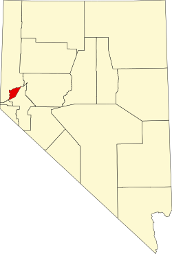
The Storey County is a county in the US state of Nevada . The county seat is Virginia City .
history
The county was founded in 1861 and was named after Captain Edward Fariss Storey , who was killed in one of the " Indian Wars " in 1860 . The county is relatively small because the county area was the most densely populated in Nevada at the time of formation. Virginia City has always been the administrative center. The county would first be named McClellan County after General McClellan .
One place in the county has the status of a National Historic Landmark , the Virginia City Historic District . Twelve buildings and sites in the county are listed in the National Register of Historic Places (as of February 14, 2018).
Demographic data
| growth of population | |||
|---|---|---|---|
| Census | Residents | ± in% | |
| 1870 | 11,359 | - | |
| 1880 | 16,115 | 41.9% | |
| 1890 | 8806 | -45.4% | |
| 1900 | 3673 | -58.3% | |
| 1910 | 3045 | -17.1% | |
| 1920 | 1469 | -51.8% | |
| 1930 | 667 | -54.6% | |
| 1940 | 1216 | 82.3% | |
| 1950 | 671 | -44.8% | |
| 1960 | 568 | -15.4% | |
| 1970 | 695 | 22.4% | |
| 1980 | 1503 | 116.3% | |
| 1990 | 2526 | 68.1% | |
| 2000 | 3399 | 34.6% | |
| 2010 | 4010 | 18% | |
| Before 1900
1900–1990 2000 + 2010 |
|||
As of the 2000 census , the county had 3,399 people. There were 1,462 households and 969 families. The population density was 5 people per square kilometer. The racial the population was composed of 93.00% White, 0.29% African American, 1.44% Native American, 1.00% Asian, 0.15% Pacific Islander, and 1.68% other races Groups; 2.44% from two or more races. Hispanic or Latino of any race was 5.12% percent of the population.
Of the 1,462 households, 21.80% had children and adolescents under the age of 18 living with them. 54.60% were married couples living together, 7.50% were single mothers. 33.70% were not families. 25.60% were single households and 6.90% had someone living there who was 65 years of age or over. The average household size was 2.32 and the average family size was 2.74 people.
For the entire county, the population was 19.70% below the age of 18, 4.70% between 18 and 24, 26.80% between 25 and 44, and 35.70% between 45 and 64 13.10% were 65 years of age or over. The median age was 44 years. For every 100 females there were 107.60 males, and for every 100 females aged 18 and over there were 103.10 males.
The median income for a household in the county is $ 45,490 , and the median income for a family is $ 57,095. Males had a median income of $ 40,123 versus $ 26,417 for females. The per capita income was $ 23,642. 5.80% of the population and 2.50% of families are below the poverty line. 4.20% of them were under 18 years of age and 4.80% were 65 years of age or older.
Places in the county
economy
A large part of the county area belongs to the 433 square kilometer Tahoe Reno Industrial Center , where the Tesla Gigafactory 1 was also located .
prostitution
The county is one of Nevada's 11 counties that allow prostitution and brothel building .
Individual evidence
- ↑ GNIS-ID: 858642. Retrieved on February 22, 2011 (English).
- ↑ Listing of National Historic Landmarks by State: Nevada . National Park Service , accessed February 14, 2018.
- ↑ Search mask database in the National Register Information System. National Park Service , accessed February 14, 2018.
- ↑ US Census Bureau - Census of Population and Housing . Retrieved March 15, 2011
- ↑ Extract from Census.gov . Retrieved February 28, 2011
- ↑ Extract from census.gov (2000 + 2010) Retrieved April 13, 2012
- ^ Extract from the National Register of Historic Places . Retrieved March 13, 2011
Web links
Coordinates: 39 ° 27 ′ N , 119 ° 32 ′ W


