Clark County, Nevada
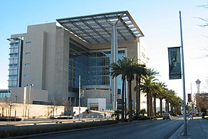
 Lloyd D. George Federal District Courthouse |
|
| administration | |
|---|---|
| US state : | Nevada |
| Administrative headquarters : | Las Vegas |
| Foundation : | February 5, 1908 |
| Demographics | |
| Residents : | 1,951,269 (2010) |
| Population density : | 95.2 inhabitants / km 2 |
| geography | |
| Total area : | 20,955 km² |
| Water surface : | 467 km² |
| map | |
| Website : www.co.clark.nv.us | |
Clark County is a county in the state of Nevada in the United States . It covers the south of the state including the city of Las Vegas , which is the county seat . With 1,951,269 inhabitants (as of 2010), this corresponds to over 72% of all residents of Nevada, Clark County is the most populous county in Nevada.
history
The county has existed since February 5, 1908, when it was separated from Lincoln County . Before Nevada became a state in the 1860s, much of the area belonged to Pah-Ute County in the Arizona Territory . It is named after the politician William A. Clark .
One structure in the county has the status of a National Historic Landmark , the Hoover Dam . 61 buildings and sites in the county are registered in the National Register of Historic Places (as of February 14, 2018).
geography
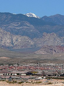
The Colorado River borders the county in the southeast, the river forms Lake Mead through the Hoover Dam on part of the route . Las Vegas is framed by four mountain ranges, of which the Spring Mountains with Mount Charleston in the northwest is the highest at 3633 meters. Unlike the forest-covered Mount Charleston, Clark County consists largely of desert. Creosote bush represents the predominant vegetation, the mountains are otherwise rocky and have little vegetation.
Demographic data
| growth of population | |||
|---|---|---|---|
| Census | Residents | ± in% | |
| 1870 | 1215 | - | |
| 1880 | 1581 | 30.1% | |
| 1890 | 1551 | -1.9% | |
| 1910 | 3321 | - | |
| 1920 | 4859 | 46.3% | |
| 1930 | 8532 | 75.6% | |
| 1940 | 16,414 | 92.4% | |
| 1950 | 48,289 | 194.2% | |
| 1960 | 127.016 | 163% | |
| 1970 | 273.288 | 115.2% | |
| 1980 | 463.087 | 69.5% | |
| 1990 | 741.459 | 60.1% | |
| 2000 | 1,375,765 | 85.5% | |
| 2010 | 1,951,269 | 41.8% | |
| Before 1900
1900–1990 2000 + 2010 |
|||


As of the 2000 census , the county had 1,375,765 people. There were 512,253 households and 339,623 families. The population density was 67 inhabitants per square kilometer. The racial the population was composed of 71.58 percent white, 9.08 percent African American, 0.79 percent Native American, 5.27 percent Asian, 0.47 percent of residents from the Pacific island area and 8.61 percent from other ethnic groups Groups; 4.20 percent were from two or more races. Hispanic or Latino of any race was 21.96 percent of the population.
Of the 512,253 households, 31.7 percent had children and young people under the age of 18 living with them. 48.7 percent were married couples living together, 11.8 percent were single mothers. 33.7 percent were not families. 24.5 percent were single households and 6.7 percent had people aged 65 years or over. The average household size was 2.65 and the average family size was 3.17.
For the entire county, the population was composed of 25.6 percent of residents under 18 years of age, 9.2 percent between 18 and 24 years of age, 32.2 percent between 25 and 44 years of age, 22.3 percent between 45 and 64 years of age 10.7 percent were 65 years of age or over. The median age was 34 years. For every 100 females there were 103.5 males, and for every 100 females aged 18 and over there were 102.8 males.
The median income for a household in the county is $ 44,616 , and the median income for a family is $ 50,485. Males had a median income of $ 35,243 versus $ 27,077 for females. The per capita income was $ 21,785. 10.8 percent of the population and 7.9 percent of families are below the poverty line. These included 14.1 percent of people under the age of 18 and 7.3 percent of people aged 65 and over.
Places in Clark County
Churchill County has five parishes, all of which have city status. For statistical purposes, the US Census Bureau 19 census-designated place , which is subordinate to the county and has no self-government. Like the Unincorporated Communities, this is an unincorporated area.
Census-designated places (CDP)
|
other unincorporated communities
|
prostitution
Clark County (including the city of Las Vegas) is one of the counties in Nevada where brothels and prostitution are prohibited.
Others
Craig Ranch Regional Park is located in North Las Vegas . The Tule Springs Fossil Beds National Monument has existed since 2014 .
Individual evidence
- ↑ GNIS-ID: 863600. Retrieved on February 22, 2011 (English).
- ↑ Listing of National Historic Landmarks by State: Nevada . National Park Service , accessed February 14, 2018.
- ↑ Search mask database in the National Register Information System. National Park Service , accessed February 14, 2018.
- ↑ US Census Bureau - Census of Population and Housing . Retrieved March 15, 2011
- ↑ Extract from Census.gov . Retrieved February 28, 2011
- ↑ Extract from census.gov (2000 + 2010) . Retrieved April 13, 2012
Web links
Coordinates: 36 ° 12 ′ N , 115 ° 1 ′ W

