Tamangur
| Tamangur reserve | ||
|---|---|---|
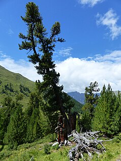
| Arve in God Tamangur. Looking north, down the valley. | ||
|
|
||
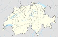
| Location: | Graubünden , Switzerland | |
| Next city: | Scuol | |
| Surface: | 7.8 km² | |
| Length: | 6,200 km | |
| Founding: | 1996 | |
Tamangur (pronunciation tamaŋ'guːr , from Latin A TTEGIA M INICORUM "hut of the miners" or from A TTEGIA M ONACHORUM "hut of the monks" ) is a remote moor and pine forest landscape in the Lower Engadine . The area is of particular importance because of its highest closed stone pine forest in Europe and as a symbol of the persistence of the Rhaeto-Romans in connection with the preservation of culture and language.
location
The Tamangur area is located in the uppermost Val S-charl in the municipality of Scuol in the Lower Engadine. A small proportion in the uppermost area belongs to the former municipality of Valchava and thus since the municipality merger in 2009 to the municipality of Val Müstair .
The area begins at the mouth of the Val Plazèr ( 1994 m above sea level ) and ends with the section Zondra da Tamangur (German: Tamangur-Legföhrenwald ) at the Pass da Costainas ( 2251 m above sea level ), which connects the Engadine with the Val Müstair connects. In the Tamangur area lie the Tamangur Dadora (German: Ausser-Tamangur ), Alp Praditschöl and Tamangur Dadaint (German: Inner-Tamangur ) Alps with the Alp Astra . The Foppa Tamangur (German: Tamangur valley basin ) on the flank of the Piz Starlex towering over the valley ( 3,075 m above sea level ) represents one of the headwaters of the Clemgia .
The Clemgia drains the area towards the Inn and ultimately to the Black Sea .
Picture gallery
Crumbling huts on Alp Tamangur Dadora . In the background left the Lorenziberg , right the Piz Murtera .
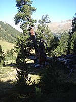
Pine in God Tamangur , with dead wood .
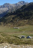
Alp Astra in Tamangur Dadaint , with Clemgia stream. On the left in the background the Piz Plazèr ( 2989 m above sea level ), on the right the Piz Sesvenna , at 3204 m above sea level. M. the highest elevation on the right side of the valley of the Lower Engadine.
nature
The Tamangur area is characterized by a continental climate . The annual rainfall is around 750 mm. A nearby weather station often shows values of −30 ° Celsius in winter.
Protected area moorland
The U-shaped valley is the result of Ice Age glaciers. The valley floor along the meandering Clemgia is heavily muddy and in this form unique in Switzerland.
Smaller moors are already in the uppermost area at the Pass da Costainas , but the most beautiful flat moors , stretching over a length of approx. 2.5 km, are between Alp Astras and the God Praditschöl (German Pradischöl forest ) at approx. 2100 m above sea level M. In the lowest part of the area are Hang Moore that are geared to the stone pine forest.
Since 1996 the Tamangur area has been listed as "Object 265" among the Swiss "Moorlands of Special Beauty and National Importance". The registered area only includes the valley basin up to a maximum of 2440 m above sea level. M. , without the summit areas of the Clemgia valley and without the Foppa Tamangur . On the other hand, not only the moorland along the Clemgia, but also the Swiss stone pine forests belong to the inventory object.
As a registered moorland, Tamangur is protected by the " Rothenthurm Article" (Art. 78 Paragraph 5 BV).
Swiss stone pine forest reserve
The God Tamangur (also God da Tamangur , dt Tamangur forest ) in the central area of Tamangur has a special meaning for the area . It consists mainly of Swiss stone pine , with juniper and larch undergrowth . The extraordinarily dense, closed population of Swiss stone pines close to the tree line makes the forest unique, it is considered to be the highest closed Swiss stone pine forest in Europe. Some Swiss stone pines are up to 800 years old. However, the God Giavagl forest in Val Chamuera (municipality of Zuoz ) also claims the superlative of the highest pine forest in Europe.
The God Tamangur is registered by the Canton Grisons as a forest reserve. The area of 86 hectares is part of the moor reserve and includes the God Tamangur in its length of approx. 1.5 km, from the valley floor to approx. 2300 m above sea level. M. The reserve was established in 2007 and the protection provisions will initially apply until 2057.
The objectives of the natural forest reserve include allowing natural succession of the plant community in the Alpine rose-rich Swiss stone pine forest and securing refuges for animal and plant species that could not thrive with forest management. However, certain human interventions still take place, namely the trail is kept free of fallen wood , and hunting, berry picking and mushrooming are possible under the usual regulations.
In the upper Zondra da Tamangur valley section at the tree line , dense stands of leg pine dominate the vegetation. They are interrupted by alluvial fans, streams and debris cones and turn into moors in the valley floor.
use
Alpine farming
The Tamangur Alps have been cultivated for centuries. The Alp Praditschöl and Alp Astras and Tamangur Dadaint are still used today, while the buildings of the Alp Tamangur Dadora and the Alp d'Astra Dadora have crumbled today.
tourism
Tamangur is a popular hiking and mountain biking area from June to October . The starting point is usually S-charl , the end points are either Lü GR (via Pass da Costainas ) or the Ofen Pass (via Fuorcla Funtana da S-charl ). On foot, the tours require 4 to 6 hours, the level of difficulty is T2 . The hiking trail that leads through God Tamangur runs on the right (eastern) side of the valley, while the road used for alpine farming and by mountain bikers runs on the left (western) side of the valley.
Apart from well-developed hiking trails and the sale of drinks and snacks at Alp Astra, there is no tourist infrastructure in the area.
Use of wood
From the Middle Ages to the 19th century, mining was carried out on the Ofen Pass, in the Val S-charl and in its side valley, the Val Mingèr . The processing of the ore required a lot of wood and coal.
While the forests in the main valley of the Inn and the Rambach were more carefully managed as protective forests, in all the mining areas mentioned, according to today's understanding , the forests were overexploited . This overexploitation had all the more negative consequences as the forest at the tree line needed significantly longer to regenerate than at lower altitudes.
However, this does not seem to have been the case for God Tamangur : It is highly likely that the wood of God Tamangur was neither used for mining in S-charl nor for the salt works in Hall , Austria , but such wood was used up to Plan d ' Immez takes place directly on the lower limit of today's moorland reserve . In 1799, the use of Tamangur wood for the Hall salt pans was officially examined, but rejected because of the high rafting costs.
However, the use of firewood for the various Alps of Tamangur is considered certain.
Importance in culture and language politics
Peider Lansel
Peider Lansel , the Lower Engadine poet and promoter of the Romansh language , compared the dying forest of Tamangur with the Romansh, which had been dwindling since the 19th century, in a famous poem in the Vallader idiom . The God Tamangur is conjured up as a symbol of tenacity, the will to survive and strength. An excerpt from the poem:
Al veider god, chi pac a pac gnit sdrüt
sumeglia zuond eir nos linguach Prüvà,
chi dal vast territori d'üna jà
in usché strets cunfins uoss'es ardüt.
Scha'ls Rumanschs nu fan tuots il dovair lur,
jaraj'a man cun el, sco Tamangur.
German translation:
The old forest, which is gradually falling apart,
is very much like our dear language,
which has been
pushed back from the former, wide space into today's narrowest borders.
If the Rumans do not do all of their duty,
it will be over with her, as with Tamangur.
Linard Bardill
The German-Rhaeto-Romanic songwriter Linard Bardill released a double CD in 1996 with the title Tamangur . The songs use texts by Men Rauch and Peider Lansel, which originated in the Rhaeto-Romanic idiom Vallader in the first half of the 20th century, but also texts by Madlaina Stuppan from the 1980s. Titles include Tamangur , Il bös-ch rumantsch (German: The Romanesque tree ) and Bilantsch rumantsch (German: Romanesque balance sheet ).
Linard Bardill creates a reference to rescue operations in the context of Tamangur / Rhaeto-Romanic language, as they took place in the 1980s, but now takes a less combative and more observant position.
Transit Tamangur
"Transit Tamangur" is a culture and language project of the Lia Rumantscha . It intends to implement traditional values (symbolized with the name part Tamangur ) in a modern form (name part Transit ). In this project framework, Romansh is linked to topics such as school, sport, music and the media.
Leta Semadeni
The Lower Engadine poet Leta Semadeni published the novel Tamangur as her first prose work in 2015 in Rotpunktverlag . It is also Semadeni's first work that she has written exclusively in German. In the story Semadenis, Tamangur symbolizes the place where the protagonist's grandfather disappeared in childhood. Tamangur thus becomes the cipher for the realm of the dead .
Piz Amalia
The summit with the height of 2918 m above sea level. M. between the Piz Mezdi and the Piz d'Astras (approx. 2 km west of the Alp Praditschöl ) was founded in 2004 by the Engadin tourism officials after the Dutch Princess Catharina-Amalia of Orange-Nassau , who was born in 2003 and the Dutch ambassador to Switzerland with the name Piz Amalia .
According to the official nomenclature commission of the canton of Graubünden , such a field name designation is not permitted, and the designation is therefore missing in the maps of the Swiss Federal Office of Topography (as of 2015).
Regardless of this, the name “Piz Amalia” continues to be used: In 2008 the tanker “Columbia”, built in 1993 and operating between Switzerland and the Netherlands, was renamed “Piz Amalia” and in September 2015 Scuol is celebrating a “Piz Amalia Music Festival”.
Web links
Individual evidence
- ↑ Robert von Planta, Andrea Schorta: Rätisches Namenbuch , Volume II, p. 856.
- ↑ Swisstopo , accessed on August 12, 2012.
- ↑ //de.wikipedia.org/w/index.php?title=Wikipedia:Defekte_Weblinks&dwl= http://www.gr.ch/DE/institutionen/verwaltung/bvfd/awn/dokumentenliste_afw/3_4_3_3_015_tamangur_beschrieb.pdf?lang=de Page no longer available ] , search in web archives: [ http://timetravel.mementoweb.org/list/2010/http://www.gr.ch/DE/institutionen/verwaltung/bvfd/awn/dokumentenliste_afw/3_4_3_3_015_tamangur_beschrieb.pdf ? lang = de Office for Forests and Natural Hazards, Canton Graubünden (2009) God Tamangur Natural Forest Reserve . Chur.
- ↑ Page no longer available , search in web archives: Federal inventory of moorland landscapes of particular beauty and of national importance, object 265 , accessed on August 12, 2012.
- ↑ Radio DRS3 report from July 29, 2012 ( memento from January 1, 2013 in the web archive archive.today ), accessed on August 12, 2012.
- ^ Office for Forests and Natural Hazards (2009). God Giavagl natural forest reserve . Chur (PDF; 233 kB), accessed on October 10, 2012.
- ↑ Engadiner Post (PDF; 3.0 MB) from June 17, 2008, accessed on October 10, 2012.
- ↑ According to SwissTopo, the closed God Tamangur stock extends up to 2300 m, while the God Giavagl extends up to 2320 m. In addition, God Tamangur only extends up to 2240 m in most places and up to 2300 m in only one place.
- ^ Office for Forests and Natural Hazards, Canton of Graubünden (2009) God Tamangur Natural Forest Reserve . Chur. (PDF; 220 kB), accessed on August 23, 2012.
- ↑ Article Cheese Awards in Southeastern Switzerland , October 11, 2010, accessed on August 12, 2012.
- ^ Hiking description July 26, 2006 , accessed on August 12, 2012.
- ↑ Formerly Alp Astras Dadaint , see Siegfried map.
- ↑ Hiking description July 20, 2010 , accessed on August 12, 2012.
- ↑ Hiking description July 20, 2010 , accessed on August 12, 2012.
- ↑ Swisstopo and Siegfried Map
- ↑ Hiking description July 20, 2010 , accessed on August 12, 2012.
- ^ Office for Forests and Natural Hazards, Canton of Graubünden (2009) God Tamangur Natural Forest Reserve . Chur. (PDF; 220 kB), accessed on August 23, 2012.
- ↑ Original Peider Lansel ( Memento of the original from August 30, 2011 in the Internet Archive ) Info: The archive link was automatically inserted and not yet checked. Please check the original and archive link according to the instructions and then remove this notice. , accessed August 12, 2012.
- ↑ German translation "Tamangur" , 30. August 2010, Sigmund Haider, Linkwriter.com, accessed August 12, 2012.
- ↑ Radio DRS3 report from July 29, 2012 ( memento from January 1, 2013 in the web archive archive.today ), accessed on August 12, 2012.
- ↑ Project "Transit Tamangur" ( page no longer available , search in web archives ) Info: The link was automatically marked as defective. Please check the link according to the instructions and then remove this notice. , accessed on August 13, 2012.
- ↑ Martina Läubli: The heart is a dense forest , accessed on July 25, 2015.
- ^ Description of the hike , accessed on August 12, 2012.
- ^ Hiking description May 1, 2007 , accessed on August 12, 2012.
- ^ Article by Swiss television from June 4, 2004 ( page no longer available , search in web archives ) Info: The link was automatically marked as defective. Please check the link according to the instructions and then remove this notice. , accessed August 12, 2012.
- ↑ Extract from the national map of Switzerland, accessed on August 5, 2015.
- ↑ Information ( Memento of the original from September 23, 2015 in the Internet Archive ) Info: The archive link was inserted automatically and has not yet been checked. Please check the original and archive link according to the instructions and then remove this notice. to the tanker “Piz Amalia”, accessed on August 5, 2015.
- ↑ Tourism information from Engadin Scuol, accessed on August 5, 2015.


