Thy
Thy is a historical landscape and the western part of the island Vendsyssel-Thy , which forms the north of Denmark to the north of the Limfjord . In 2007, the Danish Ministry of the Environment set up Denmark's first national park in the western part of Thy . The official inauguration of the Thy National Park took place on August 22, 2008.
Surname
Thy was first mentioned in King Waldemars' earth book in 1231 as Thiuthæ sysæl (Thy- Syssel ). Thiuthæ comes from the Old Norse þjóð , which means "people". The naming can therefore come from different, indefinable tribes. The geographer Claudius Ptolemy (2nd century), however, located the Teutons in Jutland, so that the theory still finds supporters today that the Teutons settled in Thy, which is where the name derives from.
geology
Thy owes its formation to the debris from the last glacial period . Originally the landscape consisted of several smaller and larger islands. Only a geological uplift process allowed the islands to merge with each other and with the island of Vendsyssel to the east . A compensatory coast began to develop on the North Sea side , which around 1100 in the southwest led to a merging with the Jutian mainland near Thyborøn . During the February flood of 1825 the sea broke through to the Limfjord at this point and made Vendsyssel-Thy an island again.
history
Human settlement is in Thy as early as 4000 BC. To prove. Evidence of this are the striking burial mounds that can be found everywhere . The chief's house in South Thy is Bronze Age date. Thy stepped into the light of recorded history earlier than any other place in Scandinavia : this is where the Teutons possibly had their home, which dates back to around 120 BC. Began their migration to southern Europe. They defeated Roman armies several times until they fell in 102 BC. Were crushed in what is now France . In the Viking Age 800 to 1050, the bays of the western Limfjord were the starting point for expeditions to the British Isles . From there, with St. Theodgarus († 1065), Christianity came to Thy, in contrast to the Jutian Peninsula , which was evangelized from the south by Ansgar . During the Second World War , positions of the Atlantic Wall were built in Thy .
The "Museet for Thy og Hanherred" in Thisted, Jernbanegade, offers object lessons on the natural and settlement history of Thy.
Megalithic culture
- Stone and Bronze Age
- Flint mine from Hov
- Langdysser from Thisted
- Passage grave with additional chamber in Lundehøj
- Stone box in Ellidsbøl
- Stone row in the Torup forest (remnants of a barren bed)
- Burial mounds near Skårup, Hov Dås (long mounds), Torshøj near Nors (where the gold boats from Torshøj were found ), Edshøjene near Vester Vandet and the prehistoric cemetery at Ydby Hede (Ydby Heide)
- Viking age
- the Aggersborg , largest Viking fortress in Denmark, probably under Sven Forkbeard created
- Vestervig Kirke , Scandinavia's largest village church
- Højstrup grave site with building stones
- Picture stone in Hørdum Church
Landscape and nature conservation
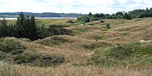
Due to its geological development, Thy consists mainly of hilly plateaus . On their often steep edges, the former cliffs , there are often only a few meadows, swamps and inland lakes that rise above sea level. In many cases, these areas are protected as bird reserves. Thy was completely treeless for centuries due to overexploitation , which caused great problems with drifting sand and shifting dunes. Wood had to be imported from Norway. It was not until the end of the 19th century that large-scale pine forests began to be planted according to plan. The west coast in particular consists of dunes with sandy beaches facing the sea.
Settlement and traffic
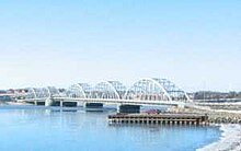
The administrative center of Thy is the town of Thisted , which lies on one of the foothills of the Limfjord. Great importance is the north of it on the coast of the Skagerrak preferred Hanstholm , Denmark's largest consumer fishing port and former ferry terminal for connections to Norway , the Faroe Islands , the Shetland Islands and Iceland . Thy is connected to the Danish mainland by the two bridges Oddesundbroen and Vilsundbroen . There are also three car ferries that run between Thyborøn and Agger Tange and from Feggesund and Næssund (also called Neessund ) to the island of Mors .
literature
- Jette Kjær: Antiquities from Thy. Edited by Sparkasse Thy, Thisted 1976
Web links
Individual evidence
- ↑ Langdysser (Danish: langdysse ) is the name for dolmens in Denmark, which are located in a rectangular or trapezoidal barn , in contrast to those dolmens that are located in the round hill.
- ↑ Morsø Kommune : Mors-Thy Færgefart ( Memento of the original from January 4, 2012 in the Internet Archive ) Info: The archive link has been inserted automatically and has not yet been checked. Please check the original and archive link according to the instructions and then remove this notice. , accessed on November 14, 2011 (Danish)
Coordinates: 56 ° 56 ' N , 8 ° 31' E

