
Buyukkale
Coordinates: 40 ° 0 ′ 54 ″ N , 34 ° 37 ′ 7 ″ E


Büyükkale ( Turkish for Great Castle ) is a rocky ridge in the Hittite capital Ḫattuša . It was from the Early Bronze Age in the late 3rd millennium BC. Populated until Roman times . Even before the arrival of the Hittites in the Hattier period, there was a fortified settlement, as did the Assyrian trading colonies ( Karum period ). During the Hittite empire, the hill was built on and fortified. In the second half of the 2nd millennium BC, it became more and more important. The seat of government of the Hittite kings. There were also walled settlements on the Büyükkale in later Phrygian , Hellenistic and Roman times . From the early 20th century, the rock ridge was extensively researched and excavated, primarily by German archaeologists. The castle complex there is also significant for Hittite because of the large number of cuneiform tablets that were found in the remains of the building and are written in the Hittite language, but also in several other languages.
Research history

The French traveler Charles Texier , who discovered the ruins at Boğazköy in 1834 and believed them to be the remains of the ancient pteria , recorded the castle on his map under the name Esplanade . The British geologist William John Hamilton , who visited the site in 1836, was the first to report on the pits or cisterns on the site and on numerous ceramic shards. On the more detailed plan of Carl Humann from 1882, the fortress is entered as Böjük Kale . The first excavations on Büyükkale began with the French archaeologist Ernest Chantre . After finding individual fragments of clay tablets with cuneiform writing in 1893, he undertook an exploration the following year , probably in the western part of the hill. These finds aroused general interest, as they promised further information about connections in the ancient Orient. The German ancient orientalist Hugo Winckler then traveled to Boğazköy in 1905, where he and Theodor Makridi carried out excavations until 1907, presumably in the same place as Chantre, although they focused their attention on the cuneiform texts and largely ignored the architecture. Numerous clay tablets came to light that led Winckler to the conclusion that the ruins of Boğazköy must be Ḫattuša, the capital of the Hittite empire. The excavations, which were unsystematic and unpublished even for the time, were at least partially documented by Otto Puchstein, who was on site at the same time.
From 1907 to 1931 - also in connection with the First World War - work on Büyükkale was suspended. In 1931 the German took Prehistorians Kurt Bittel on behalf of the Archaeological Institute of the German Empire, today's German Archaeological Institute (DAI), and the German Oriental Society excavations in Boğazköy again, where he initially focused on Büyükkale. In the next two years, large numbers of cuneiform tablets came to light. Mainly these finds were the decisive factor that the excavations have continued until today. Architectural remnants from different layers were systematically excavated and documented. The excavation work continued under Bittel's direction and with the support of the DAI, the DFG and various sponsors, initially until 1939 and continued after an interruption due to the war from 1952, now together with the building researcher and archaeologist Rudolf Naumann . From 1954 to 1966, Peter Neve was responsible for the Büyükkale research, and from 1978 he took over the overall management of the excavations in Ḫattuša. His successor from 1994 was Jürgen Seeher , and Andreas Schachner has been in charge of the excavation since 2006 . Finds and findings have been published regularly from the beginning of the 20th century in the series of publications of the German Orient Society in Berlin and Scientific Publications of the German Orient Society . Peter Neve published the first overall inventory of architecture in 1982 under the title Büyükkale - The Buildings .
The finds are exhibited in the local museum in Boğazkale, the Museum Çorum and, for the most part, in the Museum of Anatolian Civilizations in Ankara .
location
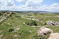
The rock ridge, consisting of Mesozoic limestone , is part of a mountain range that closes the Budaközü Çayı valley to the east. It is oriented from southwest to northeast, the high plateau has a size of about 260 × 150 meters. The highest point is a rock barrier in the northeast with a height of 1128 meters above sea level. Before the development, the surface was much more fragmented than it can be seen today. The surface was clearly leveled by the structural measures and natural influences. Especially in the north and east, the plateau is protected by steep cliffs, while in the south and west the slopes are gentler. It is located in the eastern center of the urban area of Ḫattuša on the border between the upper and lower towns. - The Lower Town separated from the younger Upper Town city wall Postern called - also forms the southern surrounding wall of the fortress. It runs around the old town in a large arc and, coming from the north, connects again to the northern fortification of Büyükkale. To the south of the hill is the elevation known as the south castle , which carried a sanctuary with a hieroglyphic chamber and later a Phrygian fortification. To the south-west, where the entrance is also, the modern street that comes down from the Löwentor leads past the foot of the hill. Diagonally opposite, west of the road, is the rock Nişantepe with the rock inscription Šuppiluliumas II called Nişantaş . The rock ridge offered a good overview of the lower town and large parts of the upper town.
history
The oldest traces of settlement in Ḫattuša come from the Chalcolithic era in the 6th millennium BC. And can be found on the Büyükkaya ridge, north of Büyükkale. Büyükkale itself has been inhabited since the end of the Early Bronze Age, the oldest evidence being storage pits in the south and south-west of the plateau. Their dating is uncertain, only the origin before 2000 BC can be proven. Then began the development of the high plateau into a settlement. It was initially limited to the southern part, but was already showing in the 19th century BC. A fortification. The pre-Hittite Hattians come into question as their inhabitants. With the destruction of the entire city of Ḫattuša by Anitta von Kaniš around 1700 BC. This settlement on the Büyükkale also perished in a fire disaster. The resettlement began again about 100 years later, when the city around 1600 BC. Was newly founded by Ḫattušili I. Probably because of the raids of the Kaškäer , Ḫantili I built at the turn of the 17th to the 16th millennium BC. The first wall around the city, which according to his statement was unprotected until then. It was probably identical to the postern wall that forms the southern section of the Büyükkale fortification. As a result of throne disputes, which began under unterantili, there was an economic and political decline of the city, which neighbors probably took advantage of, so that the city was sacked again and then slowly fell into disrepair. It was not until the succession of Telipinu after 1500 BC. The succession to the throne was regulated, so that internal disputes were ended and the rule was consolidated, after which the city was rebuilt. A systematic construction of a palace center followed on the Büyükkale for the first time. It did not fall until after 1280 BC. BC, probably in connection with the throne disputes between the designated ruler Urḫi-Teššup ( Muršili III. ) And his uncle, the later great king Ḫattušili III. , again victim to destruction. The latter as well as his son and successor Tudḫaliya IV were responsible for the rebuilding of the last palace of the Great Empire, which finally ended with the end of the Hittite Empire around 1180 BC. BC again fell victim to destruction.
From the 8th to the 6th century BC As well as in Roman times, the plateau was inhabited and mostly fortified, but it never gained more supraregional importance. Nothing is known about a possible further story.
construction
The castle hill was built on in several construction periods and layers. The first division into five layers was made in the 1930s, numbering from top to bottom:
- Layer I.
- Layer II - both post-Hittite
- Layer IIIb
- Layer IIIa - both from the Great Empire period
- Layer IV - Old Ethite
This division was later changed and expanded several times, but the basic structure was retained despite some weaknesses. For example, the Roman and Byzantine periods - even if only sparsely represented - could not be recorded in it. Today's division is as follows:
| layer | time |
|---|---|
| Byzantine | |
| Roman Imperial Era | |
| Hellenistic | |
| Yes | Disciples Phrygian |
| Ib | |
| IIa | Elder Phrygian |
| IIb | |
| III | Hittite empire |
| IVa-b | |
| IVc | Old Hittite |
| IVd | Karumzeitlich |
| Va | |
| Vb | |
| Vc | Vorhittite |
| Vd – f | |
| Vg | before 2000 |
The individual layers sometimes include several construction phases.


In the following description it should be noted that the drawing shows the state of the late Great Empire in the 13th century BC. Chr. (Layer III).
Pre-Hittite period
The oldest evidence is several round pits sunk into the loam, which were found in the south and southwest of the plateau next to the upper castle courtyard, in the area of the later houses M and N. Of greatly diverging size, they are between 0.25 and 0.95 meters deep and have a diameter of 0.60 to 1.95 meters. They presumably represented storage facilities that were later used as waste pits. Fragments of a Copper Age pitho were found in the pits , as well as painted shards of the so-called Alişar III ware and monochrome shards of both hand-made and potter's wheel . A more precise chronological classification is not possible to date, only an origin of or during the time of shift V could be determined.
Various remains of foundation walls could be recognized from the Prehittite layers Vd – g, primarily in the southern part of the plateau area. They consist of rubble stones, no statements can be made about their purpose. Only a strong wall facing south in the area of the later Burgtorhof seems to represent a defensive wall. Accordingly, it can be assumed that there was a fortification on Büyükkale at this time. Similar to the finds in the pits, the finds are handcrafted ceramics, Alişar III ware and thin-walled ware, so-called flower pot ware . A spatula-like bronze device is assigned to layer Vd. For layer Vc, several houses with clay floors were found in the area of the later lower castle courtyard, some of which not only the stone foundations but also some layers of the rising mud brick masonry were preserved. In the largest, eight-room house built over three terraces, two completely charred door leaves measuring 85 × 180 centimeters came to light. The house was presumably the residence of a higher-ranking person. Another building was probably two floors. Pithoi, dishes, stoves, pot stands, a stone mold, a bone pin, stamps, burnt grain and a human skeleton were found in the buildings. The buildings were all destroyed in a fire disaster. On the basis of C14 analyzes on the wooden parts found, they are between 1800 and 1600 BC. Dated.
Karumzeit
From the pre-Hittite layers Va and Vb, only sparse remains of the foundations have survived, as they were built over according to plan by the reconstruction of the following layer IVd, partly removed and leveled. They contained only a few remains of hand-made and disk-made pottery. The dating is uncertain. Layer IVd, on the other hand, can certainly be dated as Karumzeit . On the one hand, it includes parts of a four-meter-wide wall in the area of the lower castle courtyard gate. They represent the oldest traces of a fortification on Büyükkale, even if they were probably partly built on the rubble of an older wall. On the other hand, various remains of buildings could be excavated in the south and south-west areas. In most of them, only fragments of the wall can be detected, with the exception of building I / IVd. The house had a preserved size of 23 × 21 meters and consisted of at least twelve partly two-story rooms and a courtyard with a fireplace. In the courtyard, in addition to rich dishes, half of a red deer's antlers were found as the remains of a meal, but near the hearth there was also a child's skeleton, which proves that it was also used as a burial place. The finds in the rooms were also rich. The ceramic finds again include pithoi, ornate jugs and jugs with handles, bowls, painted tower vases and animal rhythms in the shape of lions and ducks. It is both utensils and cult vessels. There was also a millstone, a piece of lead sheet and bronze needles. Numerous seal impressions could be seen in more than a hundred lumps of clay that were worked into the walls. They were one centimeter in diameter and featured ornaments and stylized animal and human figures. The beginning of the building layer IVd is in the time of the Assyrian trading colonies ( Assyrian karum), more precisely in the 19th century BC. BC, dated. Their end was determined by a devastating fire at the transition from the 18th to the 17th century, when Anittas attacked Ḫattuša from Kuššara .
Early Hittite period

The Old Ethite building layer IVc includes settlement remains in various parts of the plateau and buildings on the southwest slope of the castle hill. Only sparse traces of the buildings can be seen there, as they are largely covered by the postern wall that was erected in the last phase of IVc. It is the oldest Hittite fortification of Ḫattuša. It continued from Büyükkale to the northwest and enclosed the lower town that was being developed. It ran around it in a large arc - partly built over by today's Boğazkale - and connected to the local wall of Büyükkale in the north. It was built without mortar from two roughly 2.7 meter thick walls made of roughly cut rubble stones, gravel and reading stones were used for filling. The total thickness was designed for 7.5 meters. At the south-western foot of the elevation was a gate with an inner passage of 3.6 meters and an outer passage of 3.8 meters. On the side there were two gate chambers 11 meters wide, 3.5 meters deep in the east and 3.0 meters in the west. The finds in this south-western area do not differ significantly from the older ones, most of them are also secondary relocated, so they come from older construction phases. Worth mentioning are two roughly arm-thick clay pipes, which are closed at one end and have a thin, nozzle-like bore. Since they were burned to glass flow at the nozzle site , the excavators assume that their purpose was to ventilate kilns.
Only small remnants of the postern wall can be identified on the surface of the mountain. However, a postern found further east shows that the wall continued to the east at least 100 meters. The tunnel was 37 meters long and led steeply upwards from the southeastern foot of the castle hill to open into the area of the later upper castle courtyard gate. It was built with cut-to-size quarry stones using the corbel technique and - due to the steep incline of up to 35 degrees - had a height of between 4.0 and 4.3 meters. A coherent development of the summit plateau can only be seen in the southern part. The numerous houses were built on the rubble of the older building layers and were in turn leveled, removed or destroyed when the layers above were built. The floor plan of four houses can still be recognized by remains of the foundations or associated depressions, of the others only remains or floors have been preserved. Three of the buildings have more than two rooms. A little further north, traces of buildings can be seen again, but these cannot be clearly assigned to layer IVc. What is striking among all the buildings found is a large number (at least seven) of two-room houses, which otherwise did not occur in the urban area of Ḫattuša in the comparable period. It is considered likely that at least some of these were not residential buildings but workshops such as blacksmiths. The assumed ruler's seat is assumed to be in the north-eastern part of Büyükkale. Only the so-called “Manda” tablet, a fragment of a clay tablet written in cuneiform , is of significance for the dating . Its content relates to events in the time of Ḫattušili I and therefore in his reign in the 16th or late 17th century BC . BC or shortly thereafter. The beginning of the new settlement after the fire mentioned is around 100 years after the end of the Karumper period, i.e. around 1600 BC. Chr., Assumed. The postern wall could be the fortification that Ḫantili I (around 1520) said was the first city wall to be built against the attacks by the Kaška people .
Great Empire
.jpg)
In layers IVa and IVb, indications of a palace in the northern area of the mountain plateau came to light for the first time. The oldest finding is the house J / IVb, which was built over again in the epoch of the early empire. It was in the area of the later entrance to House D and was possibly the substructure of an early audience hall . Two so-called terrace walls in the east and north of the mountain also belong to period IVb / a. The north-western wall, located under the later buildings E and F, is 85 meters long and made of trimmed, partly Cyclopean stones. It is about 3 meters thick and on the sloping terrain probably served both as a retaining wall for the buildings to the southeast and as a foundation for structures erected above it. To the south-east, some wall remains of a building were excavated at a level two meters higher. The second terrace wall is in the east by the rock step on which storage pits were found. It is about twice as long as its northern counterpart, with several kinks, whereby its course adapts to the gradations of the adjacent rock. Its structure corresponds to that of the northern wall, and its dual function as a retaining wall and foundation is likely to be the same. The traces of a pillar hall parallel to the eastern terrace wall are also seen as an indication of the building above. The walls continued to be used as a substructure for the later palace buildings in the following periods . A dating approach in the form of a clay tablet found in the rubble above is available for a successor to House J / IVb. Its content is the so-called Bentešina letter, which is most likely to Ḫattušili III. (Took office around 1278 BC). However, it is only a terminus ante quem and cannot be generalized as the end of period IVa / b for the rest of the palace buildings. The construction activity to redesign the entire castle hill in period III certainly started earlier.
On the southern plateau remains of various buildings (IV / A – H) could be excavated, which were in the area of the lower castle courtyard under the protection of the postern wall. Only minor changes were made to the latter in the gate area. The houses were built one after the other in several phases and have different floor plans. Initially, some buildings were built with no apparent architectural connection, but with traffic routes in between. The houses then came closer together, probably because of the lack of available land, and a complex system of alleys, streets and canals was created. One of the houses (House IVb / E), which was about under the later house N, is believed to have had a cultic function; a pair of painted bull vessels was found there, which was interpreted as a libation vessel through filling openings on the neck and spouts through the nostrils Vessels for libations. The other houses were probably residential and farm buildings. Most of them had round or square fireplaces, and two ovens were found in House F. In addition to the well-known utility ceramics, the finds, in addition to the rhyta in the shape of a bull mentioned, included a duck rhython, pithoi, small bronze objects and burnt grain. By comparing architecture with dated buildings in the lower town of Ḫattuša, the beginning of layer IVa / b can only date to the end of the 15th century BC at the earliest. To be set. For the end of the period, the above-mentioned Bentešina letter indicates an approximate point in time, so that a period of 120 to 140 years results for the duration.
Late empire period

From the late 13th century BC Began under Ḫattušili III. the monumental expansion of the palace hill. The traces of this development, layer III, are those that can mainly be seen on Büyükkale today.
Attachment
The entire castle plateau was now used for government buildings and is surrounded on all sides by a castle wall. In the southern area it replaced the former postern wall, but was moved upwards. West, north and east walls adapted to the unevenness of the terrain, and the locations of the 21 towers or bastions were mostly based on the existing rocky outcrops. The massive wall base consisted of rubble stones , only in the area of the gates and the tower facades were stone used. Above that, timber frame and clay bricks were used, which also formed spaces in the wall. Gates existed in the southwest, south, and east. The main entrance was the southern gate, which was reached from the southwest via a viaduct . Its reconstructed stone substructure can be seen east of today's street. It had a tall mudbrick structure and was perhaps covered with beams that horse-drawn carts could drive over. The path first met a four-meter-deep forecourt of the south gate. Behind it were two passages four meters apart, the outer three, the inner four meters wide. The gate was flanked by two towers, the east twelve, the west eight meters wide. They hid the guardroom in the west and a staircase in the east that led to the upper floors and the battlements. The gate was thus similar in structure to the gates in the upper town wall, the lion, the sphinx and the king gate, albeit in slightly smaller dimensions due to the circumstances. Like the lion gate, the south gate was equipped with lion sculptures on the outer passage. A fragment of a lion relief was found on the slope of the castle hill. Four fragments of an inscription stone with Luwian hieroglyphs were also found in a collapsed position , which were probably built into the base of the tower's wall. However, too little of the inscription is legible to give any indication of the date. The southwest gate was completely destroyed in Phrygian times when a deep well was built, only a threshold stone and a soffit stone have been preserved . Accordingly, it was smaller than the south gate and the gates of the city wall in the upper and lower town. The gate with the access path running parallel to the wall behind it was the direct connection to the lower town, which was probably used by suppliers, but also by the king on the way to the local sanctuaries. Below the gate was the only spring that supplied Büyükkale with water. The east gate between building K and the wall coming from the north offered direct access to the upper part of the palace area with the royal apartments, bypassing the lower courtyards.
The castle wall encloses the castle hill as a closed ring, with the exception of the point in the southeast, where it connects to building K when coming from the west, while the east wall coming from the north meets it in an offset manner and thus forms the passage for the east gate. In the south, the fortification is around seven meters thick and the towers are up to twelve meters wide. On the other flanks, the structure is designed very differently due to the natural conditions. Although the wall itself was about five meters thick, the length of the curtains varied between 14 and 41 meters, the width of the towers between 6.9 and 12 meters, the projection of the bastions between 3.5 and 9 meters. The towers towered over the wall throughout. Depending on whether the walls and towers were one or two storeys high, the height can be assumed to be 10 to 12 meters for the curtains and 14 to 18 meters for the towers. While the southern wall was founded on the substructures of the old postern wall, the rest of the wall was built on the natural rock. This was done in steps, often with a web on the outside, which was supposed to prevent the wall plinth from slipping off. The double-shell masonry made of timber framework with adobe bricks in box construction then sat on this base made of stone and rubble, that is, transverse walls were drawn into the wall at irregular intervals. It is not generally possible to clarify whether the resulting rooms were accessible. The tower facades were built in ashlar. On the surface of the wall, which was probably paved with clay slabs, a battlement ran between the battlements.
Two written finds are available for dating the fortification. The mentioned Bentešina letter, which was found in the earth filling, gives a terminus post quem , thus shows that the expansion in the time of Ḫattušilis III. (about 1266–1236 BC) or later. The fragment of an orthostat with a ruler's cartouche belonging to his son Tudḫaliya IV (around 1236–1215 BC) leads to the conclusion that the construction work continued during his reign.
Interior development


Simultaneously with the construction of the fortifications, the expansion of the palace was advanced so that finally the entire surface of the castle rock was used for the settlement in the southern area disappeared. Across the viaduct in the south, through the south gate, you first entered the roughly triangular castle gate courtyard, which was surrounded by the castle wall in the south and west. In the northeast was the entrance to the next courtyard. A red paved path led there, comparable to today's red carpet, from which it can be seen that this was the official entrance for visitors to the ruler. The path continued over the lower courtyard and another gate to the middle and finally to the upper courtyard. The lower courtyard was bordered on both sides by porticoes that ran in front of the buildings there. These were the buildings M, N and H on the left, northwestern side, on the right the buildings G and A. M and G, which are also similar in floor plan, probably served representative purposes or were residences of high-ranking court officials. Building N, on the left between M and H, was a small gatehouse. Behind it ended the path leading up to the south-west gate, which gave access to the lower castle courtyard from the lower town and the above-mentioned spring. Like almost all the houses on the Burgberg, the buildings were at least two-story, with access mostly on the upper floor due to the hillside location.
In the north corner of the courtyard, in front of building H, there was a passage that led to the complex of houses B, C and H. This path ran between a connecting building and house B, turned at its eastern corner to the west, where the three buildings were then accessed via a lane running between B and C. At the bend to the west there was also an access - subsequently built in - to the large representative building D. House B is divided into ten rooms of different sizes, which are distributed over different levels following the slope of the underground. 24 fragments of cuneiform tablets were found in one of the rooms. The roughly square building C, located to the northwest, consists of six rooms. In addition to numerous ceramic parts, a stele with a hieroglyphic inscription was found here, which mentions the name Tudhaliya (probably IV.). However, it was used a second time, perhaps as a threshold stone, and is therefore heavily sanded down. The central room was deepened like a basement and built with a water basin as an impluvium . A cultic function of the house can therefore be assumed, probably together with house B. It was one of the few single-storey houses. House H adjoins it to the southwest, separated by an access lane. Both are connected by the northwest retaining wall. With its four rectangular rooms on two floors, H is regarded as a magazine. The north-eastern end of the lower courtyard was formed by a gate, which, like the south gate, was flanked by gate lions. Because of the difference in level of about one storey height to the following, middle courtyard, the passage was designed as a ramp or - more likely for reasons of space - as a staircase. In the rubble, fragments of a lying lion were found, which was probably placed in the passage, as well as a fragment with a partially preserved ruler cartridge Tadhaliyas, who can therefore be assumed as the builder of the gate system. The gate building was multi-storey and contained twelve rooms, the plinths were made of ashlar like the south gate.
With the middle courtyard you enter the inner palace area. The courtyard was lined with rows of columns on three sides, to the northwest, northeast and southeast. Building A and another small gate in the south corner of the courtyard form the south-western end. On the left, northwest side behind the colonnade is building D, which is connected to the gatehouse to the south by a connecting structure. House D is the largest building of this period with 39 × 48 meters. It initially consisted of 14 rooms, in a later construction phase a small room, the mentioned side entrance at House B, was added on the south corner and a porch with the main entrance in the southeast. Also in the south-east were six smaller rooms that formed the entrance with the associated side chambers. In the southwest, an elongated room takes up almost the entire length of the building. The rest of the house is made up of six equal, also long-rectangular rooms, with a smaller chamber separated from one. Due to the extreme hillside location, their floors have a level difference of over six meters from northwest to southeast. They lie parallel to the slope in the northwest and together form an almost exact square of 35.3 × 35.5 meters. They represented the substructure of the audience hall above the Great King, with rows of columns or pillars standing above the walls of the basement, which supported the ceiling of the hall. Due to the distance between the walls, five by five columns, presumably made of wood, can be assumed. Numerous fragments of sculptures, lions and bulls, were found in the area of the entrance rooms and the part of the courtyard in front of it. They were probably the pillared bases of the present portico. A number of fragments of clay tablets and a hoard of 280 sealed clay seals were also found in the rooms of the basement. Accordingly, it is reasonable to assume that the building was a representative reception building with an attached document archive. The long rooms in the basement also served as storage rooms.
Building A forms the south-western end of the middle courtyard and adjoins the gate to the south-east. It covers an area of maximum 36 × 34 meters. It consists of an upper and a lower wing, corresponding to the sloping terrain to the south. The upper tract has mainly two long rooms parallel to the central courtyard, with two small chambers separated from the south. One of them has an entrance to the west from the lower courtyard. The southern part of the building, which adjoins the lower courtyard in the west, consists of five elongated rooms at right angles to the upper part. Rows of limestone and granite bases with dowel holes were found in the four larger ones. It is unclear whether the pillars on top were used to support the ceiling and the upper floor. It is more likely that they belonged to shelves in the rooms. In the rubble and on the rammed earth floors, around 4,000 fragments of clay tablets came to light. The building is therefore seen as a magazine and archive, although the upper wing may have housed administration rooms and a writing school. In the east there is a small gate building. It leads to another courtyard, which could be entered in the south through the east gate of the castle. There, in continuation of the castle wall coming from the west, is the building K. This has a floor area of 27.5 × 22.5 meters. It consists of a core building with three rooms of different sizes and eleven chambers, which are connected to the core building in two rows in the northwest and northeast. The latter were added in a second construction phase after a fire in the building. In one room of the old building, support bases were found in the corners, which indicate shelves. Since more than 200 pieces of clay tablet came to light in the rubble, it is assumed that this is also an archive. Overall, the building is assigned a more representative function, with the small, chamber-like lanes on the northern sides probably representing pillar halls in front of it. This function could be related to the east gate of the castle immediately to the east.
To the northwest of building K is the area known as Südgasse. It is bordered in the south by K, the castle wall and the integrated building J, in the north by the backs of A and G. From the south side of house G it continues as a narrow, steeply sloping alley along the wall to the castle gate courtyard. The area was originally paved with stones and had a canal underneath that drained through the castle gate to the western slope. The area between house G and the castle wall was separated from the narrow lane by a short wall. In a later construction phase, a 35 to 50 centimeter thick layer of clay with a sewer system running through it was applied. The partition wall was moved to the west end of the castle gate courtyard, a threshold and the door walls were excavated from the passage. Building J was built into the castle wall about ten meters west of House K. It was 20 meters long and protruded about 2.5 meters from the wall in the north. It consists of ten small, different rooms; its southern part has collapsed along with the castle wall. In the middle of the south square, roughly parallel to the house, there is a water basin. At the longest point it measures 24.0 meters from west to east, the width is 5.0 meters in the east and 1.5 meters in the west. Numerous votive offerings - jugs with handles, mugs, bowls - were found in it. It follows from this that the basin and the square including the surrounding buildings had, among other things, a cultic significance. An additional function of the basin for the water supply of the castle is however also likely.
The south-eastern end of the central courtyard is uncertain, perhaps it was delimited by a row of pillars. Nothing is known about the development of the badly collapsed area between this assumed dividing row and the castle wall.
The upper castle courtyard adjoins the northeast, probably again separated by a row of pillars. Its southeastern boundary is a 24.5 meter long and up to 2.2 meter high artificial rock step. In front of it you can see pillar bases, both directly at the barrier and - correspondingly - at a distance of 2 meters in front of it, which certainly indicates a pillar hall (L) in front of it. Traces of building can be seen in the rock on the eastern surface of the rock, but more precise information about the existing buildings is not possible due to the later Phrygian overbuilding. There are indications that the vestibule continued to the south and thus formed the east end of the central courtyard. At the southern end of the rock barrier, building remains to the west indicate that not only a row of pillars but also a gate could have separated the two courtyards. Parts of door hinge stones and a beautifully crafted lion head even suggest a monumental gateway with gate lions. Two depressions on the surface of the rock step probably represented storage pits or cisterns from earlier, possibly pre-Hittite times, their exact date is uncertain. How far the courtyard extended to the north and northwest is not clear. There are no traces of construction in the free space in the north. Buildings E and F are to the northwest, but because of the five-meter difference in height between the courtyard and the houses, it is unlikely that the courtyard extended to the buildings. They were two-story, with the upper floor again being accessed from the courtyard side. The southwest building E measures 26.6 × 22.2 meters and has 13 rooms. The centrally located, largest of these was entered via an entrance room facing the courtyard, which was perhaps designed as a portico. The surrounding rooms, like those in the basement, presumably had storage and archive functions. Numerous fragments of clay tablets were found in two of the lower rooms. House F is at the far end of the north terrace and has dimensions of 33.1 × 29.2 meters. It is much worse preserved, which is why less information can be given about the individual rooms. The center is formed by five parallel, elongated rooms. This could mean that, analogous to House D, there was a portico above it. It can safely be said that both buildings, apart from the representative area of the castle, were the private apartments of the ruling couple. Both offer a magnificent view of the entire lower town and large parts of the upper town of Ḫattuša. It can be assumed that the buildings in the northeast of the plateau, which can no longer be identified, also belonged to the private domain of the great king.
To date the buildings from the late Great Empire period, this period is divided into three construction phases, III c, b and a. In the first phase III c, which was probably in the reign of Ḫattušilis III. (around 1266–1236 BC), new buildings were erected on the foundations and substructures of the old palace in the northeast area. The second phase III b is dated to the time of Tudhaliyas IV (around 1236-1215 BC), who tackled the monumental expansion of the entire palace complex, which is also evident from various inscriptions found that name his name. Phase III a finally shows negligent and improvised repair and new construction activities, probably after a fire, it was probably in the time of Tudhaliya's successors Arnuwanda III. (about 1215 to 1214 BC) and Šuppiluliuma II. (about 1214 to 1190 BC), the last attested rulers of the Hittite Empire before its fall.
The low density of furnishings and other finds on Büyükkale compared to other excavated palace complexes suggests that the move, which took place after 1190, proceeded in an orderly manner without outside interference. The residents were able to take important utensils with them and only left objects that seemed unimportant (or heavy) such as the clay tablets. Existing traces of fires, such as those on the royal palaces, probably date from a time when the city was already deserted.
In a pit near building G as well as in the excavation rubble in the area of the southern fortification - as in temples 5 and 9 of the upper town - some fragments of wall paintings came to light. The small and poorly preserved fragments are between 0.2 and 0.55 centimeters thick and consist of one or two layers of plaster, occasionally a white primer can still be seen under the paint. Besides black and white, the colors used are mainly red, blue and yellow ocher. Rosettes, spirals and ribbons can be recognized by the motifs. The paintings are dated to the second half of the 13th century BC. Dated.

Buildings E and F, Royal Palace

Upper castle courtyard with rock barrier

Pit (cistern or storage pit) on the rock barrier
Water basin between house G and J

On the right building K and east gate, on the left the castle wall with building J

Building G, in the background building A


Post-Hittite period


After Ḫattuša in the early 12th century BC After it had been abandoned, other parts of the city, for example Büyükkaya, had been settled again after some time by simple Anatolian inhabitants, possibly also by Kaškaers. Disk-turned ceramics with clearly Hittite features leads to the assumption that Hittite elements were also represented in this Iron Age population. However, Büyükkale was not settled again until the beginning of the 8th century BC. A. Numerous finds, including inscriptions, prove that the new inhabitants were Phrygians .
Phrygian settlement
In the first, not before the 8th century BC Building phases IIb and IIa, which began in BC, an unpaved settlement was built in the southern part of the plateau up to the former upper castle courtyard. It consisted mainly of one or two-room houses, including some so-called pit houses. In these, a lower part of the rooms was sunk into the terrain. A little higher up, in the area of the upper castle courtyard, there was probably the ruler's residence. Since most of the buildings in these phases were overbuilt in the following period, only sparse remains are detectable. The end of this Old Phrygian phase often came with the Kimmerer invasions towards the end of the 7th century BC. Related. Andreas Schachner considers this explanation to be untenable, because on the one hand the Cimmerians are nowhere to be found in Central Anatolia and the dating of the destruction of Gordion , which was associated with the Cimmerians, is not certain. During this time, the lower town of Ḫattušas was destroyed and sacked, but no traces of it can be found on Büyükkale.
In the course of the subsequent resettlement with the construction phases Ib and Ia, the hill was fortified again, so that for the first time a complete city complex with settlement, ruler's palace and city walls found space on the Büyükkale.
The fortification walls were built in the south-west, south and south-east and followed the Hittite complex, only slightly upwards. In contrast to this, however, they were not built in a box construction, but rather massive and thus overall weaker. With a few exceptions, they were also made entirely of quarry stone; bricks, as in the Hittite wall, only appear on a gate. The distances between the towers were very different, the curtains had lengths of up to 35 meters. The towers, which presumably towered over the walls, were not integrated into them, but separate structures. The curtains were led up to or past them. The fortification had an older and a younger gate in the west and south-east. The younger south-east gate is remarkable because its monumental design is reminiscent of the Hittite gates. In addition to sacrificial sites and sculptures, a cult niche with a statue of Cybele was found there. A staircase leads from a well that was built by the spring on the south-west slope of the hill to the south-west bastion.
In the Younger Phrygian Era, the interior development is divided into three sections, which were made by two walls, one from north to south and a second, in the northern part at an angle to the east. In the northern area, roughly identical to the Hittite upper courtyard, was the palace. It was trapezoidal in shape and measured about 30 meters from west to east, from north to south between 16 meters in the east and 25 meters in the west. It was entered from a courtyard in the north through a kind of vestibule consisting of five small rooms. The central room of 8 × 11 meters was surrounded by rooms in double rows. The section wall formed the southern end, in the west there were various associated farm buildings. The other two sections were residential quarters. There were a number of rectangular buildings that are interpreted as workshops, magazines and administrative and cult buildings. Other, less rectangular houses were purely residential buildings. In general, in this later phase, the development, which was based on a system of paths determined by the gates, led to the irregular construction. In contrast to the Hittite period, the Phrygian houses are built exclusively from rubble stones; no traces of mud bricks have survived. However, it cannot be ruled out that they were used in possibly existing but not verifiable upper floors.
The beginning of the second Phrygian building phase is believed to be the beginning of the 7th century BC. Dated. Their end was probably at the earliest at the transition from the 6th to the 5th century, when the southeast gate was destroyed. However, it cannot be ruled out that the settlement continued to exist long afterwards - unfortified.
Hellenistic and Roman buildings
In the Hellenistic and Roman times there was another fortified settlement on the Büyükkale, of which, however, only sparse remains have been preserved. This includes two wall bases of a fortification in the southeast and southwest, but without towers or bastions. Like the Phrygian wall, it consisted of shell masonry with a backfill of rubble. In two places there are traces of buildings adjoining the wall, which probably belonged to rooms for guards. Other remains of the wall inside the fortification could represent living spaces. The buildings can be dated to Hellenistic or Roman times through small finds. The beginning of this building period can be in the late 2nd century BC. The end is likely to be dated to the later Roman Empire in the 3rd century AD. There is no evidence of a longer period of development between the Phrygian and Hellenistic periods.
Individual finds such as coins and ceramics from the Byzantine, Seljuk and Ottoman times confirm that people also stayed on Büyükkale in later epochs. There is no architectural evidence of this.
Clay tablets
A total of 30,000 inscribed clay tablets were found in Ḫattuša. 4000 of them are in the archive in House A of the Late Period. Based on the find situation, Kurt Bittel suspects that they were stored in wooden shelves, possibly on the upper floor. There were also extensive clay tablet archives in buildings E and K. The oldest date from the time of the Assyrian trading colonies, but most of them from the Hittite period. In addition to the Hittite and Assyrian languages, they are written in the languages Hurrian , Palai , Luwish and Hattish . The texts have profane as well as religious content. This includes purchase contracts (especially from the Karumzeit), correspondence with foreign rulers, contracts, but also service and cult regulations.
Although the texts are very numerous, none of them refer to the palace. Only a fragment, of which unfortunately only the first panel is available, allows conclusions to be drawn about possible functions of the palace architecture. It is the so-called Mešedi text, a service regulation for palace employees. The tablet was found in the western part of the castle hill by Winckler and Makridi at the beginning of the 20th century. Due to the lack of documentation of the excavation, the exact location can no longer be traced. The text was created in the earlier period of the Great Empire, but can also be related to the last phase of construction of the castle hill. The text mentions two separate courtyards in the palace area, the courtyard of the Ḫalentuva house, by which the ruler's residence is meant, and the bodyguard courtyard (Mešedi courtyard), which is adjacent to it and on which court hearings and receptions took place. Both have different gates, including the Great Gate (É ḫilammar) and the Kaškaštepa Gate of the residential palace, and a lower and an upper gate are also mentioned. The former courtyard can be equated with the upper courtyard, the Mešedi courtyard is probably the middle courtyard with the audience building D. The Kaškaštepa gate denotes the entrance from the middle to the upper castle courtyard, the Great Gate is the one from the lower to the middle courtyard interpret his. The entrance with the vestibule of House D could be the aforementioned lower gate. A place called É arkiu, which was probably a type of chapel where the king offered his prayer before leaving the palace, may be identified with the sanctuary in the center of Building C. Maciej Popko identifies a few other temples on Büyükkale, but these localizations are very speculative. In connection with the gates, arsenals are mentioned in which the weapons were stored that the guards had to hand over to the respective porter when leaving the premises.
literature
- Kurt Bittel : Hattuscha - capital of the Hittites. History and culture of an ancient oriental great power. DuMont, Cologne 1983, ISBN 3-7701-1456-6 , pp. 87-132.
- Peter Neve : Büyükkale - The buildings. Excavations 1954–1966. Berlin 1982, ISBN 978-3-7861-1252-5 .
- Jürgen Seeher : Hattuscha leader. A day in the Hittite capital. 2. revised Edition, Ege Yayınları Publishing House, Istanbul 2002, ISBN 975-8070-48-7 , pp. 102–115.
- Andreas Schachner : Hattuscha - In search of the legendary empire of the Hittites. Beck, Munich 2011, ISBN 978-3-406-60504-8 , pp. 71-82.
- Maciej Popko : On the topography of Ḫattuša: Temple on Büyükkale. In: Harry A. Hoffner (Ed.): Hittite Studies in Honor of Harry A. Hoffner, Jr: On the Occasion of His 65th Birthday. Eisenbrauns, 2003, ISBN 978-1-57506-079-8 , pp. 315-323.
Web links
Individual evidence
- ^ Charles Texier : Description de l'Asie Mineure, faite par ordre du Gouvernement Français de 1833 à 1837, I Paris 1839. Pl. 73 ( digitized ).
- ^ William John Hamilton : Researches in Asia Minor, Pontus and Armenia: with some account of their antiquities and geology . Landon 1842 pp. 391-392 ( digitized ).
- ^ Carl Humann , Otto Puchstein : Travel in Asia Minor and Northern Syria. Publishing house by Dietrich Reimer, Berlin 1890. Plate XIV ( digitized version ).
- ^ Otto Puchstein, Heinrich Kohl, Daniel M. Krencker: Boghasköi, Die Bauwerke. In: Scientific publications of the German Orient Society 19 Leipzig, JC Hinrichs, 1912 pp. 20ff.
- ↑ Andreas Schachner: Hattuscha - In search of the legendary Hittite Empire , Beck, Munich 2011, ISBN 978-3-406-60504-8 , p. 11.
- ↑ Kurt Bittel: Introduction by the editor In: Peter Neve: Büyükkale - The buildings. Excavations 1954–1966. Berlin 1982, ISBN 978-3-7861-1252-5 , pp. IX-XV.
- ^ Peter Neve: Büyükkale - The buildings. Excavations 1954–1966. Berlin 1982, ISBN 978-3-7861-1252-5 , p. 1.
- ↑ Andreas Schachner: The excavations in Boğazköy-Ḫattuša 2008 In: Archäologischer Anzeiger 1/2009 p. 42.
- ↑ Jürgen Seeher : Hattuscha guide. A day in the Hittite capital . 2. revised Edition. Ege Yayınları Publishing House, Istanbul 2002, ISBN 975-8070-48-7 . Pp. 103-115.
- ↑ Andreas Schachner : Hattuscha - In search of the legendary Hittite Empire , Beck, Munich 2011, ISBN 978-3-406-60504-8 , p. 44.
- ^ Peter Neve: Büyükkale - The buildings. Excavations 1954–1966. Berlin 1982, ISBN 978-3-7861-1252-5 , p. 33.
- ^ Peter Neve: Büyükkale - The buildings. Excavations 1954–1966. Berlin 1982, ISBN 978-3-7861-1252-5 , pp. 45-46.
- ^ Peter Neve: Büyükkale - The buildings. Excavations 1954–1966. Berlin 1982, ISBN 978-3-7861-1252-5 , p. 74.
- ^ Peter Neve: Büyükkale - The buildings. Excavations 1954–1966. Berlin 1982, ISBN 978-3-7861-1252-5 , p. 136.
- ^ Peter Neve: Büyükkale - The buildings. Excavations 1954–1966. Berlin 1982, ISBN 978-3-7861-1252-5 , pp. 2-6.
- ↑ a b Peter Neve: Büyükkale - The buildings. Excavations 1954–1966. Berlin 1982, ISBN 978-3-7861-1252-5 , pp. 7-20.
- ^ Peter Neve : Büyükkale - The buildings. Excavations 1954–1966. Berlin 1982, ISBN 978-3-7861-1252-5 , pp. 21-33.
- ↑ Andreas Schachner : The excavations in Boğazköy-Ḫattuša 2008 In: Archäologischer Anzeiger 1/2009 p. 42.
- ↑ a b Peter Neve: Büyükkale - The buildings. Excavations 1954–1966. Berlin 1982, ISBN 978-3-7861-1252-5 , pp. 34-46.
- ↑ a b Peter Neve: Büyükkale - The buildings. Excavations 1954–1966. Berlin 1982, ISBN 978-3-7861-1252-5 , pp. 47-69.
- ↑ Jürgen Seeher : Hattuscha guide. A day in the Hittite capital . 2. revised Edition. Ege Yayınları Publishing House, Istanbul 2002, ISBN 975-8070-48-7 . P. 103.
- ↑ Occasionally, as in Neve, referred to as West, Southwest and Southeast Gate.
- ↑ a b c Peter Neve: Büyükkale - The buildings. Excavations 1954–1966. Berlin 1982, ISBN 978-3-7861-1252-5 , pp. 76-90.
- ↑ Jürgen Seeher : Hattuscha guide. A day in the Hittite capital . 2. revised Edition. Ege Yayınları Publishing House, Istanbul 2002, ISBN 975-8070-48-7 . Pp. 102-115.
- ^ Peter Neve: Büyükkale - The buildings. Excavations 1954–1966. Berlin 1982, ISBN 978-3-7861-1252-5 , pp. 111-118.
- ^ Peter Neve: Büyükkale - The buildings. Excavations 1954–1966. Berlin 1982, ISBN 978-3-7861-1252-5 , pp. 102-107.
- ^ Peter Neve: Büyükkale - The buildings. Excavations 1954–1966. Berlin 1982, ISBN 978-3-7861-1252-5 , pp. 104-111.
- ^ Peter Neve: Büyükkale - The buildings. Excavations 1954–1966. Berlin 1982, ISBN 978-3-7861-1252-5 , pp. 128-130.
- ↑ Jürgen Seeher : Hattuscha guide. A day in the Hittite capital . 2. revised Edition. Ege Yayınları Publishing House, Istanbul 2002, ISBN 975-8070-48-7 , p. 111.
- ^ Peter Neve: Büyükkale - The buildings. Excavations 1954–1966. Berlin 1982, ISBN 978-3-7861-1252-5 , pp. 90-98.
- ^ Peter Neve: Büyükkale - The buildings. Excavations 1954–1966. Berlin 1982, ISBN 978-3-7861-1252-5 , pp. 131-136.
- ↑ Jürgen Seeher : Hattuscha guide. A day in the Hittite capital . 2. revised Edition. Ege Yayınları Publishing House, Istanbul 2002, ISBN 975-8070-48-7 , p. 170.
- ↑ Johannes Jungfleisch: Preliminary report on the work on the wall paintings from Büyükkale and the Upper Town In: Andreas Schachner: Die Arbeit in Boğazköy-Ḫattuša 2012 . Wasmuth, Tübingen-Berlin 2013, ISBN 978-3-8030-2350-6 , pp. 170-174.
- ^ Hermann Genz: The Iron Age in Central Anatolia in the light of the ceramic finds from Büyükkaya in Boğazköy / Hattuša In Türkiye Bilimler Akademisi Arkeoloji Dergisi. Istanbul 2000 pp. 35–54 especially p. 40.
- ↑ Andreas Schachner: Hattuscha - In search of the legendary Hittite Empire , Beck, Munich 2011, ISBN 9783406605048 , p. 326.
- ↑ a b c d Peter Neve: Büyükkale - The buildings. Excavations 1954–1966. Berlin 1982, ISBN 978-3-7861-1252-5 , pp. 142-169.
- ^ Peter Neve: Büyükkale - The buildings. Excavations 1954–1966. Berlin 1982, ISBN 978-3-7861-1252-5 , pp. 170-172.
- ↑ Jürgen Seeher : Hattuscha guide. A day in the Hittite capital . 2. revised Edition. Ege Yayınları Publishing House, Istanbul 2002, ISBN 975-8070-48-7 . P. 162.
- ^ Peter Neve: Büyükkale - The buildings. Excavations 1954–1966. Berlin 1982, ISBN 978-3-7861-1252-5 , p. 106.
- ^ Andreas Schachner : Hattuscha - In search of the legendary Hittite Empire , Beck, Munich 2011, ISBN 978-3-406-60504-8 , p. 153.
- ^ Hans G. Güterbock , Theo PJ van den Hout: The Hittite Instruction for the Royal Bodyguard . The Oriental Institute Chicago 1991 ISBN 0-918986-70-2 .
- ^ Maciej Popko: On the topography of Ḫattuša: Tempel auf Büyükkale In: Harry A. Hoffner (Ed.): Hittite Studies in Honor of Harry A. Hoffner, Jr. on the Occasion of his 65th Birthday . Eisenbrauns, 2003, ISBN 978-1-57506-079-8 , pp. 315-323.
- ^ Peter Neve: Büyükkale - The buildings. Excavations 1954–1966. Berlin 1982, ISBN 978-3-7861-1252-5 , pp. 136-137.
- ↑ Andreas Schachner : Hattuscha - In Search of the Legendary Hittite Empire , Beck, Munich 2011, ISBN 978-3-406-60504-8 , pp. 147-150.