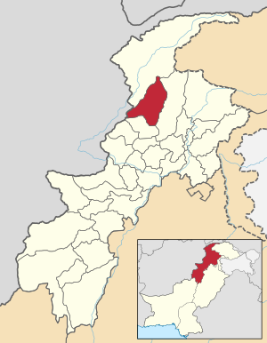
Upper Dir
|
Upper Dir ضلع دیر بالا |
|
| State : |
|
| Province : | Khyber Pakhtunkhwa |
| Founded : | 1996 |
| Seat : | to you |
| Coordinates : | 35 ° 12 ' N , 71 ° 52' E |
| Area : | 3 699 km² |
| Residents : | 899,000 (2014) |
| Population density : | 243 inhabitants per km² |
| Time zone : | PST ( UTC + 5 ) |

|
|
The Upper Dir District ( Urdu ضلع دیر بالا, Pashtun بر دير ولسوالۍ) is located in the Pakistani province of Khyber Pakhtunkhwa . It has existed since 1996, when the original district out in the districts of Upper Dir District and Lower Dir was divided.
In early June 2011 around 300 Tehrik-i-Taliban Pakistan (TTP) fighters attacked a border post into Afghanistan in Upper Dir . Between 24 and 50 soldiers and 6 civilians were killed in the 24-hour battle.
Web links
Commons : District Upper Dir - Collection of pictures, videos and audio files
Individual evidence
- ↑ a b The battle lasted 24 hours. In: ORF . June 2, 2011, accessed June 8, 2011 .
