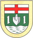
Verbandsgemeinde Kell am See
| coat of arms | Germany map | |
|---|---|---|

|
Coordinates: 49 ° 38 ' N , 6 ° 49' E |
|
| Basic data (as of 2019) | ||
| Existing period: | 1970-2019 | |
| State : | Rhineland-Palatinate | |
| County : | Trier-Saarburg | |
| Area : | 160.18 km 2 | |
| Residents: | 9268 (Dec. 31, 2017) | |
| Population density : | 58 inhabitants per km 2 | |
| License plate : | TR, SAB | |
| Association key : | 07 2 35 5002 | |
| Association structure: | 13 municipalities | |
| Association administration address : |
Rathausstrasse 1 54427 Kell am See |
|
The Verbandsgemeinde Kell am See was in the southern part of the Trier-Saarburg district in Rhineland-Palatinate . The Verbandsgemeinde belonged to 13 independent local congregations , the administrative seat was in Kell am See . The area of the Verbandsgemeinde was in the Saar-Hunsrück Nature Park .
Association members communities
| Surname | Area (km²) |
Inhabitants (1950) |
Population (December 31, 2017) |
|---|---|---|---|
|
|
1.76 | 162 | 256 |
|
|
12.12 | 873 | 957 |
|
|
4.90 | 204 | 264 |
|
|
6.15 | 344 | 391 |
|
|
28.26 | 1,385 | 1.925 |
|
|
8.16 | 503 | 566 |
|
|
23.96 | 816 | 853 |
|
|
4.30 | 195 | 238 |
|
|
19.58 | 902 | 1,203 |
|
|
2.46 | 163 | 126 |
|
|
8.57 | - | 197 |
|
|
11.08 | 629 | 806 |
|
|
28.87 | 1,156 | 1,486 |
|
|
160.20 | 7,459 | 9,268 |
history
The Verbandsgemeinde Kell existed since November 7, 1970, as part of the functional and territorial reform in Rhineland-Palatinate from the communities of the previous Verbandsgemeinde Kell (with Heddert, Hinzenburg, Kell, Lampaden, Mandern, Schillingen and Waldweiler) with the exception of Hinzenburg , which came to the Verbandsgemeinde Ruwer, and the communities in the Hochwald of the Verbandsgemeinde Saarburg-Ost (Baldringen, Greimerath, Hentern, Paschel, Schömerich, Vierherrenborn and Zerf) a new Verbandsgemeinde Kell was formed. The name was changed to "Verbandsgemeinde Kell am See" on March 24, 1992.
On January 1, 2019, the new Saarburg-Kell association was created through the merger with the Saarburg Association .
Population development
The development of the population in relation to the area of the Verbandsgemeinde Kell am See at the time of dissolution, the values from 1871 to 1987 are based on censuses:
|
|
politics
Association municipal council
The local council Kell am See consisted of 24 honorary council members, who in the local elections on May 25, 2014 in a personalized proportional representation were elected, and the full-time mayor as chairman.
The distribution of seats in the municipal council:
| choice | SPD | CDU | FWG | July | total |
|---|---|---|---|---|---|
| 2014 | 7th | 10 | 6th | 1 | 24 seats |
| 2009 | 8th | 10 | 4th | 2 | 24 seats |
| 2004 | 8th | 13 | 3 | - | 24 seats |
| 1999 | 10 | 11 | 3 | - | 24 seats |
- FWG = Free Voting Group Kell am See e. V.
- JuLi = Young List e. V. in the community of Kell am See
mayor
- August Justen (CDU), 1970 to 1988
- Werner Angsten (CDU), 1988 to 2014
- Martin Alten (CDU), September 2014 to December 2018
tourism
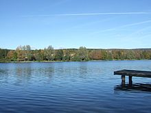
Tourist attractions were the Keller reservoir , the Ruwer-Hochwald-Radweg and the Saar-Hunsrück-Steig with the so-called dream loops ( premium hiking trails ):
- Ruwer-Hochwald loop near Hentern
- Schillinger Panoramaweg near Schillingen
- Greimerather Höhenweg near Greimerath
- Hochwald-Acht near Waldweiler and Kell am See.
literature
- Ewald Wegner (arrangement): District of Trier-Saarburg. Verbandsgemeinden Hermeskeil, Kell, Konz, Saarburg (= cultural monuments in Rhineland-Palatinate. Monument topography Federal Republic of Germany . Volume 12.1 ). Wernersche Verlagsgesellschaft, Worms 1994, ISBN 3-88462-100-9 .
Web links
Individual evidence
- ↑ a b State Statistical Office Rhineland-Palatinate - regional data
- ↑ State Statistical Office of Rhineland-Palatinate, Official Municipality Directory 2016
- ↑ State Statistical Office of Rhineland-Palatinate - population status 2019, districts, communities, association communities ( help on this ).
- ↑ The Regional Returning Officer Rhineland-Palatinate: Municipal elections 2014, Verbandsgemeinderatswahlen


