Württemberg house
| Württemberger Haus DAV hut category I |
||
|---|---|---|
| location | in the upper medriol; Tyrol , Austria | |
| Mountain range | Lechtal Alps | |
| Geographical location: | 47 ° 12 '36 " N , 10 ° 32' 7" E | |
| Altitude | 2220 m above sea level A. | |
|
|
||
| owner | DAV - Section Stuttgart | |
| Built | 1924/25 | |
| Construction type | hut | |
| Usual opening times | Beginning of July to mid-September | |
| accommodation | 8 beds, 55 camps , 15 emergency camps | |
| Winter room | 5 bearings | |
| Web link | Württemberg house | |
| Hut directory | ÖAV DAV | |
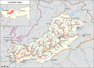
The Württemberger Haus is an Alpine Club hut of the Stuttgart section of the German Alpine Club in the Lechtal Alps , Tyrol , Austria .
location
The Württemberger house, built in 1924/25, is located at an altitude of 2220 m above sea level. A. in the upper medriol.
Accesses
- from Zams near Landeck through the Zammer Loch, 5 hours
- from Gramais over the Bitterscharte, 6 hours
- from Madau via the Leiterjöchl, 5 hours
Neighboring huts and crossings
- to the Memminger Hütte 4½ hours, over the Großbergspitze and -kopf as well as the Seescharte. Short rope insurance in the crags on the ascent to the Großbergspitze.
- to the Steinseehütte via Gebäudjöchl and Roßkarscharte, 4 hours. The ascent to the Roßkarscharte leads through an uncomfortable, flat gully, longer rope insurance. Inexperienced people should only undertake the path in the company of experienced mountain hikers or guides.
- to Hanauer Hütte 4½ hours, via Bitterscharte, Vordere Gufelscharte and Gufelseejöchl.
summit
- Großbergspitze, 2657 m , and Großbergkopf, 2612 m ; these peaks are exceeded in the course of the transition to the Memminger Hütte, 1½ hours
- Bittrichkopf, 2698 m , pathless over the ridge from the Bittrichscharte, 1½ hours (also suitable for ski tours - beautiful descents into the Lech Valley)
- Ladder tip , 2750 m , NE flank difficulty level I +, some climbing climbs between level II and IV
- Schieferspitze, 2735 m , climbing routes difficulty level between II and IV
- Gauntlets, western 2703 m and eastern 2700 m , climbing routes with a difficulty level between II and IV
- Schönpleiskopf (Schönpleisgrat), several peaks, highest 2549 m , southern summit not difficult , crossing of all peaks alternately I to IV, extremely brittle in places
- Kreuzjochspitze, 2672 m , pathless, demanding terrain with a short climbing section III, otherwise several sections I and II
cards
- Alpine Club Map 3/3 Lechtal Alps - Parseierspitze (1: 25,000)
literature
- Heinz Groth, Rudolf Wutscher: Area guide Lechtal Alps . Bergverlag Rother , 6th edition, Munich 1996, ISBN 978-3-7633-3261-8
- Dieter Seibert: Alpine Club Guide alpine, Lechtal Alps . Bergverlag Rother, 2nd edition, Munich 2008, ISBN 978-3-7633-1268-9

