
Gramais
|
Gramais
|
||
|---|---|---|
| coat of arms | Austria map | |
 |
|
|
| Basic data | ||
| Country: | Austria | |
| State : | Tyrol | |
| Political District : | Reutte | |
| License plate : | RE | |
| Surface: | 32.43 km² | |
| Coordinates : | 47 ° 16 ' N , 10 ° 32' E | |
| Height : | 1321 m above sea level A. | |
| Residents : | 41 (January 1, 2020) | |
| Population density : | 1.3 inhabitants per km² | |
| Postal code : | 6650 | |
| Area code : | 05634 | |
| Community code : | 7 08 12 | |
| NUTS region | AT331 | |
| Address of the municipal administration: |
No. 16 6650 Gramais |
|
| Website: | ||
| politics | ||
| Mayor : | Michael Fasser ( ÖVP ) | |
|
Municipal Council : (2010) (9 members) |
||
| Location of Gramais in the Reutte district | ||
  |
||

|
||
| Source: Municipal data from Statistics Austria | ||

Gramais is a municipality with 41 inhabitants (as of January 1, 2020) in the Reutte district in Tyrol ( Austria ). The community is located in the judicial district of Reutte . It is the smallest municipality in Austria.
geography
Gramais is located in a side valley of the Tyrolean Lech Valley , which branches off at Häselgehr . The community consists of two districts - the village of Gramais and the hamlet of Riefen. The Kogelsee and the Roßkarsee also belong to the rear municipal area .
Neighboring communities
The neighboring communities are Bach , Häselgehr , Imst , Zams and Pfafflar .
history
Gramais was first mentioned in a document in 1427. The name is derived from the Latin "graminosa" (rich in grass) or Romansh "grumoso" (rich in weeds), rather "grass-rich area".
The settlement activity took place in the 13th century from the Imst area. At first only used as pasture area, a permanent settlement developed here. In 1837 Gramais still had 121 inhabitants. The community can now be reached via a well-developed 8.5 km long road from Häselgehr. Gramais was part of the Imst district until 1938 and part of the Imst judicial district until 1947 .
coat of arms
The bull jumping up over the red background indicates the grazing and settlement of the Gramais valley from Imst.
Population development

politics
After no list was found for the municipal council and mayoral elections in 2016, the old list from 2010 remained in office.
Culture and sights
- Gramaiser Heimatmuseum: The small museum shows tools and equipment from rural life and documents the historical development of the small community.
Tourism and economy
Agriculture in Gramais is characterized by mountain farming. The place is the starting point for hikes and mountain tours in the Lechtal Alps . According to a publication from 2009, Gramais has the highest per capita debt of all municipalities in Austria at € 40,380.

The church of Gramais and the ladder tips in the upper, middle background

church
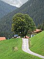
Impressions


Web links
- Official community website
- History-Tyrol: Gramais
- "Reconstruction of the farm" Wechner-Burgas "from Gramais" (1984) - film from the collection of the Federal Institute for Scientific Film (ÖWF) in the online archive of the Austrian Media Library
Individual evidence
- ↑ a b The bankrupt vulture circles all over the country: Our communities have so many debts. In: news.at. September 3, 2009, accessed September 3, 2009 .
- ^ Tirol Atlas, Geography Innsbruck: Gramais. Retrieved June 3, 2016 .
- ↑ No candidate: Tyrolean village cancels municipal council elections. In: Courier. Retrieved June 3, 2016 .
- ^ Gramais local history museum association. Retrieved March 27, 2016 .
Bach | Berwang | Biberwier | Bichlbach | Breitenwang | Ehenbichl | Ehrwald | Elbigenalp | Elmen | Forchach | Grän | Gramais | Häselgehr | Heiterwang | Hinterhornbach | Courtyards | Holzgau | Young wood | Emperor | Lechaschau | Lermoos | Musau | Nameless | Nesselwängle | Pfafflar | Pflach | Pinswang | Reutte | Schattwald | Stanzach | Steeg | Tannheim | Vils | Vorderhornbach | Wängle | Weißenbach am Lech | Zöblen