
Zöblen
|
Zöblen
|
||
|---|---|---|
| coat of arms | Austria map | |
 |
|
|
| Basic data | ||
| Country: | Austria | |
| State : | Tyrol | |
| Political District : | Reutte | |
| License plate : | RE | |
| Surface: | 8.78 km² | |
| Coordinates : | 47 ° 30 ' N , 10 ° 29' E | |
| Height : | 1087 m above sea level A. | |
| Residents : | 233 (January 1, 2020) | |
| Population density : | 27 inhabitants per km² | |
| Postal code : | 6677 | |
| Area code : | 05675 | |
| Community code : | 7 08 37 | |
| NUTS region | AT331 | |
| Address of the municipal administration: |
No. 39 6677 Zöblen |
|
| Website: | ||
| politics | ||
| Mayor : | Werner Gehring | |
|
Municipal Council : (2016) (11 members) |
||
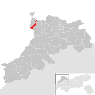
| Location of Zöblen in the Reutte district | ||
  |
||
 View from the Upper Halde to Zöblen |
||
| Source: Municipal data from Statistics Austria | ||

Zöblen is a municipality with 233 inhabitants (as of January 1, 2020) in the Reutte district in Tyrol ( Austria ).
geography
location
The smallest community in the Tannheimer Tal , through which the Vils flows, is a densely built-up village on an alluvial cone on the north side of the valley. On the north side of the village there are more farms on mountain meadows with agricultural use. Located in the vicinity of Tannheim , a modest tourism could develop.
Community structure
Zöblen consists of a single cadastral municipality and village of the same name :
|
structure
|
||||||
|
Legend for the breakdown table
|
Neighboring communities
| Schattwald | Pfronten ( Ostallgäu district , Bavaria ) | |
| Bad Hindelang ( Oberallgäu district , Bavaria ) |
.svg)
|
|
| Tannheim |
history
Originally, Zöblen was a Rodsiedlung in the 14th century. The place was first mentioned in 1399 as Gut Zobel . In 1427 there were already 42 residents living in six families. In 1835 Zöblen was raised to an independent municipality and previously belonged to the municipality of Tannheim as a district .
traffic
The two streets are connected with the Tannheimer Straße (B 199), which leads from Weißenbach am Lech to the German border with the federal highway 308 .
coat of arms
Blazon : Black sable running in a silver shield in a three-pass .
The colors of the municipality flag are black and white.
The coat of arms, awarded on October 20, 1987, symbolizes the name of the community.
The name Zöblen is derived from the female form of the family name Zobl = Zöblin (female), a family name that is very common in the Tannheimer Tal. The Zobl = stone marten can therefore also be seen in the coat of arms.
Culture and sights

Expositurkirche hl. Joseph

View from the Schönkahler to the Pirschling


Personalities
- Professor Franz Xaver Schedle , who comes from Zöblen, founded the first CV association on Austrian soil with fellow students in 1864, the AV Austria in Innsbruck. A memorial plaque on his relatives' house testifies to this.
- Walter Besler (born January 4, 1929), a teacher, geologist and university lecturer, was born in Zöblen and has received the Great Decoration of Honor for Services to the Republic of Austria .
Web links
- Municipality of Zöblen in the Tyrol region ( Memento from February 1st, 2008 in the Internet Archive )
Individual evidence
- ^ The community of Zöblen. In: Tirol Atlas. Retrieved May 15, 2020 .
Bach | Berwang | Biberwier | Bichlbach | Breitenwang | Ehenbichl | Ehrwald | Elbigenalp | Elmen | Forchach | Grän | Gramais | Häselgehr | Heiterwang | Hinterhornbach | Courtyards | Holzgau | Young wood | Emperor | Lechaschau | Lermoos | Musau | Nameless | Nesselwängle | Pfafflar | Pflach | Pinswang | Reutte | Schattwald | Stanzach | Steeg | Tannheim | Vils | Vorderhornbach | Wängle | Weißenbach am Lech | Zöblen