Steinseehütte
| Steinseehütte ÖAV refuge category I |
||
|---|---|---|
|
Steinseehütte from the southeast. Behind it Hinterer Gufelkopf, Steinkarspitze, Parzinntürme and Spiehlerturm |
||
| location | in the Steinkar; Tyrol , Austria | |
| Mountain range | Lechtal Alps | |
| Geographical location: | 47 ° 13 '34 " N , 10 ° 35' 14" E | |
| Altitude | 2061 m above sea level A. | |
|
|
||
| owner | Landeck section | |
| Built | 1924, extended 1954, 1966/68, 1983 | |
| Construction type | Refuge | |
| Development | Material ropeway from the Hinterstarkalpe | |
| Usual opening times | Mid June to late September | |
| accommodation | 24 beds, 60 camps | |
| Winter room | 12 bearings | |
| Web link | www.steinseehuette.at | |
| Hut directory | ÖAV DAV | |
The Steinseehütte is an Alpine Club hut of the Landeck section of the Austrian Alpine Club in the Lechtal Alps , Tyrol , Austria .
location
The Steinseehütte, built in 1924, is at an altitude of 2061 m above sea level. A. in the Steinkar. The eponymous Steinsee is about 20 minutes' walk away and 160 meters above the hut.
history
The first small wooden hut was built as early as 1924, in this area, which is particularly popular for climbers. Shortly afterwards a kitchen room was added. In 1954 a stone building was added to the previous hut. A second extension was added between 1966 and 1968. In 1983, the shell of a further extension could be created, which was followed by interior work the following year.
In 2017 an extension was added.
Accesses
From Zams near Landeck via the Alfuzhütte / Alfuzalm through the Starkenbachtal, 5 hours, ascent to the south. There is a path to the Alfuzhütte that can be used by car, private ski hut, partly managed, parking lot, from here 2.5 to 3 hours.
Neighboring huts and crossings
- to the Württemberger Haus via Roßkarscharte and Gebäudljöchl, 4 hours. The descent from the Roßkarscharte leads through an uncomfortable, flat gully, longer rope insurance. The transition is unsuitable for inexperienced people without experienced guidance.
- to the Hanauer Hütte either via the front or the rear Dremelscharte, 2.5 or 3.5 hours. Both transitions take place over long, loose rubble slopes and require surefootedness . From the Steinseehütte it is better to walk the front, western Dremelscharte, from the Hanauer Hütte the rear, eastern one, because the steeper part is then in the ascent.
- to the Muttekopfhütte through the Larsennkar, little used, varied, long (according to the AV guide 6 hours, rather longer), over the hidden Gratscharte on the Bergwerkskopf. Hardly marked. Alternatively, the long route past the Hanauer Hütte via Galtseitjoch and Muttekopfjoch, which is very popular.
summit
- Dremelspitze , 2741 m, normal route (marked) difficulty level II, further climbs up to VI ("the most beautiful climbing in brittle rock"),
- Steinkarspitze , 2650 m, u. a. easy via ferrata, further climbs up to level VI
- Parzinnspitze 2613 m, difficulty level II
- Southwestern Parzinnturm, 2590 m, east edge ("long edge"), degree of difficulty III, one of the most popular climbing tours in the area, descent over southern flank I.
- Northeast Parzinnturm, 2582 m, western flank difficulty level I, further tours III to IV
- Spiehlerturm , approx. 2550 m, popular climbing point, normal ascent, difficulty level III +, exposed, further routes up to V +
- Schneekarlespitze , 2647 m, normal route difficulty level II +, many other routes in areas IV to V.
- Bergwerkskopf , 2728 m, normal route difficulty level II to III, further routes up to V
Climb
The area around the Steinseehütte offers many climbing opportunities. In recent years, numerous classics have been renovated sparingly with bolts. There are also some new, very well secured routes. The "Gusta" route is an example. There are several climbing gardens at the base of the Schneekarlespitze . Thanks to the large number of climbing routes of varying difficulty and safety status, the area around the Steinseehütte is ideal for taking the step from sport climbing or indoor climbing to alpine climbing.
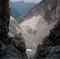
- Surroundings of the Steinseehütte
cards
- Alpine club map 3/4 Lechtal Alps - Heiterwand and Muttekopf area (1: 25,000)
Sources and literature
- Heinz Groth / Rudolf Wutscher: Area Guide Lechtal Alps . Bergverlag Rother , Munich, ISBN 978-3-7633-3261-8
- Dieter Seibert: AVF alpin, Lechtal Alps . Bergverlag Rother, Munich, ISBN 978-3-7633-1268-9
Web links
Individual evidence
- ↑ The history of the Steinseehütte. Retrieved June 20, 2019 .
- ↑ http://www.bergstieg.com/de/touren.aspx?ID=1493


