
Hamlet (Rottenburg)
|
hamlet
City of Rottenburg am Neckar
|
|
|---|---|
.svg) |
|
| Height : | 457 (373-558) m |
| Area : | 3.84 km² |
| Residents : | 1065 (Jul 31, 2018) |
| Population density : | 277 inhabitants / km² |
| Incorporation : | 1st December 1971 |
| Postal code : | 72108 |
| Area code : | 07472 |
Weiler is a district of Rottenburg am Neckar in the Tübingen district in Baden-Württemberg ( Germany ).
geography
Geographical location

Weiler is located around four kilometers south of Rottenburg on the eastern Gäu plateau at an altitude of 373 to 558 meters. In the east, on the foothills of the Keuperhöhenzug belonging to the Rammert, is the 40.12 hectare nature and landscape protection area Rappenberg .
expansion
The district area of the place is 384 hectares . Of this, 53.3% is agricultural land, 35.5% is forest, 10.4% is settlement and traffic area, 0.3% is water and 0.5% is used for other purposes.
Neighboring places
The following places border on hamlets, they are called clockwise, starting in the north: Rottenburg, Dettingen and Bad Niedernau (all belong to the Tübingen district ).
population
With a population of around 1070, Weiler is one of the medium-sized districts of Rottenburg. In relation to the district area of 3.84 km 2, Weiler has a population density of 280 inhabitants per square kilometer .
history

Weiler was first mentioned in 1244 as Wilaere (then Burgweiler) and was responsible for supplying the Rotenburg (today: Weilerburg ). There were frequent droughts and periods of drought, which resulted in crops not growing and people suffering from thirst. There used to be two chapels in the hamlet, St. Jodokus (1339) and St. Wolfgang (approx. 1450). The St. Jodokus Chapel used to be the actual place of worship in the village, although the chapel was three kilometers from the village. This chapel was demolished in 1809 and the foundations were almost completely removed. Today only a wayside shrine reminds of the former chapel. The parish church of St. Wolfgang was built in the Weinbrenner style in 1828 on the old site of the St. Wolfgang Chapel.
see also Burgstall Rotenburg
From 1381 Weiler belonged to Front Austria and from the end of Front Austria to the Kingdom of Württemberg . In 1884, under the direction of Karl von Ehmann, a single-cylinder piston pump with diesel / oil drive and an engine house were built, which is said to have been one of the first in the Kingdom of Württemberg . Despite this water supply, there were always water shortages and problems with the cleanliness of the water in Weiler, so that the health department in the hamlet town hall was a permanent guest. Since 1849 there has been a bakery with a wood oven in the old town center of Weilers . There you can bake or buy fresh bread two to three times a week. The two hamlet inns have long been closed, so that the hamlet citizens are dependent on organizing their own parties. There used to be a school, a teacher's house, a wine press and a poor house in Weiler. Up until the Second World War, wine was grown around today's Weilerburg (formerly Rotenburg). The wine press was badly damaged by a bomb strike in 1945 and had to be demolished as a result. Since 2011 there has been a mobile nutcracker lift in Weiler in winter , which was purchased for skiers and snowboarders.
Weiler has been part of the large district town of Rottenburg am Neckar since December 1, 1971 .
Culture and sights
Buildings
- Katzenbacher brickworks
- Weilerburg (Rottenburg)
- Pumphäusle (1884)
- Seven Valleys Cave
- Ski lift on the Rappenberg

Bakery hamlet
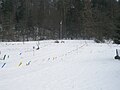
Ski lift on the Rappenberg

Wine press at the hamlet Burgparkplatz

Half-timbered house and fountain


Regular events
- Baking kitchen festival, village festival around the bakery kitchen built in 1849 in the old town center.
- Pumphäusle festival of the bird and nature conservation association.
- May Festival
Economy and Infrastructure
Weiler is on the L 385 between Rottenburg, Ofterdingen and Hirrlingen . In the local public transport bus line 7623 between Rottenburg and Hirrlingen. The place is in honeycomb 112 of the Neckar-Alb-Danube transport association . There are mainly small businesses.
literature
- Karlheinz Geppert (Red.): Weiler 1244 - 1994 . About the village at the foot of the Weilerburg and its history, Rottenburg / N. 1994.
Individual evidence
- ^ Federal Statistical Office (ed.): Historical municipality directory for the Federal Republic of Germany. Name, border and key number changes in municipalities, counties and administrative districts from May 27, 1970 to December 31, 1982 . W. Kohlhammer, Stuttgart / Mainz 1983, ISBN 3-17-003263-1 , p. 535 .
Web links
Bad Niedernau | Baisingen | Bieringen | Dettingen | Eckenweiler | Ergenzingen | Frommenhausen | Hailfingen | Hemmendorf | Kiebingen | Obernau | Oberndorf | Schwalldorf | Seebronn | Hamlet | Wendelsheim | Wormlings