Motorway 17 (Belgium)
| Motorway / Autoroute / Autosnelweg A17 in Belgium | |

|
|
| |
|
| map | |
| Basic data | |
| Operator: | |
| Overall length: | 67 km |
|
Course of the road
|
|
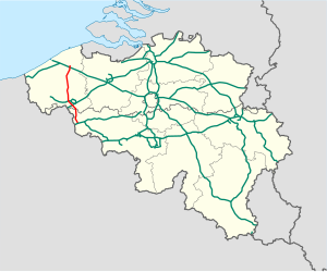
The Belgian motorway 17 , also on French. Autoroute 17 or Dutch Called Autosnelweg 17 , it starts in Marquain and ends in Bruges . Their total length is 67 km.
course
The A17 begins at the Marquain motorway junction , where it branches off from the A8 . At the Aalbeke junction, it crosses the A14 . After the Wevelgem tunnel with a length of 600m, it crosses the A19 at Moorsele . In the further course it crosses many national roads until it ends at the Bruges motorway junction . There it crosses the A10 , which leads to Ostend and Brussels . After the cross, the A17 changes to the N31 .
history
During construction, the A17 was divided into seven sections, which were opened between 1977 and 1998.
| section | opening |
|---|---|
| Brugge - Ruddervoorde | 1984 |
| Ruddervoorde - Lichtervelde | 1983 |
| Lichtervelde - Roeselare-Haven | 1982 |
| Roeselare-Haven - Aalbeke | July 1, 1977 |
| Aalbeke - Dottignies | 1998 |
| Dottignies - Templeuve | 1986 |
| Templeuve - Marquain | 1977 |
photos
Motorway intersection between A17 and A19
End of the A17: motorway junction Brugge


