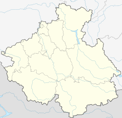
Aktash (Altai Republic)
| Village
Aktash
Акташ
|
||||||||||||||||||||||||||||||
|
||||||||||||||||||||||||||||||
|
||||||||||||||||||||||||||||||
Aktash ( Russian Акта́ш ) is a village (selo) in the Altai Republic ( Russia ) with 2755 inhabitants (as of October 14, 2010).
geography
The place is about 220 km as the crow flies south-southeast of the republic capital Gorno-Altaisk in the Russian Altai between the almost 3500 m high, northeast running Kurai chain (Kuraiski chrebet) and the almost 4200 m high Northern Chuja chain (Severotschuiski chrebet) in the south. It is located between the river Tschibitka and its tributary Menka, about 8 km above (east) the confluence of the Tschibitka in the Tschuja .
Aktash belongs to the Ulaganski Rajon and is located almost 50 km southwest of its administrative seat Ulagan . It is the seat and the only locality of the rural municipality of Aktaschskoje selskoje posselenije.
The M52 in Aktasch
history
The town owes its existence to a nearby mercury ore deposits, which in 1842 by Pyotr Tschichatschow first described in 1914 and of Vladimir Obruchev was then in the 1920s, more precisely explored. However, until 1942, when during the war , the other major mercury deposits (as in Horlivka in Ukraine ) in the German Wehrmacht were occupied territory, was begun to reduce. A miners' settlement was created, which became an official site in 1957 and shortly thereafter an urban-type settlement .
Aktash initially belonged to the Kosh-Agatschski rajon , but was assigned to the Ulaganski rajon in 1968. At the same time, its administration was moved from Ust-Ulagan (now Ulagan) to Aktasch, but back again in the 1980s. In 1994 Aktash lost the status of an urban settlement and has been a village ever since.
On September 27, 2003 and the following days, the site was significantly destroyed by a strong earthquake ( magnitude 7.3) with a series of aftershocks.
Population development
| year | Residents |
|---|---|
| 1959 | 2230 |
| 1970 | 3539 |
| 1979 | 3293 |
| 1989 | 3550 |
| 2002 | 3356 |
| 2010 | 2755 |
Note: census data
traffic
Aktasch is located on the M52 trunk road , which starts from Novosibirsk and passes Barnaul and Gorno-Altaisk from Aktasch and continues through the neighboring district of Kosch-Agach to the Mongolian border at Taschanta . In Aktasch, the 50 km long Ulaganski trakt road branches off in a north-easterly direction over the 2080 m high Ulaganski pass to Ulagan.
Individual evidence
- ↑ a b Itogi Vserossijskoj perepisi naselenija 2010 goda. Tom 1. Čislennostʹ i razmeščenie naselenija (Results of the All-Russian Census 2010. Volume 1. Number and distribution of the population). Tables 5 , pp. 12-209; 11 , pp. 312–979 (download from the website of the Federal Service for State Statistics of the Russian Federation)


