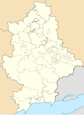
Horlivka
| Horlivka | ||
| Горлівка | ||

|
|
|
| Basic data | ||
|---|---|---|
| Oblast : | Donetsk Oblast | |
| Rajon : | District-free city | |
| Height : | 215-316 m | |
| Area : | 421.172 km² | |
| Residents : | 257,126 (2019) | |
| Population density : | 611 inhabitants per km² | |
| Postcodes : | 84646 | |
| Area code : | +380 624 | |
| Geographic location : | 48 ° 18 ' N , 38 ° 3' E | |
| KOATUU : | 1410600000 | |
| Administrative structure : | 3 city rajone , 3 SsT , 1 village, 7 settlements | |
| Address: | пр. Перемоги 67 84646 м. Горлівка |
|
| Website : | http://gorlovka.dn.ua/ | |
| Statistical information | ||
|
|
||
Horliwka ( Ukrainian Горлівка ; Russian Горловка Gorlowka ) is a Ukrainian city with about 255,000 inhabitants (2019).
Horlivka is located in Donetsk Oblast on the Luhan River, 47 km north of Donetsk . The place has several train stations that connect the railway lines Kharkiv-Horlivka , Otscheretyne-Svervo , Poltava-Rostov and Sumy-Horlivka in the network of Donetska Salisnyzja . The international trunk road M 04 runs south of the village , plus the territorial roads T-05-13 and T-05-16 in the local area.
history
Horliwka was founded as the Korsun station in 1779 and was renamed Gorlowka or Horliwka from 1868 in honor of the Russian geologist Petr Gorlow , as Petr Gorlow found cinnabarite there . During his work for the coal industry in the area, the place grew into a workers' settlement, since 1932 the Horliwka tram has been running in the city.
There were two prisoner-of-war camps in the city, 242 (on the northern edge of the city) and 472 for German prisoners of war of the Second World War . Seriously ill people were cared for in the prisoner-of-war hospitals in 1242 and 6027 .
At the end of April 2014, Horlivka was captured by pro-Russian separatists during the armed conflict in Ukraine . From August 2014, the city has been fought over between separatists and Ukrainian troops, the urban area has been largely occupied by separatists from the so-called Donetsk People's Republic since 2016 .
Political structure
The Horliwka district has a total of 276,069 inhabitants (2012).
Horliwka is divided into:
- 3 Stadtrajone ( Rajon Kalinin , Rajon Mykytiwka , Rajon Zentralne-Misto , in the graph on the left: violet, green or red)
- 2 urban-type settlements: Holmiwskyj , Pantelejmoniwka
- 1 village: Ryazne (Рясне)
- 7 settlements: Hladossowe (Гладосове) Mychajliwka (Михайлівка) Oserjaniwka (Озерянівка) Pjatychatky (П'ятихатки) Stawky (Ставки) Fedoriwka (Федорівка) Schyroka Balka (Широка Балка)
The area of the urban-type settlement Sajzewe also belonged to the urban area, but was attached to the Bachmut district on September 8, 2016 .
population
| 1923 | 1926 | 1939 | 1959 | 1970 | 1979 | 1989 | 2001 | 2005 | 2016 | 2019 |
|---|---|---|---|---|---|---|---|---|---|---|
| 11,476 | 23,149 | 181,448 | 292,616 | 335.064 | 336,487 | 338.106 | 292,250 | 279.061 | 249.048 | 257.126 |
Source:
| nationality | number | proportion of | of which ... as a mother tongue | ||||
| the language of one's own nationality |
Ukrainian | Russian | other | no information | |||
| all | 312.284 | 100 | x | x | x | x | x |
| Ukrainians | 160.397 | 51.4 | 28.4 | 28.4 | 71.5 | 0.1 | 0 |
| Russians | 139,980 | 44.8 | 98.9 | 1 | 98.9 | 0.1 | 0 |
| Belarusians | 4079 | 1.3 | 9.4 | 2.1 | 88.3 | 0.2 | - |
| Tatars | 876 | 0.3 | 17.9 | 1.7 | 80.2 | 0.2 | - |
| Armenians | 784 | 0.3 | 40.4 | 0.1 | 58.6 | 0.5 | 0.4 |
| Moldovans | 720 | 0.2 | 11.3 | 12.6 | 76.0 | 0.1 | - |
| Azerbaijanis | 647 | 0.2 | 4.34 | 1.9 | 53.9 | 0.8 | - |
sons and daughters of the town
- Mark Reisen (1895–1992), Soviet opera singer, born near Horliwka
- Michail Malzew (1904–1982), Soviet general, born near Horlivka
- Evgeni Bulantschik (1922–1996), hurdler
- Anatoly Evtushenko (* 1934), Russian handball trainer and Olympic participant
- Nikolai Kapustin (1937–2020), Soviet-Ukrainian composer and pianist
- Juli Makowos (* 1937), Russian mathematician
- Alexander Volkov (* 1948), Soviet cosmonaut
- Jurij Boiko (* 1958), Ukrainian politician
- Najponk (* 1972), Czech jazz musician
- Sergej Rebrow (* 1974), Ukrainian football player
- Natalija Semenova (* 1982), discus thrower
- Ruslan Ponomarjow (* 1983), Ukrainian world chess champion
- Olena Pawluchina (* 1989), Azerbaijani cyclist
- Mykyta Shevchenko (* 1993), Ukrainian football goalkeeper
Web links
Individual evidence
- ↑ Сhyselnist Naselennya po mistakh ta rayonakh. Retrieved December 12, 2019 (Ukrainian).
- ↑ Maschke, Erich (ed.): On the history of the German prisoners of war of the Second World War. Verlag Ernst and Werner Gieseking, Bielefeld 1962–1977.
- ↑ Spiegel.de:Ukraine_Konflik, separatists storm government buildings
- ↑ Map of the current front line on liveuamap.com
- ↑ Population figures of Donetsk Oblast from the Central Statistical Office in Donetsk
- ↑ Верховна Рада України; Постанова, План від 08.09.2016 № 1520-VIII Про зміни в адміністративно-територіальному устрої Донецької області, зміну і встановлення меж міста Горлівка та Бахмутського району Донецької області
- ↑ Demography of Ukrainian cities on pop-stat.mashke.org
- ↑ http://history.org.ua/LiberUA/NatsSklRMDonObl/NatsSklRMDonObl.pdf


