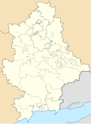
Kutejnykowe
| Kutejnykowe | ||
| Кутейникове | ||

|
|
|
| Basic data | ||
|---|---|---|
| Oblast : | Donetsk Oblast | |
| Rajon : | Amvrosiyivka district | |
| Height : | 186 m | |
| Area : | Information is missing | |
| Residents : | 1,767 (2011) | |
| Postcodes : | 87321 | |
| Area code : | +380 6259 | |
| Geographic location : | 47 ° 49 ' N , 38 ° 18' E | |
| KOATUU : | 1420655600 | |
| Administrative structure : | 1 urban-type settlement | |
| Mayor : | Eduard Urwachev | |
| Address: | вул. Шкільна 16 87321 смт. Кутейникове |
|
| Statistical information | ||
|
|
||
Kutejnykowe (Ukrainian Кутейникове ; Russian Кутейниково / Kuteinikowo ) is an urban-type settlement in Donetsk Oblast in eastern Ukraine with about 1700 inhabitants.
The settlement is on the edge of the Donets Basin , about 14 kilometers west of the Rajonshauptstadt Amvrosiivka as well as 34 kilometers southeast from Oblastzentrum Donetsk area.
The place was built in 1878 in the course of the construction of the railway line between Ilowajsk and Taganrog / Rostov-on-Don and has had the status of an urban-type settlement since 1938. There is a baked goods combine and a feed mill with a grain silo in the village.
Since August 2014, as a result of the war in Ukraine , the settlement has been in the hands of pro-Russian separatists from the Donetsk People's Republic .

