Debaltseve
| Debaltseve | ||
| Дебальцеве | ||

|
|
|
| Basic data | ||
|---|---|---|
| Oblast : | Donetsk Oblast | |
| Rajon : | District-free city | |
| Height : | 308 m | |
| Area : | 24.31 km² | |
| Residents : | 25,184 (2014) | |
| Population density : | 1,036 inhabitants per km² | |
| Postcodes : | 84700 | |
| Area code : | +380 6249 | |
| Geographic location : | 48 ° 21 ' N , 38 ° 26' E | |
| KOATUU : | 1410900000 | |
| Administrative structure : | 2 cities , 1 urban-type settlement | |
| Address: | вул. Совєтська 85 85 700 м. Дебальцеве |
|
| Website : | debalcevo-dnr.ru | |
| Statistical information | ||
|
|
||
Debaltseve ( Ukrainian Дебальцеве ; Russian Дебальцево Debaltsevo ) is a railway town in eastern Ukraine . In 2014 it had about 25,000 inhabitants.
geography
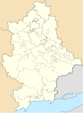
The city is located in the Donbass in the Donetsk Oblast 58 km northeast of the Donetsk Oblast center . In the east, the city borders on the Luhansk Oblast . In the southwest it borders on the city of Wuhlehirsk .
The municipality has a total of 46,000 inhabitants (2013) and is divided into the city of Debaltseve in the south of the municipality and the city of Switlodarsk and the urban-type settlement Myronivskyj in the north of the municipality. On May 20, 2015, the settlement councils of Switlodarsk and Myroniwskyj came to Artemivsk Raion (now Bachmut Raion ) by decision of the Verkhovna Rada .
Economy and Infrastructure
The Debaltseve station is an important junction station in the east of Ukraine . In this station, four routes are linked:
- Debalzewe- Alchevsk - Luhansk - ( Voronezh ) - ( Moscow )
- Debalzewe- Chornukyne - Sverdlovsk - ( Volgograd )
- Debaltseve - Stakhanov - Popasna - Rubizne - Kupyansk
- Debalzewe- Vuhlehirsk - Horlivka - Dnipro - Kiev
The neighboring Wuhlehirsk station to the west of Debalzewe is also a hub station. This is where the two routes branch off from the main route to Kiev
- Wuhlehirsk - Donetsk - Mariupol and
- Wuhlehirsk - Switlodarsk - Popasna
from. In the neighboring Chornukyne station to the south, the route to Sverdlovsk branches off to Molchalyne or Shakhtarsk .
The international highways M 03 and M 04 also cross near the city .
history
In 1878 the railway station and the Debaltseve settlement were founded. In 1894, workshops for the maintenance of the trains were built around the station. The population grew to 2,000 by 1897. In 1911 Debaltseve had 20,000 inhabitants. At the end of the Russian Empire , the railway facilities were supplemented by one of the few marshalling yards with a waste mountain at that time . In the 1930s, the city was connected to the electricity and water networks and cultural institutions such as the Palace of Culture were built. In 1938 Debaltseve received city status. After heavy destruction in the German-Soviet war , Debaltseve was rebuilt in the post-war period.
During the war in Ukraine that began in 2014 , the city was the scene of protracted skirmishes between pro-Russian separatists and Ukrainian units. The local railway station has been closed for rail traffic since mid-2014 until further notice. At the end of July 2014 the Ukrainian army recaptured the place. From January 2015, the rebels attacked the position of government forces with heavy weapons. On February 17, 2015, armed separatists invaded the town, although the Minsk II agreement contained a ceasefire that would apply from February 15. The next day, the President of Ukraine announced the withdrawal of the army from the city, which has since been under the control of the separatists.
population
| 1923 | 1926 | 1939 | 1959 | 1970 | 1979 | 1989 | 2001 | 2005 | 2014 |
|---|---|---|---|---|---|---|---|---|---|
| 9,586 | 13,100 | 34.202 | 33,847 | 35,366 | 33,871 | 35,511 | 30,246 | 28,644 | 25.184 |
Source:
The population consists of 64.4% Ukrainians, 32.6% Russians and 1% members of other ethnic groups.
Personalities
- Volodymyr Sosjura (1898–1965), writer, poet and poet
- Boris Shcherbina (1919–1990), Soviet politician
- Wladimir Sergejewitsch Imschennik (* 1928), Russian theoretical physicist
Web links
- Side of town (Russian)
- Information and pictures about the train station (Russian)
Individual evidence
- ↑ a b Demography of Ukrainian cities on pop-stat.mashke.org
- ↑ Data from the Central Statistical Office of Donetsk Oblast (Ukrainian)
- ↑ official page Switlodarsk (Ukrainian)
- ↑ official page Myroniwskyj (Ukrainian)
- ↑ Верховна Рада України; Постанова, План від 20.05.2015 № 458-VIII "Про зміну і встановлення меж Артемівського району Донеіцької област" "
- ↑ Beilstein / Kümmerly + Frey: Railmap Europe , 1st edition 2008
- ↑ Ivan Efimovič Savčenko, K. Ju. Skalov: Razvitie železnodorožnych stancij i uzlov . Transželdorizdat, Moscow 1960, p. 9
- ↑ Lok-Magazin , issue 11/2014, p. 29
- ↑ tt.com
- ↑ kyivpost.com
- ↑ donetskstat.gov.ua ( Memento from February 3, 2012 on WebCite )


