Myronivskyi
| Myronivskyi | ||
| Миронівський | ||

|
|
|
| Basic data | ||
|---|---|---|
| Oblast : | Donetsk Oblast | |
| Rajon : | Bachmut district | |
| Height : | 181 m | |
| Area : | 11.1 km² | |
| Residents : | 8,045 (2013) | |
| Population density : | 725 inhabitants per km² | |
| Postcodes : | 84791 | |
| Area code : | +380 6249 | |
| Geographic location : | 48 ° 28 ' N , 38 ° 17' E | |
| KOATUU : | 1410945400 | |
| Administrative structure : | 1 urban-type settlement | |
| Mayor : | Ihor Kostohlodow | |
| Address: | вул. Леніна 16 84791 смт. Миронівський |
|
| Statistical information | ||
|
|
||
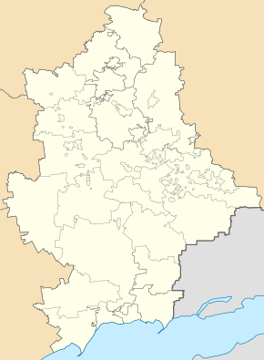
Myroniwskyj (Ukrainian Миронівський ; Russian Мироновский / Mironowski ) is an urban-type settlement in the east of the Ukrainian Donetsk Oblast with about 8,000 inhabitants. The place is 25 kilometers southeast of the Rajons capital Bachmut and 62 kilometers northeast of the Oblast capital Donetsk on the river Luhan , which is dammed up here to the reservoir Myroniwka .
Myroniwskyj was founded in 1953 as a housing estate for the workers of the Myroniwka coal-fired power plant , which was built at the same time. The name is derived from the village of Myroniwka north of the reservoir .
Until May 20, 2015, the city was administratively part of the city of Debaltseve , after which it came to Artemivsk Raion (now Bachmut Raion ) by decision of the Verkhovna Rada .
Since February 2015, as a result of the war in Ukraine, the place has been in the immediate vicinity of the southern front line to the separatist areas of the Donetsk People's Republic .


