Kurachowe
| Kurachowe | ||
| Курахове | ||

|
|
|
| Basic data | ||
|---|---|---|
| Oblast : | Donetsk Oblast | |
| Rajon : | Marjinka district | |
| Height : | 122 m | |
| Area : | 24 km² | |
| Residents : | 19,677 (2016) | |
| Population density : | 820 inhabitants per km² | |
| Postcodes : | 85612 | |
| Area code : | +380 +6278 | |
| Geographic location : | 47 ° 59 ' N , 37 ° 16' E | |
| KOATUU : | 1423310600 | |
| Administrative structure : | 1 city, 1 urban-type settlement , 1 village, 2 settlements | |
| Mayor : | Serhiy Sashko | |
| Address: | пр-т. К. Маркса 4 85612 м. Курахове |
|
| Statistical information | ||
|
|
||
Kurachowe ( Ukrainian Курахове ; Russian Курахово Kurachowo ) is a city in Ukraine with about 20,000 inhabitants (2016).
geography
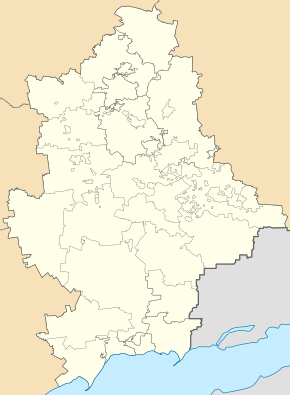
Kurakhove lies in the west of the Donetsk Oblast on the left bank of the Kurachower reservoir , a traffic jam of Wowtscha -Flusses. The city is located about 50 km west of Donetsk on the trunk road N 15 .
Administratively, belongs to the City Council community adjacent to the city and the urban-type settlement Illinka , the village Stepaniwka ( Степанівка ) and the settlements Ostriwske ( Острівське ) and Stari Terny ( Старі Терни ).
A high-voltage overhead line has been running from the Kurachowe power plant to Zaporizhia since 1964 . The local train station is in the eastern part of Roja.
history
Kurachowe arose in 1936 from a workers' settlement that was built for workers from the nearby power station and was called Kurachowgrjesstroj ( Кураховгрэсстрой ) until 1943 , then until 1956 Kurachowgrjes ( Кураховгрэс ). A POW camp was located in the Roja district until 1950. In 1956 the village had grown so much that it was declared a city.
population
| 1979 | 1989 | 2001 | 2010 | 2019 |
|---|---|---|---|---|
| 20.091 | 22,155 | 21,479 | 20,224 | 18,782 |
Swell:
economy
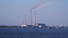
The most important employers are a large coal-fired power station for electricity and heat generation and a steel mill.
Web links
Individual evidence
- ↑ a b Population figures on pop-stat
- ↑ City history (Russian)


