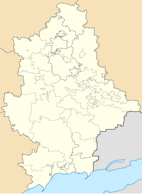
Korsun (Ukraine)
| Korsun | ||
| Корсунь | ||

|
|
|
| Basic data | ||
|---|---|---|
| Oblast : | Donetsk Oblast | |
| Rajon : | Yenakieve district | |
| Height : | 148 m | |
| Area : | Information is missing | |
| Residents : | 2,586 (2019) | |
| Postcodes : | 86499 | |
| Area code : | +380 6252 | |
| Geographic location : | 48 ° 13 ' N , 38 ° 4' E | |
| KOATUU : | 1412046800 | |
| Administrative structure : | 1 urban-type settlement , 4 villages, 1 settlement | |
| Address: | вул. Вокзальна 96 86499 смт. Корсунь |
|
| Statistical information | ||
|
|
||
Korsun ( Ukrainian and Russian Корсунь ) is an urban-type settlement in Donetsk Oblast in eastern Ukraine with around 2,600 inhabitants (2019).
The settlement is located in the Donets Basin on the banks of the Korsun , a 25 km long tributary of the Krynka . The M 04 / E 50 trunk road runs to the north of the village . The village, founded in 1938, had 6453 inhabitants in 1959 and 3909 inhabitants in 1970. Since 2014, the village has been under the control of the self-proclaimed Donetsk People's Republic .
Korsun administratively belongs to the city district, 5 km east are Yenakiieve and still the villages itself is the administrative center of the settlement council district of the same, Werchnja Krynka (Ukrainian Верхня Кринка ) Petriwske (Ukrainian Петрівське ) Puteprowid (Ukrainian Путепровід ) and Shevchenko (Ukrainian Шевченко ) and the settlement Schtschebenka (ukrainian Щебенка ) belong.
Individual evidence
- ↑ a b Demography of Ukrainian cities on pop-stat.mashke.org
- ↑ http://www.dialog.ua/news/55093_1431535006

