
Alb (Upper Rhine)
| Alb | ||
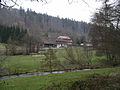
 Alb in Ettlingen |
||
| Data | ||
| Water code | EN : 2374 | |
| location | Baden-Württemberg | |
| River system | Rhine | |
| Drain over | Rhine → North Sea | |
| source |
Alb origin in the ax hole under the Langmartskopf approx. 6 km south of Bad Herrenalb 48 ° 45 ′ 0 ″ N , 8 ° 25 ′ 22 ″ E |
|
| Source height | approx. 743 m above sea level NHN | |
| muzzle | north of Karlsruhe in the Rhine Coordinates: 49 ° 4 ′ 44 " N , 8 ° 20 ′ 28" E 49 ° 4 ′ 44 " N , 8 ° 20 ′ 28" E |
|
| Mouth height | approx. 100.4 m above sea level NHN | |
| Height difference | approx. 642.6 m | |
| Bottom slope | approx. 12 ‰ | |
| length | 51.5 km | |
| Catchment area | 447.574 km² | |
| Discharge at the Ettlingen A Eo gauge : 150 km² Location: 23.5 km above the mouth |
NNQ (August 26, 1976) MNQ 1964/2009 MQ 1964/2009 Mq 1964/2009 MHQ 1964/2009 HHQ (03/21/2002) |
219 l / s 712 l / s 2.38 m³ / s 15.9 l / (s km²) 27.4 m³ / s 99.5 m³ / s |
| Left tributaries | Moosalb , Malscher Landgraben , Federbach | |
| Right tributaries | Maisenbach , Scheidgraben | |
The Alb is an approximately 51 kilometer long river in the northern Black Forest and the central Upper Rhine plain in Baden-Württemberg , which flows into the Rhine from the right and south on the northern edge of the district of Karlsruhe .
The Rhine has another tributary called Alb from the southern Black Forest , also called Hauensteiner Alb , further upstream on its Upper Rhine section .
geography
course
The Alb rises south-east of the Teufelsmühle mountain at about 743 m above sea level. NN . From here it flows in a northerly direction through an initially deeply sunk, broad-bottomed valley. It cuts through a valley step in the narrow valley of the Kluse and forms a small, previously artificially elevated waterfall. Below the rock walls of the Rotliegenden towered spa town of Bad Herrenalb the valley slopes are significantly lower, and the slope of the small river has decreased. Frauenalb with its monastery ruins is located in this section of the valley . At Marxzell the Alb takes on the Maisenbach from the right. At Fischweier the Moosalb flows to the left . At Busenbach , its course turns to the northwest. Large parts of the floodplain of the Alb and its tributaries in the northern Black Forest have been part of the Albtal and Seitentäler nature reserve since 1994 . The Alb Valley Railway , which runs in the valley floor, connects Bad Herrenalb with Ettlingen and Karlsruhe.
In Ettlingen the Alb leaves the Black Forest after exactly half its length and enters the middle Upper Rhine Plain , flows completely through Ettlingen and then turns its course in the extensive Kinzig-Murg-Rinne again in a northerly direction. In this very flat area, a few side arms such as the Alder Trench branch off to the left , which then all flow back again. On this section it flows past the Karlsruhe district of Rüppurr .
It then crosses under Bundesstraße 10 and then follows it in a north-westerly direction through the Günther-Klotz-Anlage in the south-west of Karlsruhe - partly as a district boundary between Bulach and Beiertheim - and thus forms the backbone of one of the most popular local recreation areas in Karlsruhe. It flows through Daxlanden in a large loop, otherwise a rather stretched course; One of the scenic highlights here is the “Appenmühle” barrage, where the Stadtwerke Karlsruhe has been generating electricity from hydropower since 2000; there is also a fish ladder here.
Later, the Alb flows closely around the Karlsruhe Rhine port near Mühlburg . On the south-eastern edge of Karlsruhe- Maxau , where the longest tributary, the Federbach, flows into it from the left, its course turns to the north-northeast, roughly parallel to the Rhine and flows through the MiRO oil refinery . It then flows into the Rhine immediately below the entrance to the Karlsruhe oil port and finally south-east .
Shortly before that, the Albüberleitung branches off to the right , which accompanies the river for another 3.5 km to the right and then feeds the Pfinz relief canal in the area of an oxbow at Eggenstein-Leopoldshafen , which in turn soon reaches the Rhine from the right.
Tributaries
The more important tributaries of the Alb are in the Black Forest
- the Maisenbach (from the right, approx. 9 km) and
- the Moosalb (from the left, approx. 10 km),
all others do not even reach a length of 5 km here, often it is only runs in slope blades. It has three major tributaries in the Upper Rhine Plain,
- the Scheidgraben (from the right, approx. 10 km),
- the Malscher Landgraben (approx. 17 km) (from the left, approx. 17 km) and
- the Federbach (from the left, approx. 41 km).
The last two are actually created in the same place, but the longer Federbach takes a very detoured course.

View towards Bad Herrenalb in the Alb valley

Frauenalb monastery ruins in the Alb valley
The Alb at Gertrudenhof

Middle Alb Valley and Northern Black Forest


Lower end of the valley near Ettlingen with storm damage from Hurricane Lothar

The straightened Alb for local recreation in the urban area of Karlsruhe

The straightened Alb at MiRO

The Alb as the receiving water of the sewage treatment plant


reception
painting
-
Johann Wilhelm Schirmer : An der Alb , oil painting from 1858, which gives an impression of the Alb below Ettlingen before the water corrections.
 Schirmer's oil painting from 1858 with the Alb in the valley sands of the Upper Rhine Plain

Movie
- Nymphs, toads and magic - On the river Alb to Karlsruhe (30 min), July 7th, 2009, 10 p.m., go there , SWR television
- Our Alb - The Film (102 min), nature documentary, shooting November 2014 to September 2017, cinema release in Ettlingen on October 14, 2017
literature
- The Alb valley. Nature and culture from the Black Forest to the Rhine, ed. from the State Institute for Environmental Protection Baden-Württemberg (LfU). Regional culture publishing house, Ubstadt-Weiher 2005. ISBN 978-3-89735-279-7 .
- Max Scheifele : The rafting on the Ettlinger Alb. From the history of the Alb valley . Katz, Gernsbach 1993, 148 pages, ISBN 3-925825-60-6 .
- FA Bran: Ettlingen and the Albgau in the course of history. Tour through the city, the district and the Albgau Museum. G. Braun publishing house, Karlsruhe 1951.
- S. Kirchenbauer and R. Warda: The Alb: A river in the interplay between man and nature. Badenia Verlag, Karlsruhe 2001, ISBN 978-3-89735-357-2 .
Individual evidence
- ↑ a b c d State Institute for the Environment Baden-Württemberg (LUBW) ( information )
- ^ German Hydrological Yearbook Rhine Region, Part I 2009 State Institute for Environment, Measurements and Nature Conservation Baden-Württemberg, p. 93, accessed on January 22, 2016 (PDF, German, 1.85 MB).
- ↑ Nymphs, Toads and Magic - On the Alb River to Karlsruhe . Swr.de. Retrieved September 13, 2010.