Alberta Highway 93
| Highway 93 in Alberta, Canada | ||||||||||||||||||||||||||||||||||||||||||||||||||||||||||||||||
| Icefields Parkway | ||||||||||||||||||||||||||||||||||||||||||||||||||||||||||||||||

|
||||||||||||||||||||||||||||||||||||||||||||||||||||||||||||||||
| map | ||||||||||||||||||||||||||||||||||||||||||||||||||||||||||||||||
| Basic data | ||||||||||||||||||||||||||||||||||||||||||||||||||||||||||||||||
| Operator: | Parks Canada | |||||||||||||||||||||||||||||||||||||||||||||||||||||||||||||||
| Start of the street: |
Vermillion Pass ( 51 ° 14 ′ N , 116 ° 3 ′ W ) |
|||||||||||||||||||||||||||||||||||||||||||||||||||||||||||||||
| End of street: |
Jasper ( 52 ° 52 ′ N , 118 ° 6 ′ W ) |
|||||||||||||||||||||||||||||||||||||||||||||||||||||||||||||||
| Overall length: | 266 km | |||||||||||||||||||||||||||||||||||||||||||||||||||||||||||||||
| Highway 93 (section Icefields Parkway) | ||||||||||||||||||||||||||||||||||||||||||||||||||||||||||||||||
|
Course of the road
|
||||||||||||||||||||||||||||||||||||||||||||||||||||||||||||||||
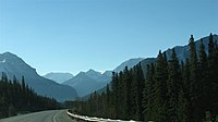
The Highway 93 in the Canadian province of Alberta leads over a length of 266 km in north-south direction through the Rocky Mountains . It begins on the border with British Columbia at Vermillion Pass in Banff National Park and ends south of Jasper at the junction with Highway 16 , the Yellowhead Highway in Jasper National Park .
Sections
Highway 93 can be divided into three sections:
Banff-Windermere Highway
At Vermillion Pass, the British Columbia Highway 93 crosses the border between the provinces coming from the south and becomes Alberta Highway 93. When crossing the border, the highway has not only changed to another province, but also from Kootenay National Park in British Columbia to Banff National Park in Alberta. The following 10 km to the intersection with Highway 1 , Highway 93 is also called Banff-Windermere Highway.
Trans-Canada Highway
Near the town of Vermillion Crossing, Highway 93 meets Highway 1, which also forms the southern course of the Trans-Canada Highway here. These two highways run together for the next 30 km. The streets first cross the Bow River before they reach Lake Louise . Shortly after the village, the two highways separate again. The Trans-Canada Highway continues west, with Golden , British Columbia as the next major city. Highway 93 turns north again after the split.
Icefields Parkway
After separating from Highway 1, Highway 93 is now called Icefields Parkway and leads to Jasper for the next 230 kilometers . It runs in a northerly direction along several river courses. In the southern section, west of the road, is the Bow River . Along the route there are numerous viewpoints and parking lots from which the famous lakes and mountains can be reached. At the northern end of the Bow River is Bow Lake , which is fed by Bow Glacier (Bow Glacier). The road crosses the Bow Summit here , the highest point on the route at 2088 m. In the high valley that follows, between numerous mountains with heights of more than 3000 m, follows the Peyto Lake , which pours into the Mistaya River . Along its course, Highway 93 continues north, it then crosses the North Saskatchewan River , into which the Mistaya River flows. At the mouth of the river is the only settlement along the way, the Sasketchewan River Crossing . The settlement is the only way between Banff and Jasper to refuel and replenish supplies. Highway 11 also branches off in the settlement . This highway follows the North Saskatchewan River from here to Rocky Mountain House and Red Deer . Highway 93 follows upstream the North Saskatchewan River to the north and reaches Jasper National Park via Sunwapta Pass at an altitude of 2030 m .
West of the crossed park boundary is the Columbia Icefield, in German Columbia Icefield , which serves as the namesake for the route. From the road, however, you can only see one glacier leading out of the ice field, the Athabasca Glacier .
The highway now leads along the Sunwapta River until it swings west at the Sunwapta Falls and then flows into the Athabasca River . After about 9 km, however, the highway is again in a river valley, now in that of the aforementioned Athabasca River.
Alberta Highway 93A branches off at Athabasca Falls , about 30 kilometers south of Jasper . This is the former stretch of Highway 93. The two highways now run to the right and left of the Athabasca River further north, shortly after Highway 93 has crossed the Athabasca River, to reunite about 6 km before Jasper. The last few kilometers the Icefields Parkway now runs through industrial parks in Jasper to end at an intersection with Alberta Highway 16 , which is the northern Trans-Canada Highway here.
fees
Highway 93 is chargeable for its full length as it is entirely in national parks. However, since the start and end are on access roads that are already in the national park, no tolls are due directly along the route; the fee is already collected on British Columbia Highway 93 and Highway 16.
Individual evidence
- ^ List of Fees. Parks Canada, accessed March 29, 2018 .


