Asian Highway 3
| Asian Highway 3 | ||||||||||||||||||||||||||||||||||||||||||||||||||||||||||||||||||||||||||||||||||||||||||||||||||||||||||||||||||||||||||||||||||||||||||||||

|
||||||||||||||||||||||||||||||||||||||||||||||||||||||||||||||||||||||||||||||||||||||||||||||||||||||||||||||||||||||||||||||||||||||||||||||
| map | ||||||||||||||||||||||||||||||||||||||||||||||||||||||||||||||||||||||||||||||||||||||||||||||||||||||||||||||||||||||||||||||||||||||||||||||
| Basic data | ||||||||||||||||||||||||||||||||||||||||||||||||||||||||||||||||||||||||||||||||||||||||||||||||||||||||||||||||||||||||||||||||||||||||||||||
| Operator: | ||||||||||||||||||||||||||||||||||||||||||||||||||||||||||||||||||||||||||||||||||||||||||||||||||||||||||||||||||||||||||||||||||||||||||||||
| Start of the street: |
Ulan-Ude ( 51 ° 50 ′ N , 107 ° 37 ′ E ) |
|||||||||||||||||||||||||||||||||||||||||||||||||||||||||||||||||||||||||||||||||||||||||||||||||||||||||||||||||||||||||||||||||||||||||||||
| End of street: |
Chiang Rai ( 19 ° 55 ′ N , 99 ° 50 ′ E ) |
|||||||||||||||||||||||||||||||||||||||||||||||||||||||||||||||||||||||||||||||||||||||||||||||||||||||||||||||||||||||||||||||||||||||||||||
| Overall length: | 7,331 km | |||||||||||||||||||||||||||||||||||||||||||||||||||||||||||||||||||||||||||||||||||||||||||||||||||||||||||||||||||||||||||||||||||||||||||||
|
States : |
||||||||||||||||||||||||||||||||||||||||||||||||||||||||||||||||||||||||||||||||||||||||||||||||||||||||||||||||||||||||||||||||||||||||||||||
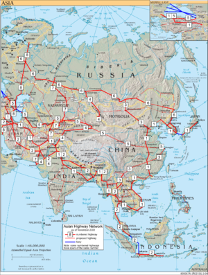
| Overview map of all routes of the Asian trunk road project | ||||||||||||||||||||||||||||||||||||||||||||||||||||||||||||||||||||||||||||||||||||||||||||||||||||||||||||||||||||||||||||||||||||||||||||||
|
Course of the road
|
||||||||||||||||||||||||||||||||||||||||||||||||||||||||||||||||||||||||||||||||||||||||||||||||||||||||||||||||||||||||||||||||||||||||||||||
The Asian Highway 3 (AH3) ( English for 'Asian Highway 3') is a stretch of the Asian Highway Project with a total length of 7,331 km.
Similar to the European roads, existing routes are also given the designation "AH3". The participating states have undertaken to increase the standard of the transnational roads and to further develop them for single-letter connections such as the AH3 to form motorway-like highways .
General
The Asian Highway leads from Ulan-Ude , Russia (AH6) via Tanggu , as well as Shanghai , People's Republic of China (AH5) and Laos to Chiang Rai , Thailand or on the alternative route via Mong La to Keng Tung , Myanmar . Both routes finally meet the Asian Highway 2 .
Similar to the European roads, existing routes are also given the designation "AH3". The participating states have undertaken to increase the standard of the transnational roads and to further develop them for single-letter connections such as the AH3 to form motorway-like highways .
South East Asia
By mid-2008, the north-south stretch of the Asian Highway, AH3, had been paved almost entirely, with only a few kilometers incomplete.
This route was funded by the Asian Development Bank and aimed to connect the connected economies of China, Myanmar, Laos, Vietnam , Thailand and Cambodia . The Kunming-Bangkok Expressway , which runs through northern Laos, connects China and Thailand. The construction costs amount to US $ 95.8 million and was financed with a loan from the Asian Development Bank, along with funds from China, Thailand and Laos.
In the past, the sections consisted of dirt roads, now they have become at least two-lane roads with a paved hard shoulder. The drive from the Laotian border town of Ban Houayxay to the Chinese border near Boten in the southwest of the Yunnan Province used to take two days on the old, mostly unpaved route, depending on the weather. The new carriageway reduces travel time to around six hours. In December 2013, the fourth Thai-Lao Friendship Bridge was completed after a three-year construction period. Until then, the route in the Southeast Asian part was incomplete and inefficient.
Route sections
Russia
Mongolia
- Border russia

- A0403: Altanbulag - Süchbaatar
- A0402: Süchbaatar - Darchan
- A0401: Darchan - Ulaanbaatar
- A0101: Ulaanbaatar - Nalayh - Tschoir
- A0102: Tschoir - Sainschand
- A0103: Sainschand - Zamin-Uud
- Frontier People's Republic of China

course
China
- Mongolia border

-
 G208: Erenhot - Jining (353 km)
 -
 G25: Jining - Zhangjiakou - Xuanhua - Beijing (344 km)
 -
 G20: Beijing - Tianjin - Tanggu (145 km)
 -
 G65: Shanghai - Hangzhou - Nanchang - Xiangtan - Guiyang - Kunming (2810 km). One possible route.
 -
 G213: Kunming - Yuxi - Yuanjiang (203 km)
 -
 G213: Yuanjiang - Puer - Jinghong (352 km)
 -
 G213: Jinghong - Mengla - Mohan (186 km)
 - Border Laos

-
 G214: Jinghong - Menghai (alternative route)
 -
 S320: Menghai - Daluo (alternative route)
 - Myanmar border

Laos
- Frontier People's Republic of China

- National road 13 : Boten (Luang Namtha) - Nateuy (20 km)
- National road 13B : Nateuy - Luang Namtha (45 km)
-
 National Road 3 : Luang Namtha - Ban Houayxay (197 km)
 - Border thailand

- Fourth Thai-Lao Friendship Bridge Hotels (0.48 km)
Thailand
- Border Laos

-
 Thai Highway 1020 : Alternative route 1174/1098/1173: Chiang Khong - Chiang Rai (113 km) ( AH2 )
Myanmar
- Frontier People's Republic of China

- Mong La - Keng Tung (Alternative Route) ( AH2 )
See also
Individual evidence
- Asian Highway Handbook ( Memento from November 27, 2013 in the Internet Archive )
- Working Group on the Asian Highway ( Memento from October 1, 2013 in the Internet Archive )
- Asian Highway Database 2010: AH Network in Member Countries ( Memento from June 1, 2013 in the Internet Archive )
- ↑ http://www.unescap.org/sites/default/files/Mongolia-2017.xls Asian Highway Database of UNESCAP ; Mongolia Excel file

