Asian Highway 6
| Asian Highway 6 | ||||||||||||||||||||||||||||||||||||||||||||||||||||||||||||||||||||||||||||||||||||||||||||||||||||||||||||||||||||||||||||||||||||||||

|
||||||||||||||||||||||||||||||||||||||||||||||||||||||||||||||||||||||||||||||||||||||||||||||||||||||||||||||||||||||||||||||||||||||||
| map | ||||||||||||||||||||||||||||||||||||||||||||||||||||||||||||||||||||||||||||||||||||||||||||||||||||||||||||||||||||||||||||||||||||||||
| Basic data | ||||||||||||||||||||||||||||||||||||||||||||||||||||||||||||||||||||||||||||||||||||||||||||||||||||||||||||||||||||||||||||||||||||||||
| Operator: | ||||||||||||||||||||||||||||||||||||||||||||||||||||||||||||||||||||||||||||||||||||||||||||||||||||||||||||||||||||||||||||||||||||||||
| Start of the street: | Busan , South Korea | |||||||||||||||||||||||||||||||||||||||||||||||||||||||||||||||||||||||||||||||||||||||||||||||||||||||||||||||||||||||||||||||||||||||
| End of street: | Krasnoye , Russia | |||||||||||||||||||||||||||||||||||||||||||||||||||||||||||||||||||||||||||||||||||||||||||||||||||||||||||||||||||||||||||||||||||||||
| Overall length: | 10,533 km | |||||||||||||||||||||||||||||||||||||||||||||||||||||||||||||||||||||||||||||||||||||||||||||||||||||||||||||||||||||||||||||||||||||||
|
States : |
||||||||||||||||||||||||||||||||||||||||||||||||||||||||||||||||||||||||||||||||||||||||||||||||||||||||||||||||||||||||||||||||||||||||
|
Course of the road
|
||||||||||||||||||||||||||||||||||||||||||||||||||||||||||||||||||||||||||||||||||||||||||||||||||||||||||||||||||||||||||||||||||||||||
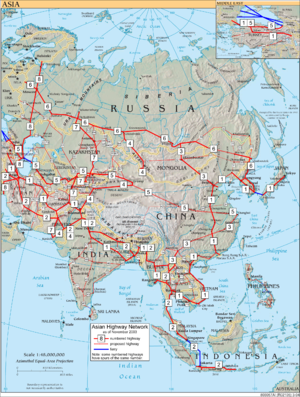
The Asian Highway 6 (AH6) ( English for 'Asian Highway 6') is a stretch of the Asian Highway Project with a total length of 10,533 km. The road begins in South Korea and leads through North Korea , China , Kazakhstan and Russia to the border with Belarus , where it is continued as. From Omsk the AH6 is congruent with the European route 30 .
![]()
Similar to the European roads, existing routes are also given the designation "AH6". The participating states have committed to increasing the standard of the transnational roads.
South Korea
-
 Busan Expressway 61 : Busan Center - Busan Nopo dong
 -
 National Road 7 : Busan -Nopo-dong - Ulsan - Pohang - Samcheok
-
 Expressway 65 : Samcheok - Gangneung - Sokcho
-
 National Road 7 : Sokcho - Goseong
- North Korea border

North Korea
Russia
- North Korea border

-
 Highway A189 : Khassan - Rasdolnoye
-
Branch
 and
and  : Rasdolnoye - Vladivostok - Nakhodka
-
Branch
-
 (formerly
  ): A370 : Rasdolnoye - Ussuriysk
-
 A184 trunk road : Ussuriysk - Pogranichny
- Frontier People's Republic of China

China
- Border russia

-
 G10 : Suifenhe - Harbin - Qiqihar - Hulun Buir
-
 National Road 301 : Hulun Buir - Manjur
- Border russia

Russia
- Frontier People's Republic of China

-
 A350 trunk road (formerly
  ): Sabaikalsk - Chita
-
 Trunk road R258 (formerly
  ): Chita - Ulan-Ude - Irkutsk
-
 Highway R255 (formerly
  ): Irkutsk - Krasnoyarsk - Novosibirsk
-
 Highway R254 (formerly
  ): Novosibirsk - Omsk - Issilkul
- Kazakhstan border

Kazakhstan
Russia
- Kazakhstan border

-
 Highway R254 (formerly
  ): Petuchowo - Kurgan - Chelyabinsk
-
 M5 : Chelyabinsk - Ufa - Samara - Moscow
-
 M1 : Moscow - Smolensk - Krasnoye
- Belarusian border (continue on )


