Brunnadern SG
| SG is the abbreviation for the canton of St. Gallen in Switzerland and is used to avoid confusion with other entries of the name Brunnadern . |
| Well veins | ||
|---|---|---|
| State : |
|
|
| Canton : |
|
|
| Constituency : | Toggenburg | |
| Political community : | Neckertal | |
| Postal code : | 9125 | |
| former BFS no. : | 3371 | |
| Coordinates : | 728 083 / 243879 | |
| Height : | 660 m above sea level M. | |
| Area : | 6.69 km² | |
| Residents: | 951 (February 23, 2008) | |
| Population density : | 142 inhabitants per km² | |
| Website: | www.brunnadern.ch | |
|
Brunnadern SG |
||
| map | ||
|
|
||
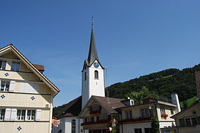
Brunnadern , in Swiss German Brunnòòdere , is a village and a former political municipality in the Neutoggenburg district and since 2003 in the Toggenburg constituency of the canton of St. Gallen in Switzerland . Since 2009, Brunnadern has formed the Neckertal community together with Mogelsberg , Ebersol and St. Peterzell . Around 500 people live in the village of Brunnadern.
geography
The village of Brunnadern and the settlements Chrüzweg, Spreitenbach, Furt and Taa are located in the valley floor of the Necker at the northern foot of the Wasserfluh . The part of Furt lying on the left side of the Necker belonged to the municipality of Mosgelsberg. The rest of the Bunnadern area with Bitzi, Waldschwil, Vögelisegg, Steig, Haselacker, Schwendi, Niderwil, Reitberg, Homberg and Hinteregg is very diverse and hilly.
history


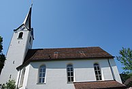
In 1377 it was first mentioned by name as Brunadran . The name can be interpreted as being at the source . Brunnadern was settled late and remained without a settlement center until the 18th century. In the late Middle Ages , the area was under the rule of the County of Toggenburg and, together with Toggenburg , came to the prince abbey of St. Gallen in 1468 . It was divided into the Hemberg and Neckertal courts . A medieval chapel was replaced by a new building in 1461, it belonged to the parish of Oberhelfenschwil . In 1528 the inhabitants turned to the evangelical cult. It was not until 1708 that its own parish was established; the church was built by Hans Ulrich Grubenmann in 1763 . In 1803 the hamlets and parts of the village merged to form the political municipality of Brunnadern.
A hiking school is mentioned in 1745, and in 1874 the school communities of Dorf and Reitberg merged. After the expansion of house weaving and spinning in the 17th and 18th centuries, larger textile companies emerged in the 19th century: a spinning and dyeing factory in the village, weaving mills in the village, in Furt and in Spreitenbach. A noodle factory developed from the latter in 1872. The embroidery industry built up from 1850 reached its peak around 1880 and collapsed in the 1920s. Small-scale family businesses, trade, small industry and tourism shaped the place from 1945. In 1910 the Bodensee-Toggenburg Railway opened with the Brunnadern-Neckertal station and since 1912 Brunnadern has been the starting point for the Postbus line to St. Peterzell and Waldstatt . The secondary school community of Brunnadern-Oberhelfenschwil-Mogelsberg, founded in 1956, has been running the Necker Upper School Center since 1977 . In 1971 the Protestant retirement and nursing home was opened. At the end of the 20th century the number of farms decreased and that of those employed in the second and third economic sectors increased.
| year | 1803 | 1827 | 1850 | 1900 | 1950 | 1970 | 2000 |
| Residents | 930 | 781 | 931 | 710 | 735 | 587 | 917 |
In the vote on October 21, 2007, the residents of Brunnadern, which had previously been an independent political municipality , voted for a merger with Mogelsberg and St. Peterzell to form the new Neckertal municipality on January 1, 2009. The neighboring municipalities at that time were Oberhelfenschwil , Wattwil and Hemberg and Mogelsberg.
traffic
Brunnadern is on Hauptstrasse 8 , which , coming from Herisau , leads over the Wasserfluh Pass to Lichtensteig and on to Wattwil . Another connection leads from Brunnadern along the Necker down the valley to Lütisburg , where it joins the main road Wil SG – Wattwil .
The Brunnadern-Neckertal station on the St. Gallen-route Wattwil the Südostbahn is the S-Bahn St. Gallen in half hour served. Postbuses run from Brunnadern every hour up the Necktertal to Herisau and via Oberhelfenschwil to Dietfurt train station .
Attractions
In Spreitenbach, Furt and in the village there are numerous typical Toggenburg farmhouses from the 17th and 18th centuries:
More pictures
Web links
Individual evidence
- ↑ a b Brunnadern on ortsnames.ch (online database), accessed on June 20, 2020
- ↑ Brunnadern, on the website of the municipality of Neckertal, accessed on June 19, 2020
-
↑ a b c d Hans Büchler : Brunnadern (SG). In: Historical Lexicon of Switzerland .
These sections are largely based on the entry in the Historical Lexicon of Switzerland (HLS), which, according to the HLS's usage information, is under the Creative Commons license - Attribution - Distribution under the same conditions 4.0 International (CC BY-SA 4.0). - ↑ Anina Rütsche: Brunnadern: Demolition begins next week. In: St. Galler Tagblatt (online), March 8, 2017
- ↑ 870 Romanshorn - St. Gallen - Wattwil - Rapperswil. In: Official course book , timetable year 2020
- ↑ 80.182 Brunnadern-Neckertal - Schönengrund - Waldstatt - Herisau. In: Official course book , timetable year 2020
- ↑ 80.771 Dietfurt - Oberhelfenschwil - Brunnadern-Neckertal. In: Official course book , timetable year 2020
|
|
This version of the article is based on Hans Büchler's entry in the Historical Lexicon of Switzerland (HLS), which, according to the HLS's usage information, is under the Creative Commons - Attribution - Share under the same conditions 4.0 International (CC BY-SA 4.0) license . If the article has been revised and expanded to such an extent that it differs significantly from the HLS article, this module will be removed. The original text and a reference to the license can also be found in the version history of the article. |


