Neckertal
| Neckertal | |
|---|---|
| State : |
|
| Canton : |
|
| Constituency : | Toggenburg |
| BFS no. : | 3378 |
| Postal code : | 9105 Schönengrund ( Wald ) 9113 Degersheim (Wolfensberg, Mämetschwil, Wolfhag) 9114 Hoffeld 9115 Dicken 9116 Wolfertswil (Moos) 9122 Mogelsberg (seat of the municipal administration) 9122 Ebersol 9123 Nassen 9125 Brunnadern 9126 Necker 9127 St. Peterzell |
| Coordinates : | 730 043 / 245 467 |
| Height range : | 585–1171 m above sea level M. |
| Area : | 49.00 km² |
| Residents: | 4035 (December 31, 2018) |
| Population density : | 82 inhabitants per km² |
| Website: | www.neckertal.ch |
|
The Brunnadern-Neckertal station building was demolished in 2017 to make room for the redesign of the station area. |
|
| Location of the municipality | |
Neckertal is a municipality in the Toggenburg constituency in the canton of St. Gallen in Switzerland . It was created on January 1, 2009 through the merger of the communities Brunnadern , Mogelsberg and St. Peterzell .
The municipalities of Neckertal, Oberhelfenschwil and Hemberg plan to merge into a single municipality on January 1, 2023 .
history
In the late Middle Ages , the area of the municipality of Neckertal was under the rule of the County of Toggenburg and, together with Toggenburg , came to the prince abbey of St. Gallen in 1468 . In 1798 it became part of the canton of Säntis and since 1803 it has belonged to the canton of St. Gallen . With the founding of the ring canton , the political communities were also created . Until 2002, Brunnadern and St. Peterzell belonged to the Neutoggenburg district , while Mogelsberg belonged to the Untertoggenburg district .
In the vote on October 21, 2007, the residents of the three communities Brunnadern , St. Peterzell (with Wald- Schönengrund) and Mogelsberg (with Nassen , Necker , Hoffeld , Ebersol and Dicken ) voted for a merger, which took place on January 1, 2009 has been. The name of the new community is derived from the Necker River , on whose middle course it lies. At the end of 2010 the political community Neckertal had 4130 inhabitants.
→ see also: Sections history in the articles Brunnadern SG , Mogelsberg and St. Peterzell .
geography
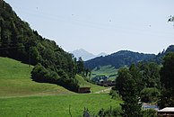
Neckertal lies in an eastern side valley of the Thur . The neighboring communities are Oberhelfenschwil , Wattwil , Hemberg , Degersheim , Bütschwil-Ganterschwil and Lütisburg in the canton of St. Gallen and Schwellbrunn and Schönengrund in the canton of Appenzell Ausserrhoden .
Planned community of Neckertal
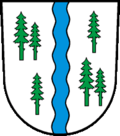
The municipalities of Neckertal, Hemberg and Oberhelfenschwil plan to merge into a new unified municipality on January 1, 2023. In May 2020, proposals for the municipality name and the municipality coat of arms were presented to the public. The new municipality should be called Neckertal , because it is not possible to merge the three previous municipality names . As with the municipality name, it does not make sense to combine the three previous coats of arms with the municipality coat of arms. Therefore a completely new coat of arms is proposed. The Necker flows under the five fir trees, which originally symbolized the five municipalities of St. Peterzell, Brunnadern, Mogelsberg, Oberhelfenschwil and Hemberg. The fir trees are raised by a sun.
Mogelsberg is proposed as the administrative location, because only there will the new administration find enough space in the existing parish hall. The new municipal council will consist of seven members, including the municipality president and the school president.
traffic
Main road 8 leads through the municipality of Neckertal from Herisau via Waldstatt to Wald-Schönengrund and further west over the Wasserfluh to Lichtensteig and Wattwil. Another main connection is along the Necker to Ganterschwil and on to Wil .
Since October 3, 1910, the opening of the water flow tunnel of the Bodensee-Toggenburg-Bahn (BT), the municipality of Neckertal with the stations Brunnadern-Neckertal and Mogelsberg has been connected to the network of today's Swiss Southeast Railway (SOB).
Attractions
→ see also: Sections of sights in the articles Brunnadern SG , Mogelsberg and St. Peterzell .
Web links
Individual evidence
- ↑ Permanent and non-permanent resident population by year, canton, district, municipality, population type and gender (permanent resident population). In: bfs. admin.ch . Federal Statistical Office (FSO), August 31, 2019, accessed on December 22, 2019 .
- ↑ Anina Rütsche: Brunnadern: Demolition begins next week. In: St. Galler Tagblatt (online), March 8, 2017
-
↑ Urs M. Hemm: Community merger in Neckertal: With the clear yes to the basic vote, the first step has been taken. In: St. Galler Tagblatt (online), July 1, 2019
Urs M. Hemm: One step closer to the goal . In: St. Galler Tagblatt (online), July 1, 2020 - ↑ a b Urs M. Hemm: Grossfusion im Neckertal: Now the suggestions for the name and coat of arms of the new municipality are known. In St. Galler Tagblatt (online), May 26, 2020

![The Brunnadern-Neckertal station building was demolished in 2017 to make room for the redesign of the station area. [2]](https://upload.wikimedia.org/wikipedia/commons/thumb/7/74/2011-08-21-Brunnadern_%28Foto_Dietrich_Michael_Weidmann%29_214.JPG/280px-2011-08-21-Brunnadern_%28Foto_Dietrich_Michael_Weidmann%29_214.JPG)


