Bärenthal castle ruins
| Bärenthal castle ruins | ||
|---|---|---|
|
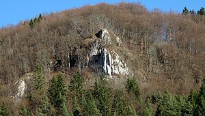
Castle rock from the southwest |
||
| Alternative name (s): | New Hohenberg | |
| Creation time : | around 1150 | |
| Castle type : | Höhenburg, spur location | |
| Conservation status: | Castle stable, neck ditch, small remains of the wall | |
| Construction: | Small cuboid and hump cuboid masonry | |
| Place: | Bärenthal | |
| Geographical location | 48 ° 4 '6 " N , 8 ° 55' 57.1" E | |
| Height: | 758 m above sea level NHN | |
|
|
||
Castle remains Bärenthal called the Outbound Burg Neu-Hohenberg at the community Bärenthal in district Tuttlingen in Baden-Württemberg .
Geographical location
The castle stable of the Spornburg is located around 500 meters southeast of the center of Bärenthal in a steep spur location at 758 m above sea level. NHN over the valley of the bears .
history
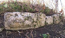
The small castle complex was probably built around the middle of the 12th century. The Counts of Zollern are named as possible founders . As the later owners of the "vesti zu der nuwen Hohenberg" first documented in 1334, the Counts of Hohenberg , who are related to the Zollern, are documented. The castle was abandoned around the middle of the 14th century, possibly in connection with the great earthquake of 1348. Small remnants of small blocks and hump blocks still bear witness to the former castle complex .
literature
- Christoph Bizer: Surface finds of castles in the Swabian Alb . Konrad Theiss Verlag, Stuttgart 2006, ISBN 3-8062-2038-7 , pp. 275-277.
Web links
- Entry on Bärenthal in the private database "Alle Burgen".


