
Chardonne VD
| VD is the abbreviation for the canton of Vaud in Switzerland and is used to avoid confusion with other entries of the name Chardonne . |
| Chardonne | |
|---|---|
 |
|
| State : |
|
| Canton : |
|
| District : | Riviera-Pays-d'Enhaut |
| BFS no. : | 5882 |
| Postal code : | 1803 |
| Coordinates : | 553 023 / 147 444 |
| Height : | 586 m above sea level M. |
| Height range : | 372–1079 m above sea level M. |
| Area : | 10.31 km² |
| Residents: | 2944 (December 31, 2018) |
| Population density : | 286 inhabitants per km² |
| Website: | www.chardonne.ch |
 Chardonne VD |
|
| Location of the municipality | |
  |
|
Chardonne is a municipality in the Riviera-Pays-d'Enhaut district in the canton of Vaud in Switzerland .
geography

Chardonne is 586 m above sea level. M. , 2 km northwest of the district capital Vevey (air line). The village extends on the steep southern slope of Mont Pèlerin , in eastern Lavaux , in a panoramic position around 200 m above lake level of Lake Geneva , above Vevey.
The area of the 10.3 km² municipal area comprises a section on the north-eastern shore of Lake Geneva (around 1200 m lakeshore line). The community soil extends from the lake shore northwards over the steep vineyard slope of Chardonne (the western border is formed by the Salenche brook ) to the adjacent heights of Mont Pèlerin. This ridge, which is mostly wooded in the ridge area, belongs almost entirely to Chardonne and forms at 1080 m above sea level. M. also the highest point of the municipality. It also forms the main European watershed between the Rhone and the Rhine , which runs just a few kilometers north of Lake Geneva. The source brooks of the Biorde , which flow to the Broye and thus belong to the catchment area of the Rhine, arise in the northeast of the area . In 1997, 15% of the municipal area was in settlements, 37% in forests and woodlands, 47% in agriculture and a little less than 1% was unproductive land.
Chardonne includes the settlements Baumaroche ( 810 m above sea level ) and Monts de Chardonne ( 825 m above sea level ) above the village, the hamlet of Paully ( 924 m above sea level ) on the western slope of Mont Pèlerin and numerous individual farms. Neighboring municipalities of Chardonne are Jongny , Corsier-sur-Vevey , Corseaux , Saint-Saphorin (Lavaux) and Puidoux in the canton of Vaud and Granges (Veveyse) and Attalens in the canton of Friborg .
population
With 2944 inhabitants (as of December 31, 2018), Chardonne is one of the medium-sized municipalities in the canton of Vaud. 77.5% of the residents are French-speaking, 8.7% German-speaking and 4.3% English-speaking (as of 2000). The population of Chardonne was 998 in 1850 and 1011 in 1900. The population increased continuously during the 20th century. Increased growth was observed particularly during the 1990s. The settlement area of Chardonne has now seamlessly merged with that of Jongny.
economy
Until the beginning of the 20th century, Chardonne was mainly an agricultural village. Even today, agriculture with viticulture (around 100 hectares) on the optimally sunny slopes of Lavaux has an important role in the income structure of the population. The quality wines produced here go under the Chardonne appellation. The Chardonne vineyards have been protected from overbuilding by a law since 1984. In the higher elevations there is arable farming , cattle breeding and dairy farming.
Further jobs are available in local small businesses and especially in the service sector. In addition to everyday goods, the Chardonne trade is also geared towards tourism. Chardonne has a business school and is home to the Institut de recherche en geobiologie and the Center de revitalization Cambuzat. There is a sports boat harbor and a campsite on Lake Geneva. In recent decades, the village has developed into a residential community thanks to its attractive location (with a view over Lake Geneva to the Alps and in the southwest to the Jura). A large number of those in employment are commuters who work in the Vevey-Montreux region, sometimes also in Lausanne .
traffic
The community has good transport connections. It is located on a connection road from Chexbres to Châtel-Saint-Denis and is easily accessible from Vevey . The closest motorway connections to the A9 ( Lausanne - Sion ), which opened in 1970 and crosses the municipality, are at Chexbres (in the west) and at Vevey (in the east), each around five kilometers from the town center. In 1900, the Vevey – Chardonne – Mont-Pèlerin funicular was inaugurated, which connects Chardonne directly with Vevey station.
history
The municipality of Chardonne was settled very early; traces from the Neolithic , a necropolis from the Bronze Age and an early medieval grave were found. The place was first mentioned in a document in 1001 under the name Cardona . Later the names Chardona (1150), Carduna in the 12th century and Chardonnaz (1554) appeared. The place name goes back to the Latin word carduus (thistle).
Chardonne was initially owned by the Saint-Maurice Abbey and in 1079 came to the Bishop of Lausanne with the Corsier parish. He gave the village in 1092 as a fief to the Blonay family. Part of the municipal area came to the Cistercian Abbey of Haut-Crêt in 1226 . In the hamlet of Rueyres there was a small Premonstratensian monastery from 1141 to the beginning of the 13th century.
With the conquest of Vaud by Bern in 1536, Chardonne came under the administration of the Bailiwick of Lausanne . After 1707, the regulation of civil matters was transferred to the Bailiwick of Oron . After the collapse of the Ancien Régime , Chardonne belonged to the canton of Léman from 1798 to 1803 during the Helvetic Republic , which then became part of the canton of Vaud when the mediation constitution came into force . In 1798 it was assigned to the Vevey district. Chardonne separated from Corsier in 1798 and became a politically independent municipality, but the final determination of the borders did not take place until 1816.
Personalities
- Sergio Emery (born March 4, 1928 in Chiasso; † June 5, 2003 in Gentilino), painter, draftsman, engraver, lytographer, mosaic worker
- Matteo Emery (born June 15, 1955 in Lugano), painter, draftsman, director
Attractions
The chapel, which formerly belonged to the parish of Corsier, was elevated to a parish church in 1864. It was rebuilt in 1749, whereby the tower choir of the medieval chapel from the 15th century was included in the new building. Important wall paintings from the time it was built were discovered here during a renovation. There are other chapels at Paully and Baumaroche. In the old town center there are still some typical winegrowers' houses. The castle of Chardonne, which dates back to the 15th century, went to the Stürler family from Bern in the 16th century . They carried out extensive renovations and enlargements and made the castle their country seat.
A modern sight is the television tower Mont Pèlerin with a viewing platform accessible by a panoramic elevator.

Church, in the background Vevey
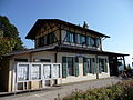
Train station

Stop inside the train station


Web links
- Official website of the municipality of Chardonne (French)
- Elisabeth Salvi: Chardonne VD. In: Historical Lexicon of Switzerland .
- Aerial views of the village
Individual evidence
- ↑ Permanent and non-permanent resident population by year, canton, district, municipality, population type and gender (permanent resident population). In: bfs. admin.ch . Federal Statistical Office (FSO), August 31, 2019, accessed on December 22, 2019 .
- ↑ Sergio Emery. In: Sikart
- ^ Matteo Emery. In: Sikart
Blonay | Chardonne | Château-d'Oex | Corseaux | Corsier-sur-Vevey | Jongny | Montreux | Rossinière | Rougemont | Saint-Légier-La Chiésaz | La Tour-de-Peilz | Vevey | Veytaux
Former municipalities: Montreux-Châtelard | Montreux Planches
Canton of Vaud | Districts of the canton of Vaud | Municipalities of the canton of Vaud