
Morona Santiago Province
|
||
|---|---|---|
| flag | ||

|
||
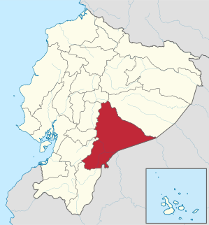
| Location in Ecuador | ||
 .svg) |
||
| Basic data | ||
| Capital | Macas | |
| population | 127,496 (2005,) | |
| - Share in Ecuador | 1.0% | |
| - Rank in Ecuador | Rank 17 out of 22 | |
| - density | 5 inhabitants per km² | |
| surface | 23,875 km² | |
| - Share in Ecuador | 9.3% | |
| - Rank in Ecuador | Rank 2 of 22 | |
| License Plate | V | |
| Set up | 1953 | |
| prefect | Jaime Mejía ( Pachakutik ) |
|
| governor | Luis Valencia | |
| Seats in the National Congress |
2 of 100 | |
| structure | 12 cantons | |
| ISO 3166-2 | EC-S | |
| moronasantiago.gob.ec | ||
Morona Santiago ( Spanish Provincia de Morona Santiago ) is a province in Ecuador . It is located in the Oriente of Ecuador in the Amazon basin and has about 130,000 inhabitants on an area of 23,800 km². Their capital is Macas . The province is named after the rivers Río Morona and Río Santiago , which are tributaries of the Amazon , and two cantons that bear the names of the rivers.
location
The province of Morona Santiago is located in the southeast of Ecuador and stretches from the eastern slopes of the Andes to the Amazon lowlands. It borders in the north on the province of Tungurahua , in the north-east and east on the province of Pastaza , in the south-east and south on the border with Peru ( Loreto region ) in the south-west on the province of Zamora and Chinchipe, established by the Rio de Janeiro Protocol and subsequent agreements to the west to the Andean provinces of Azuay , Cañar and Chimborazo .
geography
The west of the Morona Santiago province is located between the eastern slope of the Andes and various sub-Andean cordillera, including the Cordillera del Cóndor in the south , which was the scene of border wars and hostilities between Ecuador and Peru three times (1941, 1981 and 1995) (see below) . The last boundary stones were only set here in 1999.
The highest mountain in the province is the active Sangay volcano (5230 m). It is located in the Sangay National Park , which the Morona Santiago province shares with the Tungurahua and Chimborazo provinces and which is a World Heritage Site . In addition to nature, there are also remains from the second half of the fourth millennium BC. Built pyramids .
The majority of the province, however, forms a forest-covered plain, which is traversed by numerous rivers, which have their source in the mountains and flow into the Amazon and its tributaries. In addition to the eponymous rivers Río Morona and Río Santiago, the Río Palora and Río Bobonaza flow through the province. The Río Upano , Río Paute and Río Zamora are headwaters of the Río Santiago. The Río Pastaza forms the border to the province of the same name in the northeast. The climate in this region is hot and humid.
In addition to the capital Macas , Sucúa , a center of the Shuar and Achuar , and Gualaquiza are important cities in the province.
history
The Inca did not exert any significant influence on what is now the Morona Santiago province. It is possible that the ancestors of the Shuar and Achuar, the most important indigenous peoples in today's province, retreated from the area of the Loja province to the Amazon region before the advancing Inca .
During the Conquista, the Oriente was formally divided into four conquest areas by Viceroy Pedro de la Gasca in 1548 , one of which was based in Macas and included a gobernación . In fact, the indigenous population managed to keep missionaries and prospectors away from a permanent advance for a long time. In 1599, Shuar and allies attacked the gold prospecting settlements of Seville de Oro and Logroño in a large campaign and destroyed them.
Macas remained the only significant settlement in the area until the 19th century. In the law on the territorial division of Greater Colombia of 1824, the area was assigned as the canton of Sangay to the province of Chimborazo in the Department of Ecuador (Quito). This assignment persisted after the independence of Ecuador (1830). In 1860 the canton of Morona was established for the first time instead of the canton of Sangay. In 1921, the refinement of territorial legislation in the Amazon lowlands created the provinces of Napo-Pastaza and Santiago-Zamora. Macas became the capital of Santiago-Zamora.
In 1925, the canton of Morona was divided into the cantons of Macas and Morona. When the province of Morona Santiago was created in 1953 through separation from the new province of Zamora Chinchipe , in addition to the cantons of Gualaquiza, Santiago and Limón-Indanza, which were newly established after 1925, only the canton Macas belonged to it, the canton Morona not. In the following period, the canton of Macas was dissolved in 1955 and the canton of Morona was annexed to the province in 1959.
The Cordillera del Cóndor
In 1941 ( Peruvian-Ecuadorian war ), 1981 ( Peruvian-Ecuadorian border war ) and 1995 ( Cenepa war ), border wars and skirmishes took place around the area of the Cordillera del Cóndor , which is shared on the Ecuadorian side by the provinces of Morona Santiago and Zamora Chinchipe Ecuadorian and Peruvian troops instead. The reason for this is the fact that the boundary lines that were laid down in 1936 and 1942 (in the Rio de Janeiro Protocol ) did not clearly take into account the course of the mountain folds in some places and therefore repeatedly led to different interpretations of the boundary line by both countries. In the border wars, soldiers from the indigenous groups of the Shuar and Achuar fought on the Ecuadorian side, who, thanks to their local knowledge, gave the Ecuadorian military advantages in various situations and thus gained a high reputation among the national public. In 1998, Presidents Jamil Mahuad (Ecuador) and Alberto Fujimori (Peru) finally signed a peace treaty, in the course of which the border was clearly defined. As a result, a binational nature reserve was set up in the Cordillera del Condor region to protect the biodiversity there.
In the Los Tayos nature reserve in the Cordillera del Condor there is a series of very deep caves ( Los Tayos Caves ) which, according to local traditions, are said to contain immense treasures.
politics
The prefect of the province is Marcelino Chumí from Pachakutik , the party of the indigenous movement in Ecuador . The mayor of the capital Macas, Hipólito Entza, also belongs to Pachakutik. The provincial governor appointed by the President of Ecuador is Luis Valencia.
Cantons
The province of Morona Santiago is currently divided into twelve cantons. These are (in order of their establishment):
- Morona (the previous canton of Sangay was established in 1824; capital: Macas )
- Santiago (established in 1942, capital: Santiago de Méndez )
- Gualaquiza (established in 1944; capital: Gualaquiza )
- Limón-Indanza (established in 1950, capital: General Leonidas Plaza Gutiérrez ; Leonidas Plaza Gutiérrez was President of Ecuador 1901–1905 and 1912–1916)
- Sucúa (established in 1962, capital: Sucúa )
- Palora (established in 1972, capital: Palora, formerly Metiera )
- San Juan Bosco (established in 1992, capital: San Juan Bosco; named after Johannes Bosco , the founder of the Salesian Order , who is very active in the province)
- Huamboya (established in 1992, capital: Huamboya)
- Taisha (established in 1996, capital: Taisha)
- Logroño (established in 1997, capital: Logroño; the name comes from the settlement of Logroño de los Caballeros , which was destroyed in 1599 and was located in this area; today's Logroño was founded by missionaries in the 1930s)
- Pablo Sexto (established in 2001, capital: Pablo Sexto, named after Pope Paul VI. )
- Tiwinza (established in 2002, also Tiwintsa; capital: Tiwinza)
Web links
- Pages of the provincial government of Morona Santiago (span.)
- Basic information about the province (span.)
- A page about the province of the Asociación de Trabajadores Agropecuarios Santa Isabel de Macas (ATASIM) (span.)
- Homepage of the city of Macas, with information about the province (span.)
- Information on the province from the magazine Vistazo (span.) ( Memento of July 1, 2007 in the Internet Archive )
Remarks
- ↑ INEC, Población total y tasas brutas de natalidad, mortalidad general, mortalidad infantil y materna según regiones y provincias de residencia habitual, año 2005 ( Memento of February 3, 2006 in the Internet Archive ), accessed on October 13, 2007.
Azuay | Bolívar | Cañar | Carchi | Cotopaxi | Chimborazo | El Oro | Esmeraldas | Galápagos | Guayas | Imbabura | Loja | Los Ríos | Manabí | Morona Santiago | Napo | Orellana | Pastaza | Pichincha | Santa Elena | Santo Domingo de los Tsáchilas | Sucumbíos | Tungurahua | Zamora chinchipe
Coordinates: 2 ° 37 ′ S , 78 ° 0 ′ W