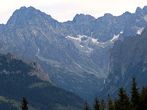
Dolina Białki
| Dolina Białki | ||
|---|---|---|
|
Dolina Białki |
||
| location | Lesser Poland Voivodeship , Poland , Slovakia | |
| Waters | Białka | |
| Mountains | High Tatras , Tatras , Carpathians | |
| Geographical location | 49 ° 15 ′ N , 20 ° 6 ′ E | |
|
|
||
| height | 1000 to 2655 m npm | |
| length | 14 km | |
| climate | High mountain climate | |


The Bialkatal (Polish: Dolina Białki , Slovak: Bielovodská dolina ), formed by glaciers in the Ice Age , is the largest valley in the High Tatras with a length of 14 km and an area of 63.5 km² . It is located north of the main ridge of the High Tatras mainly in Poland (38.2 km²) in the Lesser Poland Voivodeship and a smaller part in Slovakia 25.3 km². It has numerous side valleys: Fish Lake Valley , Roztokatal with its extension Fünfseental and Waksmunder Valley in Poland and the Red Valley ( Cervena dolina ) and the craggy valley ( ozpadliny ) in Slovakia.
geography
The valley is around 14 km long and reaches the highest mountain in the High Tatras, the Gerlsdorferspitze at 2655 m. The valley and its side valleys descend from south to north. It is traversed by the mountain river Białka / Biela voda , which drains almost all valleys north of the main ridge of the High Tatras. Its left (Polish) tributaries in the valley are Fischseebach ( Rybi Potok ), Roztoka and Waksmunder Bach , its right (Slovak) tributary in the valley is the Red Brook ( Červený potok ).
Most of the mountain lakes of the High Tatras are located in the valley. a. the largest in terms of area, the Meerauge , the largest in terms of volume, the Great Lake and the deepest, also the Great Lake.
During the last ice age, the valley had the largest glacier in the Tatra Mountains with a length of 14 km, an area of 60 km² and an ice thickness of approx. 300 m.
Both the Polish-Slovakian border and the border between the historical Podhale and Spiš regions run through the valley floor, mostly along the Białka River . There is a border crossing for road traffic on Alm Łysa Polana , and one for hikers on the Meeraugspitze ( Rysy ).
The valley belongs to the Tatra National Park on both sides of the border . Below the national park, the valley becomes wider and flatter. After a few kilometers, where the Białka forms the border between Poland and Slovakia, it flows to Poland and from there into the Jezioro Czorsztyńskie reservoir . The valley has a length of 40 km from the main ridge of the Tatra Mountains to the reservoir.
etymology
The name is derived from the mountain river Białka / Biela voda , which flows through it, and can be translated as "Valley of the Whites", "Weißbachtal" or "Weißwassertal", which corresponds to the sometimes used German term "Alpengrund-Weisswasser" .
Flora and fauna
The valley lies below and above the tree line. All alpine levels can be found in the valley. The valley is a retreat for deer, bears, wolves, lynxes, chamois, marmots and eagles. As nature reserves, parts of the valley are subject to strict nature protection and may not be entered.
climate
There is a high mountain climate in the valley.
Alpine farming
Before the establishment of the Slovak and Polish national parks in 1949 and 1954, the valley had been used for alpine farming since the 17th century. After that, the owners of the alpine pastures were expropriated or forced to sell. Former alpine huts are still in the valley.
tourism
The valley is the most visited by tourists in the High Tatras. In the lower part of the valley there are two large parking lots on the Łysa Polana and Palenica Białczańska pastures on the Oswald-Balzer-Weg , which leads through the valley to the Meerauge mountain lake . In the valley there are three refuges on the Polish side:
- Schronisko PTTK w Dolinie Roztoki
- Schronisko PTTK w Dolinie Pięciu Stawów Polskich in the side valley Dolina Pięciu Stawów Polskich
- Schronisko PTTK nad Morskim Okiem in the side valley Dolina Rybiego Potoku
Numerous hiking trails lead through the valley:
- ▬ A red marked trail on the Polish side leads from Zakopane district Toporowa Cyrhla to the peak Rysy . Part of the hiking trail follows the Oswald-Balzer-Weg into the Dolina Rybiego Potoku valley. Numerous other hiking trails start there.
- ▬ A green marked hiking trail on the Polish side leads from the valley into the Dolina Roztoki valleyand into its extension Dolina Pięciu Stawów Polskich . Numerous other hiking trails start there.
- ▬ A blue-marked hiking trail on the Polish side leads from the valley to the Rusinowa Polana and Zazadnia alpine pastures. Numerous other hiking trails start there.
- ▬ A blue-marked hiking trail on the Slovak side leads from the valley to the Prielom pass and further into the Great Kohlbachtal (Veľká studená dolina) to the »robber's hut« Zbojnicka chata. A green marked junction at an altitude of 2160 meters leads to the Poľský hrebeň pass (2200 m) in the Velická dolina valleywith the mountain hotel Sliezký dom . The peak of Vychodná Vysoká (2429 m) can be reached from the top of the pass via a yellow marked path.
Die Wanderwege auf slowakischem Gebiet sind abgesehen von Wintersperren zwischen 1. November und 15. Juni in alpinem Gelände frei zugänglich. Der Zugang auf polnischem Gebiet ist dagegen gebührenpflichtig.
literature
- Zofia Radwańska-Paryska, Witold Henryk Paryski, Wielka encyklopedia tatrzańska , Poronin, Wyd. Górskie, 2004, ISBN 83-7104-009-1 .
- Tatry Wysokie słowackie i polskie. Mapa turystyczna 1: 25.000, Warszawa, 2005/06, Polkart ISBN 83-87873-26-8 .


