
Tatra National Park (Slovakia)
| Tatra National Park Tatranský národný park |
|||
|---|---|---|---|
 |
|||
|
|||
| Location: | Prešovský , Žilinský , Slovakia | ||
| Specialty: | UNESCO - Biosphere Reserve , oldest national park in Slovakia | ||
| Next city: | Vysoké Tatry , Kežmarok , Poprad | ||
| Surface: | 738 km² | ||
| Founding: | January 1, 1949 | ||
| Address: | Sprava Tatranského národného parku Biosférická rezervácia Tatry Tatranská Štrba 75 P.O.Box 21 059 41 Tatranská Štrba www.spravatanap.org |
||

The Tatra National Park ( Slovak Tatranský národný park , abbreviation TANAP) is the oldest Slovak national park . It extends in the north-central part of Slovakia along the mountains of the same name and includes its subdivisions Western Tatras , High Tatras and Bela Tatras . The core zone covers an area of 738 km² in the political districts of Žilinský kraj (Okresy Tvrdošín and Liptovský Mikuláš ) and Prešovský kraj (Okresy Poprad and Kežmarok ). The seat of the administration is in Tatranská Štrba (part of the municipality Štrba ). The national park is recognized by the World Conservation Union IUCN as a category II protected area (national park).
Together with the Polish Tatra National Park , the National Park since 1992, a UNESCO - Biosphere Reserve . If you add a 307.03 km² protection zone, the entire area of the national park covers 1045 km². That makes about 2.13% of the area of the whole of Slovakia. Numerous hiking trails with a total length of around 600 km and 22 bike trails run through the park.
The highest mountain in the national park is the Gerlachovský štít ( Gerlsdorfer Spitze , 2654.4 m nm ), which is also the highest mountain in Slovakia and the entire Carpathian Mountains .
The Tatra chamois ( Rupicapra rupicapra tatrica ) is the symbol of the national park, which also appears on the administration's logo .
history
The park was created by law 11/1948 Zb. founded by the SNR (Slovak National Council) on January 1, 1949, making it the oldest Slovak national park. In 1987 the park was expanded to include the West Tatras, increasing the area to 741.11 km² in the core zone and 365.74 km² in the protection zone. In 2003, the borders were changed and the park was reduced to its current level. Since 2004, an area of 617.35 km² within the national park has been a Natura 2000 protected area (code: SKUEV0307 ).
geography


The national park completely covers the Slovak side of the Tatras and thus includes the Western and Eastern Tatras . This classification is roughly also valid for the political districts Žilinský kraj and Prešovský kraj . The Western Tatras are divided into the following parts: Osobitá , Roháče , Sivý vrch (literally Gray Mountain), Liptovské Tatry (Liptov Tatras), Liptovské Kopy , Červené vrchy (Red Mountains). The Eastern Tatras include the High Tatras and the Bela Tatras. In addition to the mountains themselves, there are also smaller parts of the park in the surrounding basins, especially the Podtatranská kotlina (Lower Tatra Basin). Within the traditional landscape, the majority are in the Spiš and Liptov , with a part in the north-west in the Arwa (Orava).
The watershed between two seas runs through the park, with the boundary between the areas in the area of Štrbské Pleso , on the lake of the same name. To the west of the watershed, the streams ultimately feed the Waag River , which is part of the Black Sea catchment area ; significant rivers are Biely Váh , Belá and Studený potok. To the east of Štrbské Pleso, the area belongs to the catchment area of the Poprad , whose water flows over Dunajec and Vistula towards the Baltic Sea . In addition to the Poprad river, the Studený potok, Kežmarská Biela voda and Biela voda brooks are also important.
As a relic of the last Ice Age, there are more than a hundred glacial lakes (called plesá , sing. Pleso , different from the normal term jazero for a lake) in the national park. The most famous lake is the Štrbské pleso (Tschirmer lake), the largest is the Veľké Hincovo pleso with an area of 20 hectares and a depth of 58 m. Among the most famous Tatra waterfalls are the following: Studenovodské vodopády , Kmeťov vodopád , Vajanského vodopád , Roháčsky vodopád and Vodopád Skok .
More than 300 caves are known to date, but only one is open to the public as a show cave , the Belianska jaskyňa in the Tatranská Kotlina district (town of Vysoké Tatry ). The longest known cave systems so far are the Mesačný tieň (literally: moon shadow) with more than 24 km and the Javorinka with more than 9,300 m. They are also the deepest: in the Mesačný tieň cave the difference in altitude is 451 m.
The highest mountain in the area of the national park is Gerlachovský štít in the High Tatras. In the Western Tatras and the Bela Tatras it is the Bystrá ( 2248 m nm ) and the Havran ( 2152 m nm ).
climate

The Tatras are among the coldest and most humid areas in Slovakia. In the lower elevations, the weather typical of cirques in Slovakia still prevails until you gradually reach the peaks of the highest mountains. The air temperature drops by around 0.6 ° C for every 100 meters of altitude. In Poprad (672 m nm) the annual average temperature reaches 5.5 ° C, on the Lomnický štít (2,632 m nm) it drops to −3.8 ° C. The monthly average temperature in July is 4.2 ° C on Lomnický štít, 14.4 ° C in Starý Smokovec and 16.2 ° C in Poprad.
The winds mostly blow from the west or north-west. Due to the location and height of the mountains, a rain shadow is created on the leeward Slovak side, so that the annual rainfall is around 300 mm less than in Poland, if one compares Zakopane with Tatranská Lomnica , for example . In Poprad, the average annual rainfall is 608 mm, on Lomnický štít 1,561 mm. The wettest places are in the Veľká Studená dolina valley : at Zbojnícka chata values from 2000 to 2500 mm are recorded, in some places even more. July is the wettest month and February the driest.
The snow cover usually lasts from November to May, in the higher elevations and valleys until mid-summer. At the highest altitudes it can snow in August.
As in other high mountains, sudden sudden changes in weather and rapid temperature changes can occur. Unstable months are from June to August, the sunny weather in the morning can turn into a violent thunderstorm in the afternoon. There is a particularly high risk of lightning strikes above the tree line. The Indian summer at the end of September and October is considered the most stable period and the best time for tourism . In the late year, temperature inversions are typical, whereby the cold air with fog flows into the valley basin, while further up there is clear visibility and warm weather.
Flora and fauna


The geological structure, soil properties and climatic conditions contribute to the unique flora and fauna.
About two thirds of the park is forested, mostly with spruce and fir trees . In addition to these species, Scots pine , Swiss stone pine , European larch and mountain pine also grow . Mostly maples grow in the deciduous forest of the Bela Tatras . At an altitude of 800 to around 1550 m nm, spruce species grow almost exclusively, sometimes fir trees, often at the expense of the former beech forest. A hurricane of up to 170 km / h on November 19, 2004 destroyed extensive areas of the spruce forest and changed the view of the landscape in some places. The tree line is between 1550 and 1650 m nm. Above this limit only spruce and larch grow sporadically . After the Krummholz stage (upper limit 1800–1850 m nm) one reaches the subalpine and finally alpine vegetation zone step by step.
Almost 1,400 species of vascular plants grow in the area of the national park , 37 of which are endemic to the Tatras. These include Erysimum wahlenbergii from the genus Schöterich , Cochlearia tatrae ( spoonweeds ), Erigeron hungaricus ( professional herbs ) and others. Relics from the Ice Age include the following plants: Ranunculus alpestris ( buttercup ), Ranunculus glacialis , Dianthus glacialis ( carnations ), Gentiana frigida ( gentians ), Primula minima ( primroses ), sedum saxifrage , herb willow , net willow and others . Under the extreme conditions of the alpine meadows, around 300 plant species grow, 40 of them still above 2600 m nm
The animal world is made up of more than one hundred species of birds, eleven species of fish and several species of reptiles, amphibians and mammals. You can also find an indefinite number of invertebrates. The best-known animal species of the Tatra Mountains are chamois ( Tatra chamois ), marmots ( Alpine marmots ) and eagles ( golden eagles ). Next here include capercaillie , brown bear , Eurasian lynx , otter , snow mice , wild cats and wolves , birds Sperlings- and tawny owls , eagle owls , tower and peregrine falcon and the following Ice Age relics: Three-toed Woodpecker , Ring Ouzel and nutcrackers .
Special nature reserves


In addition to the national park, there are a number of particularly protected areas:
- Národné prírodné rezervácie (NPR, National Nature Reserves)
|
|
- Národné prírodné pamiatky (NPP, National Natural Monuments)
- Belianska jaskyňa (since 1979)
- Brestovská jaskyňa (since 1979)
- Javorinka (since 2001)
- Prírodné rezervácie (PR, nature reserves)
|
|
Conflicts of use

As in many protected areas, there is also a conflict of use in the Tatra National Park: investors and business people in the tourism industry argue about the use of certain areas with representatives of nature conservation. Several proposals for a new zoning of the national park were therefore discussed; so far, however, no satisfactory solution has been found.
After the hurricane of November 19, 2004 in particular, conflicts over the export of fallen trees and the fight against forest calamity (as a result of the overgrowth of bark beetles ) arise. In the past there have been violent conflicts in the Tichá dolina and Kôprová dolina valleys between non-governmental nature conservation organizations and the forest enterprise or the Ministry of the Environment.
For example, a horse polo competition took place on the frozen lake Štrbské pleso in winter 2010 , but the lake is subject to the strictest fifth level of nature protection, where no such events are to be carried out by law.
literature
- Ján Lacika, Kliment Ondrejka: Prírodné Krásy Slovenska - Národné parky . Ed .: DAJAMA. 1st edition. Bratislava 2009, ISBN 978-80-89226-27-6 .
Web links
- Official site of the administration (Slovak)
- Unofficial page (Slovak, Polish, English)
- Site of the state forests TANAP (Slovak, English)
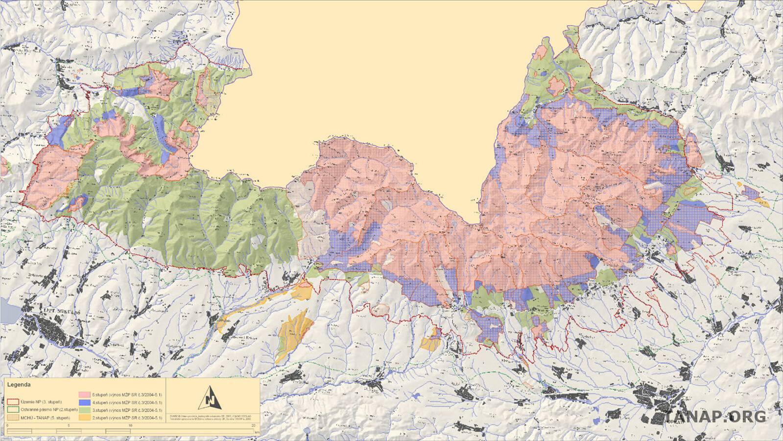
- Map of the nature protection levels since the last update in 2004
Individual evidence
- ↑ Rozloha TANAP-u sa zmenší , SME, accessed on August 16, 2011
- ↑ Štátne lesy TANAPu - Príroda TANAPu ( Memento of the original from June 9, 2007 in the Internet Archive ) Info: The archive link was inserted automatically and has not yet been checked. Please check the original and archive link according to the instructions and then remove this notice. , accessed August 19, 2011
- ↑ Správa slovenských jaskýň: Naj o jaskyniach ( Memento of the original dated August 26, 2011 in the Internet Archive ) Info: The archive link was inserted automatically and has not yet been checked. Please check the original and archive link according to the instructions and then remove this notice. , accessed August 19, 2011
- ↑ a b Slovakia Travel Tips - Climate and Vegetation Levels of the High Tatras , accessed on August 18, 2011
- ↑ Lacika and Ondrejka, "Prírodné Krásy Slovenska - Národné parky", p. 14
- ↑ V najvyšších polohách Tatier už sneží , Aktuellity.sk , accessed on August 18, 2011
- ↑ Štátny zoznam osobitne chránených častí prírody SR
- ↑ Zonáciu Tatier by mali uzavrieť do konca roka , Pravda, accessed on August 16, 2011
- ↑ Lykožrút sa v Tichej doline zdesaťnásobil , Pravda, accessed on August 16, 2011
- ↑ Konské pólo na ľade. Zábava pre miliardárov ( page no longer available , search in web archives ) Info: The link was automatically marked as defective. Please check the link according to the instructions and then remove this notice. , hnonline.sk, accessed on August 16, 2011
- ↑ Šantenie žralokov v Štrbskom plese by inde zakázali , Pravda, accessed on August 16, 2011
National parks ( Národné parky ):
Great Fatra |
Little Fatra |
Muránska planina |
Low Tatras |
Pieninese |
Poloniny |
Slovak Karst |
Slovak Paradise |
Tatra
landscape protection areas ( Chráněné krajinné oblasti ):
Biele Karpaty |
Cerová vrchovina |
Dunajské luhy |
Horná Orava |
Kysuce |
Latorica |
Malé Karpaty |
Poľana |
Ponitrie |
Strážovské vrchy |
Štiavnické vrchy |
Vihorlat |
Východné Karpaty |
Záhoria