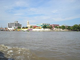
El Banco
| El Banco | ||
|---|---|---|
|
Coordinates: 9 ° 0 ′ N , 73 ° 58 ′ W El Banco on the map of Colombia
|
||
|
Location of the municipality of El Banco on the map of Magdalena
|
||
| Basic data | ||
| Country | Colombia | |
| Department | Magdalena | |
| City foundation | 1536 | |
| Residents | 56,097 (2019) | |
| City insignia | ||
| Detailed data | ||
| surface | 816 km 2 | |
| Population density | 69 people / km 2 | |
| height | 25 m | |
| Waters | Río Magdalena | |
| Time zone | UTC -5 | |
| City Presidency | Víctor Rangel López (2016-2019) | |
| Website | ||
| El Banco from the Río Magdalena | ||
| El Banco harbor | ||
El Banco is a municipality ( municipio ) in Departamento del Magdalena in Colombia .
geography
El Banco is located in the south of Magdalena , 297 km south of Santa Marta . The area of the municipality is mostly flat at about 25 m above sea level. NN . The highest point is the Cabrito hill at 290 m above sea level. NN . The place is strategically important at the confluence of the Río Magdalena and the Río Cesar . The municipality borders in the north on the municipality of Guamal in Magdalena and on Chimichagua in the department of Cesar , in the southwest on Hatillo de Loba in the department of Bolívar and in the east and southeast on Tamalameque in the Cesar.
population
The municipality of El Banco has 56,097 inhabitants, of which 36,112 live in the urban part (cabecera municipal) of the municipality (as of 2019).
history
Before the arrival of the Spaniards, the indigenous people of the Chimilas lived in the area of today's municipality . The first Spanish settlement was founded in 1536 by Gonzalo Jiménez de Quesada with the name Barbudo . The settlement was destroyed and abandoned again in 1541. The next settlement was founded in 1544 under the name Tamalameque , but it was later relocated several times and was known at times under the name Santiago de Sompayón . It was officially founded under its current name in 1680 by the released slave José Domingo Ortiz. From 1747 the name was extended to Nuestra Señora de la Candelaria de el Banco , in honor of the city's patron saint. During one of the Colombian civil wars in the 19th century, a sea battle was fought in front of the city in 1885, which went down in history as La Humareda . After the War of the Thousand Days , El Banco was also caught in a fire that destroyed almost half of the buildings.
economy
El Banco's main industries are traditionally fishing in the surrounding rivers, agriculture, and cattle and poultry production .
sons and daughters of the town
- Antonio Bayter Abud (1933–2020), Roman Catholic religious
- José Benito Barros (1915–2007), composer
Web links
- Alcaldía Municipal de El Banco. Alcaldía de El Banco - Magdalena, accessed on June 11, 2019 (Spanish, website of the municipality of El Banco).
Individual evidence
- ↑ a b Geografía. Alcaldía de El Banco - Magdalena, accessed June 11, 2019 (Spanish, information on the geography of the municipality).
- ↑ ESTIMACIONES DE POBLACIÓN 1985 - 2005 Y PROYECCIONES DE POBLACIÓN 2005 - 2020 TOTAL DEPARTAMENTAL POR ÁREA. (Excel; 1.72 MB) DANE, May 11, 2011, accessed on June 11, 2019 (Spanish, extrapolation of the population of Colombia).
- ↑ Reseña Historica. Alcaldía de El Banco - Magdalena, accessed June 11, 2019 (Spanish, information on the history of the municipality).


