Gmina Międzyrzecz
| Gmina Międzyrzecz | ||
|---|---|---|

|
|
|
| Basic data | ||
| State : | Poland | |
| Voivodeship : | Lebus | |
| Powiat : | Międzyrzecz | |
| Geographic location : | 52 ° 26 ' N , 15 ° 34' E | |
| Height : | 51 m npm | |
| Residents : | s. Gmina | |
| Postal code : | 66-300 | |
| Telephone code : | (+48) 95 | |
| License plate : | FMI | |
| Economy and Transport | ||
| Street : | S3 ( E 65 ) | |
| Rail route : | PKP line 3 Frankfurt (Oder) - Poznań (- Warsaw ) | |
| Next international airport : | Poznan-Ławica | |
| Gmina | ||
| Gminatype: | Urban-and-rural parish | |
| Gmina structure: | 40 localities | |
| 18 school offices | ||
| Surface: | 315.32 km² | |
| Residents: | 24,942 (Jun. 30, 2019) |
|
| Population density : | 79 inhabitants / km² | |
| Community number ( GUS ): | 0803023 | |
| Administration (as of 2014) | ||
| Mayor : | Remigiusz Lorenz | |
| Address: | ul.Rynek 1 66-300 Międzyrzecz |
|
| Website : | miedzyrzecz.pl | |
The Gmina Międzyrzecz [ mʲɛnˈʣɨʒɛʧ ] is a town-and-country municipality in the powiat Międzyrzecki of the Lubusz Voivodeship in Poland . The administrative seat of the Powiat and the municipality is the city of the same name ( German Meseritz ) with around 18,300 inhabitants.
geography
The municipality is located in the east of the voivodeship about six kilometers from the border with the Greater Poland Voivodeship and about 40 kilometers southeast of Gorzów Wielkopolski (Landsberg an der Warthe) . There are 30 lakes in its area of 315 km². There is a nature reserve in Nietoperek .
history
Międzyrzecz became the seat of a powiat in March 1945 . Today's municipality came to the Poznan Voivodeship on July 7, 1945 , to the Zielona Góra Voivodeship in 1950 and to the Gorzów Voivodeship from 1975 to 1999 . The powiat was dissolved in 1975 and re-established in 1999.
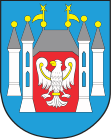
In 1997, the eagle in the city's coat of arms, which had been wearing the Prussian insignia since 1924 , was replaced by the Polish one.
Partnerships
Between 1991 and 2001 the municipality entered into the following town and municipality partnerships:
- Andrésy (France, 1997)
- Bad Freienwalde (Germany, May 4, 2001)
- Berlin district of Charlottenburg-Wilmersdorf (Germany, October 23, 1993)
- Halderberge (Netherlands, 1988)
- Haren (Germany, October 24, 1991)
- Vlagtwedde (The Netherlands, October 24, 1991).
structure
More than 25,000 people live in the urban-and-rural community. In addition to the town, the Międzyrzecz municipality includes 18 villages with a Schulzenamt and other small towns and settlements (number of inhabitants and German names in brackets):
- Bobowicko (663) (Bobelwitz)
- Bukowiec (860) (Bauchwitz)
- Gorzyca (265) (Upper Görzig)
- Kalsko (647) (Kalzig)
- Kaława (352) (Kalau)
- Kęszyca Leśna (611) (Kainscht)
- Kuligowo (142) (Kulkau)
- Kursko (301) (Kurzig)
- Kuźnik (144) (copper mill)
- Nietoperek (340) (Nipter)
- Pieski (253) (Pieske)
- Pniewo (285) (Osterwalde)
- Szumiąca (155) (Schindelmühl)
- Święty Wojciech (502) (Georgsdorf)
- Wysoka (196) (high forest)
- Wyszanowo (274) (wipe)
- Żółwin (114) (Solben)
Other places without a Schulzenamt are:
- Brzozowy Ług (Johanneshof)
- Głębokie (Glembuch)
- Jagielnik
- Jeleniogłowy (Gumpertshof)
- Kęszyca (Kainscht)
- Kęszyca-Kolonia
- Kolonia Nietoperek
- Kolonia Żółwin
- Kwiecie (Hohenbirken)
- Lubosinek
- Łęgowskie (Wilhelmsthal)
- Marianowo (Marianowo)
- Międzyrzecz-Wybudowanie
- Rojewo (Rhyn)
- Skoki
- Wojciechówek
- Zamostowo ( Saturday )
Museums
- Museum in Międzyrzecz Castle
- Fire Brigade Museum "Colonel Leon Kiszmanowicz" in Kęszyca Leśna.
Web links
Footnotes
- ↑ population. Size and Structure by Territorial Division. As of June 30, 2019. Główny Urząd Statystyczny (GUS) (PDF files; 0.99 MiB), accessed December 24, 2019 .
- ↑ The Genealogical Place Directory

