
Gmina Rakoniewice
| Rakoniewice | |||
|---|---|---|---|

|
|
||
| Basic data | |||
| State : | Poland | ||
| Voivodeship : | Greater Poland | ||
| Powiat : | Grodziski | ||
| Geographic location : | 52 ° 8 ' N , 16 ° 16' E | ||
| Residents : | s. Gmina | ||
| Postal code : | 62-067 | ||
| Telephone code : | (+48) 61 | ||
| License plate : | PGO | ||
| Economy and Transport | |||
| Street : | Wolsztyn - Poznań | ||
| Next international airport : | Poznań-Ławica | ||
| Gmina | |||
| Gminatype: | Urban-and-rural parish | ||
| Gmina structure: | 25 school offices | ||
| Surface: | 201.01 km² | ||
| Residents: | 13,241 (Jun. 30, 2019) |
||
| Population density : | 66 inhabitants / km² | ||
| Community number ( GUS ): | 3005043 | ||
| administration | |||
| Mayor : | Gerard Szymon Tomiak | ||
| Address: | os. M. Drzymały 25 62-067 Rakoniewice |
||
| Website : | www.rakoniewice.pl | ||

The Gmina Rakoniewice is an urban-and-rural municipality in the powiat Grodziski of the Greater Poland Voivodeship in Poland . Its seat is the city of the same name ( German Rakwitz ) with about 3600 inhabitants.
geography
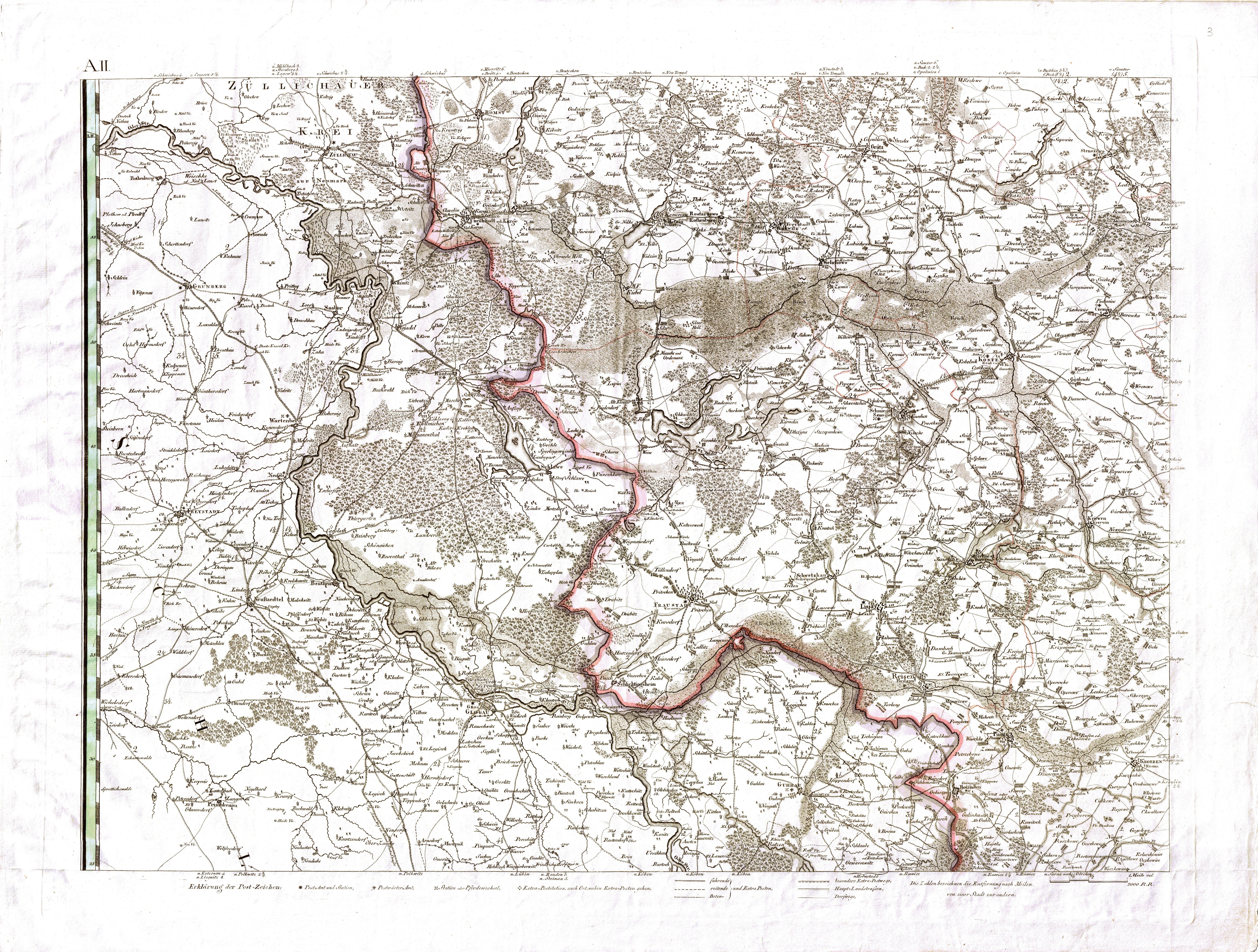
_location_map.png)
The municipality is located in the west of the voivodeship, the border with the Lubusz Voivodeship is 12-15 kilometers away. The voivodeship capital Poznan is about 40 kilometers northeast, Leszno (Lissa) about 30 kilometers southeast and the district town Grodzisk Wielkopolski (Grätz) two kilometers north. Neighboring communities are Nowy Tomyśl and Grodzisk Wielkopolski in the north, Kamieniec and Wielichowo in the east, Przemęt in the south and Wolsztyn and Siedlec in the west.
In the west of the municipality, the 42 kilometer long Dojca runs through several small lakes.
The community has an area of 201 km², 52 percent of which is used for agriculture and 41 percent for forestry.
history
The current municipality, interrupted by the German occupation in World War II - Rakoniewice was given the name Wiesenstadt in 1943 , and from 1919 to 1975 it belonged to the Wolsztyński Powiat of the Poznan Voivodeship with different layouts. - The German minority was expelled after the World War .
The rural municipality of Rakoniewice was dissolved in 1954 and repeatedly transformed into different gromadas . It was restored on January 1, 1973. From 1975 to 1998 the municipality belonged to the greatly reduced Poznan Voivodeship . The powiat was dissolved during this time. The town and country municipality of Rakoniewice were merged into the town and country municipality in 1990/1991. This has belonged to the Greater Poland Voivodeship and Powiat Grodziski since 1999.
structure
The city and country community (gmina miejsko-wiejska) Rakoniewice with 13,241 inhabitants (as of June 30, 2019) includes the city itself and 25 villages (German names until 1945) with school authorities (sołectwa):
- Adolfowo ( Adolfowo , 1939–1945 Adolfsruh )
- Blinek ( Blenke )
- Błońsko ( Blumsche Holland )
- Cegielsko ( Ciegelner Holland )
- Drzymałowo ( until 1939 Podgradowice; Pogradowitz , 1871–1919 / 1939 loyal to the emperor , 1940–1945 loyal to the people )
- Elżbieciny ( Elzbieciny , 1939–1945 Elisabethhof )
- Głodno ( Glodno , Gloden Holland , 1939–1945 Gloden )
- Gnin ( Gnin , 1939–1945 Gotthardswalde )
- Gola ( Gola , Goyla Holland , 1939–1943 Goile , 1943–1945 Obersanden )
- Goździn ( Guzdzin Holland )
- Jabłonna ( Jablonna )
- Komorówko
- Kuźnica Zbąska
- Łąkie
- Łąkie Nowe
- Narożniki ( Naroschnik , 1939–1945 Eckenwalde )
- Rakoniewice wieś ( Rakwitz Village )
- Rataje ( Rataje , 1939–1943 Rattai , 1943–1945 Treudorf )
- Rostarzewo ( Rostarschewo , also Rothenburg , 1939–1943 Rothenburg a / Obra , 1943–1945 Rothenburg ad Obra )
- Ruchocice ( Ruchocice , Rokatz , 1939–1945 Feldkirch (Kr. Wollstein) )
- Stodolsko ( Stodolsko , Stodolsker Holland , 1939–1945 Friedheim )
- Tarnowa ( Tarnowa , 1939 Tarnowo , 1939–1945 Kampfheide )
- Terespol ( Terespol , 1939–1945 Theresienau )
- Wioska ( Wioska , 1939–1945 Schlieffenwalde )
- Wola Jabłońska
Smaller villages in the municipality are Faustynowo and the hamlets Aleksandrowo, Głodno, Jelonek, Józefin, Krzewina, Rakoniewice, Ruchocice and Zamieście.
traffic
The national road DK32 leads in a west-east direction from the German-Polish border crossing Klein Gastrose - Sękowice via Zielona Góra (Landsberg an der Warthe) to Rakoniewice and Grodzisk Wielkopolski (Grätz) to Stęszew (Stenschewo) southeast of Poznan. The voivodeship road DW312 leads from Rakoniewice in the northwest via Wielichowo to Czacz (Schatz) in the southeast, where it reaches the national road DK5 . The DW305 runs from Nowy Tomyśl (Neutomischel) in the north through the west of the municipality via Wolsztyn (Wollstein) and Wschowa (Fraustadt) to the Lower Silesian Voivodeship in the south.
The nearest international airport is Poznań-Ławica .
Personalities
- Michał Drzymała (1857–1937), Polish farmer, known for his fight (1905–1909) against the Prussian authorities in the village of Kaisertreu . Two years after his death, Pogradowice was renamed Drzymałowo. A replica of his circus wagon is on display in Rakoniewice.
Web links
- City and municipality website (Polish)
- German topographic map: 3863 Rakwitz (1: 25000), edition 1940
- territorial.de: District of Rakwitz-Land (Wartheland)
Individual evidence
- ↑ population. Size and Structure by Territorial Division. As of June 30, 2019. Główny Urząd Statystyczny (GUS) (PDF files; 0.99 MiB), accessed December 24, 2019 .
- ↑ Order about change of place names in Reichsgau Wartheland in the ordinance sheet of the Reich governor in Warthegau from May 18, 1943 (PDF, 1.8 MB)
- ↑ rakoniewice.pl: Sołtysi Gminy Rakoniewice. (accessed on May 12, 2020)
- ↑ The Historical Place Directory
- ↑ a b c d e Cf. Deutsche Topograph. Map, 3863 Rakwitz
- ↑ a b c d e f g h i j Cf. web link of the district of Rakwitz (Land) in the Wartheland - local renaming
- ↑ a b c d e f g h i j David Gilly : Special map of South Prussia. (1803, accessed May 11, 2020)
- ^ Heinrich Wuttke : City book of the country of Posen. Codex diplomaticus: General history of the cities in the region of Poznan. Historical news from 149 individual cities . Leipzig 1864, p. 429.