
Kasserine Governorate
| القصرين Kasserine
|
|
|---|---|
  |
|
| Basic data | |
| Country | Tunisia |
| Capital | Kasserine |
| surface | 8066 km² |
| Residents | 439,243 (2014) |
| density | 54 inhabitants per km² |
| ISO 3166-2 | TN-42 |
Coordinates: 35 ° 10 ′ N , 8 ° 50 ′ E

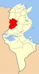
Kasserine ( Arabic ولاية القصرين, DMG wilāyat al-Qaṣrain ) is one of the 24 governorates in Tunisia . It is located in the west of the country on the border with Algeria . The governorate covers an area of 8066 km² at altitudes between 500 and 1550 m and has a total of about 440,000 inhabitants. The capital of the governorate is the city of Kasserine .
Delegations
The governorate has 13 delegations :
| delegation | 2004 residents |
Residents 2014 |
|---|---|---|
| Djedeliane | 13.205 | 12,297 |
| El Ayoun | 18,634 | 19,211 |
| Ezzouhour | 20,277 | 21,819 |
| Fériana | 45,787 | 51,455 |
| Foussana | 41,240 | 41,447 |
| Haidra | 8,716 | 9,762 |
| Hassi Ferid | 16,890 | 19,400 |
| Kasserine North | 58,343 | 65,322 |
| Kasserine South | 21,139 | 21,653 |
| Majel Bel Abbès | 21,909 | 23,315 |
| Sbeitla | 69,539 | 75,245 |
| Sbiba | 42.091 | 41,189 |
| Thala | 34,508 | 37,128 |
| total | 412.278 | 439.243 |
climate
The daytime temperatures are between 2 and 12 ° C in winter and between 30 and 40 ° C in summer. The annual average rainfall is less than 300 millimeters; Snow falls more frequently on the mountain peaks, but only rarely in the valleys and quickly melts in the daytime sun.
economy
The extraction of raw materials plays the greatest role in the region's economy, especially stone and clay, sand and lime. Another important raw material is half grass , which is used in the production of cellulose and paper as well as for weaving small bags and baskets. The smuggling of goods with neighboring Algeria also plays a role in the region's economic life.
nature
The Djebel Chambi biosphere reserve with the highest mountain in Tunisia ( Djebel Chambi , 1544 m), in which the proportion of forest is very high and in which many wild animals such as z. B. wild boar , partridge , hare , fox and jackal live. The Djebel Selloum (1373 m) and the Djebel Semmama (1314 m) also belong to the governorate. The area is crossed by the Oued Derb River , where the remains of the Roman Kasserine dam are located. The eastern border roughly corresponds to the course of the Oued Sbeitla, which dries almost all year round .
Culture

Between the biosphere reserve and the capital Kasserine lies the ancient Roman city of Cillium , most of which has not yet been excavated. A triumphal arch , two memorial buildings and a small theater have been preserved as high-rise buildings . The city fortifications date from the Byzantine period and a basilica from the early Christian period . The ruins of the Roman cities Sufetula ( Sbeitla ) and Ammaedara ( Haïdra ) are also on the territory of the governorate; there are hardly any traces of two other Roman cities ( Sufes near Sbiba and Thelepte near Fériana ).
Web links
Individual evidence
- ↑ Population statistics 2004 + 2014
- ↑ Kasserine climate diagrams
- ^ Archaeological sites in the governorate of Sidi Bouzid in the French Wikipedia