Gračac (Zadar)
|
Gračac Грачац |
||
|
||
|
|
||
| Basic data | ||
|---|---|---|
| State : |
|
|
| County : |
|
|
| Residents : | 4,690 (2011) | |
| Telephone code : | (+385) 023 | |
| Postal code : | 23 440 | |
| License plate : | ZD | |
| Structure and administration (status: 2013, cf. ) |
||
| Community type : | local community | |
| Mayor : | Nataša Turbić ( HDZ ) | |
| Website : | ||
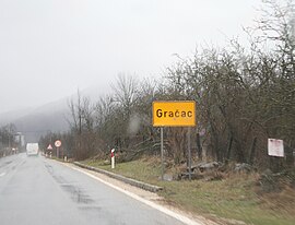
 Gračac town sign |
||
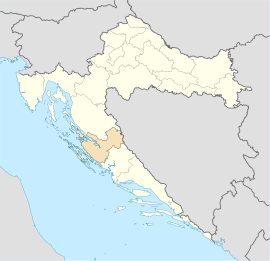
Gračac ( Serbian - Cyrillic Грачац ) is a small town in the south of the Lika region in Croatia . It is located south of Udbina , northwest of Obrovac and about 50 km southeast of Gospić . Gračac belongs to the Zadar County .
geography
Gračac lies in the middle of the Gračačko Polje plain in the lower Otuca river and not far from the Gradine karst height.
Place name
The name Gračac is derived from gradina , which means “old, abandoned castle”.
Population structure
Gračac itself has 3,063 inhabitants. The community has 4,690 inhabitants. According to the 2011 census, the proportion of:
The municipality consists of the following localities (naselja): Begluci, Brotnja, Bruvno, Cerovac, Dabašnica, Deringaj, Drenovac Osredački, Duboki Dol, Dugopolje, Glogovo, Grab, Gračac, Gubavčevo Polje, Kaldrma, Kijani, Kom, Kunovac Kupirovo, Kupirova Mazin, Nadvrelo, Neteka, Omsica, Osredci, Otrić, Palanka, Pribudić, Prljevo, Rastičevo, Rudopolje Bruvanjsko, Srb, Suvaja, Tiškovac Lički, Tomingaj, Velika Popina, Vučipolje, Zaklopac, Zrmanrelo, Zrmanja Vrmanja
Attractions
The Gračac lake and the Karstan hill Gradine are located near the town . The nearby Cerovac Caves are the largest explored caves in Croatia.
traffic
Several times a day there are buses and trains from Gračac from the direction of Zagreb or Knin . The closest motorway junction is Sveti Rok , about 20 km from Gračac.
Personalities
- Ilija Ivezić (1926–2016), actor

