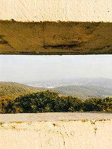
Hünenburg near Bielefeld
| Hünenburg | ||
|---|---|---|
|
View from the source (south) to the town of Bielefeld's Hünenburg: Hünenburg hilltop with the Hünenburg telecommunications tower |
||
| Creation time : | 340-200 BC Chr. | |
| Castle type : | Hilltop castle | |
| Conservation status: | Walls, remains of walls | |
| Standing position : | Fliehburg | |
| Construction: | Earthwork | |
| Place: | source | |
| Geographical location | 52 ° 0 '52 " N , 8 ° 28' 25.1" E | |
| Height: | 312.5 m above sea level NHN | |
|
|
||
The Bielefelder Hünenburg is a former Fliehburg at 312.5 m above sea level. NHN high Kuppe Hünenburg on the main ridge of the Teutoburg Forest . It is located in the area of the independent city of Bielefeld , North Rhine-Westphalia .
Geographical location
The former Hünenburg is located in the central part of the Teutoburg Forest in the TERRA.vita nature and geopark . It is located on the main mountain ridge around 4 km west-southwest of the Bielefeld core city in the north of the Quelle district , which belongs to the Brackwede district with the district of the same name . The Hoberge-Uerentrup district adjoins the Hoberge-Uerentrup district directly to the north of the area located on the summit region of the Hünenburg summit and on its southern flank , and the Peter auf'm Berge ( 225.7 m ) mountain pass along the road 778 ( Rote Earth –Uerentrup). The Hünenburgstraße, which branches off in the southwest from the L 756 running through the Bielefeld source, leads up to it. The ridge path of the Teutoburg Forest leads directly north past the Fliehburg as a hiking trail.
Fliehburg
The beginnings of the approximately 2.8 hectare fortification were determined by radiocarbon measurements in the period 200 ± 71 BC. Dated to the pre-Roman Iron Age . The mountain summit and the upper part of the south-western mountainside are enclosed by a ring-shaped earth terrace with a roughly trapezoidal course. It borders an area of around 400 by 300 meters. A short piece of dry stone wall was excavated, which had been placed as a facing in front of a two-meter-wide wooden structure. Since a quarry was operated on the southern slope of the hill in the Middle Ages , a lookout tower was built on the hill in the 19th century and two telecommunications towers were built one after the other in the 20th century , many traces of early history have been lost.
Signs were found that the interior of the ramparts was also used as a meeting place or place of worship .
Towers
Three emperors tower
In the area of the former Fliehburg, the observation tower Drei-Kaiser-Turm was built, which was started in the three-emperor year 1888 and completed in 1894. It was demolished in 1952.
Telecommunications towers
At the beginning of the 1950s, the then NWDR, as the lead broadcaster, was entrusted with developing the new medium of television . The Hamburg – Cologne transmission line required for this was planned and operated by the Deutsche Bundespost . This required a relay station between the Beckum telecommunications tower and the (old) Jakobsberg telecommunications tower . The Drei-Kaiser-Turm was not suitable for the installation of the newly developed FREDA directional radio devices ( frequency- modulated decimeter wave system ) along with horn antennas . In 1952 it had to give way to a telecommunications tower of the German Federal Post Office. This (old) tower was partially dismantled and is now used as an observation tower with a museum and café. From its 40 m high viewing platform with all-round visibility, a broad view of the Teutoburg Forest can be thrown. The amateur radio relay with the callsign DB0BI (FM radio in the 70 cm band ) is housed under the viewing platform .
In 1972, the telecommunications company was set on this tower and next to the (new) Hünenburg Telecommunication Tower built a 165 m high tower type (type FMT 3/72).
Events
Until 2017, the Queller Community held the Hünenburg Festival every year on Ascension Day on the mountain.
Individual evidence
- ↑ Topographical Information Management, Cologne District Government, Department GEObasis NRW ( Notes )
- ↑ a b c d e Hünenburg in: The castle and fortress Sparrenberg in Bielefeld , on die-sparrenburg.de
- ↑ The large radio link from north to south on fernsehmuseum.info, accessed on July 7, 2019
literature
- Torsten Capelle: Wall castles in Westphalia-Lippe. Published by the Antiquities Commission for Westphalia, Münster 2010, ISSN 0939-4745 , p. 21, no. FBW4 ( Early Castles in Westphalia special volume 1 )
- Klaus Günther: The Hünenburg, district-free city of Bielefeld. Early castles in Westphalia 4th published by the Antiquities Commission for Westphalia, Münster 2nd edition 2001.
Web links
- Hünenburg in: The castle and fortress Sparrenberg in Bielefeld , on die-sparrenburg.de
- TIM-online, geoportal of the state of North Rhine-Westphalia (rectangle of 6 × 10 km west of the Bielefeld place mark → rectangle of 500 x 700 m around the Hünenburg → services of the NRW Atlas → topographic maps → DTK off, DGK5 on → contour lines , Floor plan on [at some times the DTK5 cannot be opened)]
- Olaf Polan: Webcam DB0BI Bielefeld-Hünenburg. Retrieved March 6, 2019 .


