
Herlingsburg
| Herlingsburg | ||
|---|---|---|
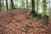
 Wooded Herlingsburg from the northwest |
||
| Creation time : | 210 ± 50 BC Chr. | |
| Castle type : | Hilltop castle | |
| Conservation status: | Trenches, ramparts and earthworks | |
| Standing position : | unknown assignment | |
| Construction: | Wooden posts set in earthwork with palisade | |
| Place: | Herlingsburg ground monument | |
| Geographical location | 51 ° 56 '54 " N , 9 ° 11' 18" E | |
| Height: | 345 m above sea level NHN | |
|
||


The Herlingsburg is a Latène period rampart and Fliehburg ( Volksburg ) in the eastern Lipper Bergland in the area of the municipalities of Lügde and Schieder-Schwalenberg in the Lippe district .
The cultural-historical ground monument is in an exposed location on the plateau-like 345 meter high Keuperberg. The archaeological evaluations show a pre-Roman Iron Age hill settlement of the late Latène period , which came into (warlike) use again by the Saxons in the Carolingian period of the 8th century .
Finding
Location, geology
The Herlingsburg is at an average altitude of 335-345 m above sea level. NN with an area of the main castle of about 7.2 hectares ( 7.5 hectares in total with outer bailey) on the plateau of the isolated Keuperberg above the villages of Eschenbruch and Glashütte (Schieder-Schwalenberg) (cadastre: TK 4021 Bad Pyrmont: r. 351290–351340, h. 575690–575745). The mountain is in front of the wooded ridge of the eastern "Lipper Bergland" (here "Blomberger Wald", forests near Blomberg ) between the north-west Barntrup , the south-west Schieder and the west Blomberg . In a southerly direction, the mountain rises steeply over the valley of the Emmer opposite the ridge of the Schwalenberg Forest . In the north and west, the location is only moderately steep, whereas in the east it is on a steep slope. The land is owned by the Lippe Regional Association under the administration of the Schieder Forestry Office.
The geological subsoil of the Herlingsburg, the keuper Berg, consists of upper keuper with quartzite - sandstone benches together, the steep slope to the Emmertal towards consists of marl of the middle keuper with some emerging water sources .
Type of attachment, condition
The ramparts, up to four meters high, enclose an area of almost six hectares. The only gate faces north. It is protected by ramparts and terraces down the slope. The water supply was secured by a well in which medieval pottery was found. The arrangement of the outer bastions and the tracks recognizable outside the ring wall in the south-west show a feeder that essentially corresponds to today's forest management routes. The southern slope, with its multiple terracing and framing by a weak wall, is regarded as pasture for the residents of the settlement. It also contains a spring horizon with several spring troughs.

Entrance area of the ramparts
Wall at the entrance area

Wall in the south

Wall in the west


Finds
During the excavations by Schuchhardt, in addition to numerous spindle whorls, only ceramic shards were found, the shapes and designs of which vary. The temporal spectrum of the ceramics shows two phases. The first points to the late Latène of the pre-Roman Iron Age from 250 BC to the Roman Empire in the early 1st century. The second phase points to the early Middle Ages of the Carolingian period from the beginning of the 8th century to the beginning of the 10th century. The majority of the shards are rather thick-walled and consist of finely marbled clay with a simple, leather-like muddy surface. Finer goods in fewer numbers have a very thin-walled quality with a black-toned polished surface. Fragments reveal a spectrum of decorations, ranging from simple, indiscriminate strokes to stye-like impressions. In comparison with ceramics from the find and excavation sites “Sachsenlager” from Tönsberg and “ Piepenkopf ” near Dörentrup , they show the same spectrum of coarse, medium and fine ceramics, but in contrast the coarse goods at Herlingsburg are almost completely absent.
Research history
The Herlingsburg is the best preserved height fortification in East Westphalia-Lippe from the pre-Roman Iron Age in a scenic and typical location. In this room there is no fortification system with such a consistent adaptation to the terrain conditions with a favorable starting point for defense purposes. Two archaeological investigations (1902 Otto Weerth and 1967 Friedrich Hohenschwert ) by the Lippisches Landesmuseum showed that the facility had been in continuous use for more than a thousand years. The cullet material discovered in 1902, the investigations carried out that year on wall profiles and the radiocarbon dating of the remains of wooden posts in 1967 established an older Latène-era construction. The strong main wall with an outer and inner double wooden shell wall was not built until the Saxon re-fortification of the strategically exposed place.
It is still uncertain at the moment whether the Herlingsburg was used as a fortress or a refuge for the population, to control long-distance routes or for representation purposes. It is also speculative that the beginning of the name Herling - suggests the Germanic tribe of the Cherusci who lived here around the birth of Christ . From 1713 the ramparts, which had been unused for centuries, separated the two principalities of Waldeck-Pyrmont and Lippe .
See also
literature
- Heinz Dietz: Cultural and historical soil antiquities in Lippe . In: Heimatland Lippe - magazine of the Lippischer Heimatbund , special issue No. 4, Lippischer Heimatbund (ed.). Detmold 1967. (with map sheet maps) ( digitized )
- Friedrich Hohenschwert : Prehistoric and early historical fortifications in Lippe . In: Lippische Studien , Vol. 4, Landesverband Lippe (Ed.). (Also as: Publications of the Antiquities Commission in the Provincial Institute for Westphalian State and Folk Research Landscape Association Westphalia-Lippe , Vol. 5). Verlag FL Wagener, Lemgo 1978, ISBN 3-921428-21-1 , OCLC 213744362 .
- Heinrich Beck , Hartmut Bötcher , Herbert Jankuhn : Fortifications and fortifications . In: Reallexikon der Germanischen Altertumskunde , Vol. 2, Heinrich Beck, Herbert Jankuhn, Kurt Ranke, Reinhard Wenskus (eds.). De Gruyter, Berlin - New York 1976, ISBN 3-11-006740-4 , pp. 140-147.
- Carl Schuchhardt : Schieder . In: Reallexikon der Germanischen Altertumskunde , Vol. 4, 1st edition, Johannes Hoops (Ed.). Karl Trübner, Strasbourg 1918–19. P. 94.
- Carl Schuchhardt: People's castles . In: Reallexikon der Germanischen Altertumskunde , 1st edition, vol. 4, Johannes Hoops (ed.). Karl Trübner, Strasbourg 1918–19. Pp. 434-441.
Individual evidence
- ^ Hohenschwert: pp. 96, 98
- ↑ Hohenschwert: p. 98
- ↑ Hohenschwert: p. 104
- ^ Report on Otto Weerth's excavations, accessed on June 26, 2010
Web links
- Entry on Herlingsburg in the scientific database " EBIDAT " of the European Castle Institute