Hamadan Province
|
استان همدان Hamadan
|
|
|---|---|
| Location of Hamadan Province in Iran | |
| Basic data | |
| Country | Iran |
| Capital | Hamadan |
| surface | 19,368 km² |
| Residents | 1,738,234 (2016 census) |
| density | 90 inhabitants per km² |
| ISO 3166-2 | IR-24 |
Coordinates: 34 ° 55 ' N , 48 ° 35' E
Hamadan ( Persian استان همدان, DMG Ostān-e Hamedān , also Ostān-e Hamadān ) is a province in northwestern Iran . The capital is also called Hamadan .
1,738,234 people live in the province (2016 census). The area of the province extends to 19,368 square kilometers. The population density is 88 inhabitants per square kilometer.
geography
Hamadan is located in the northwestern part of Iran. In addition to the city of Hamadan, the cities of Twiserkan , Nahavand , Malayer , Assad Abad , Bahar , Razan and Kabudrahang are in the province.
The population is made up of different ethnic groups, including Kurds , Lurs , Persians and Azerbaijanis .
Administrative division
The districts are listed with area and population (2016 census):
| Surname | Area in km² | population |
|---|---|---|
| Assad Abad | 1,411 | 100.901 |
| Bahar | 1,321 | 119,082 |
| Hamadan | 4.161 | 676.105 |
| Kabudrahang | 3,855 | 126,062 |
| Malayer | 3,301 | 288,685 |
| Nahavand | 1,487 | 178,787 |
| Razan | 2,548 | 107,587 |
| Twiserkan | 1,458 | 101,666 |
| total | 19,545 | 1,738,234 |
history

In New Assyrian times, Hamadan was part of the Mannaean kingdom . The capital of the Medes , Ekbatana, is also near today's Hamadan. After the Medes and Persians, the Macedonians ruled Hamadan. After the establishment of the Parthian Empire , the city became the summer residence of the Parthian kings. The Sassanids also used the city as a residence. In 642 the decisive battle between the Sassanids and the invading Arabs took place near Nehawend . With the defeat of the Sassanids, the Islamization of Iran began.
After the Arab caliphs , the Bujids ruled this area. In the 11th century the Seljuks made Hamadan their capital instead of Baghdad . Hamadan was destroyed under Timur Lenk . When the Safavid Empire was founded, the region experienced an upswing. The Ottomans , the Safavids' eternal rivals, conquered the area in the 18th century. However, they had to withdraw after a loss to Nadir Shah . Since then, Hamadan has remained in the possession of the Persians. The region also gained importance due to its location on the Silk Road .
Attractions
The Iranian Cultural Heritage Organization (ICHO) lists 442 places of historical and cultural importance in the province. These include the following locations:
- Tomb of the poet Baba Taher
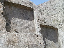
- Ganj Nameh inscriptions by Dareios I "the Great" and Xerxes I.
- Grave of Esther and Mordechai
- Ali Sadr Cave (Ardeles)
- Avicenna's tomb
- Waterfall in Ganj Nameh
- Stone lion from Hamadan
- Qorban building
- Alavian's tomb
- Eram Park
- Ekbatana , capital of the Medes Empire
- Imam (Pahlavi) Square
- Alvand Mountains
- Grand bazaar of Mozafarieh
Colleges
- Bu-Ali Sina University
- Hamdan University of Medical Sciences
- Azad Islamic University of Hamedan
- Hamedan Payam Nur University
- Hamedan University of Technology
- Payam Nur University of Bahar
- Payam Nur University of Kabutar Ahang
- Payam Nur University by Malayer
- Toyserkan Payam Nur University
- Azad Islamic University Toyserkan
- Azad Islamic University of Malayer
- Payam Nur University of Razan
See also
Web links
- HAMADĀN . In: Ehsan Yarshater (Ed.): Encyclopædia Iranica (English, including references)
Individual evidence
- ↑ City Population: Iran - Cities and Provinces .


