Hartau (Zittau)
|
Hartau
City of Zittau
Coordinates: 50 ° 51 ′ 22 " N , 14 ° 48 ′ 26" E
|
|
|---|---|
| Height : | 265 m |
| Area : | 5.28 km² |
| Residents : | 516 (March 31, 2016) |
| Population density : | 98 inhabitants / km² |
| Incorporation : | January 1, 1999 |
| Postal code : | 02763 |
| Area code : | 03583 |
|
Location of Hartau in the area of the city of Zittau
|
|
Hartau is a district of Zittau in the Görlitz district in southeast Saxony , on the border with the Czech Republic . The formerly independent community was incorporated into the city of Zittau in 1999. Hartau has about 600 inhabitants.
Geography and traffic
Hartau is located at the foot of the Zittau Mountains near the border triangle with the Czech Republic and Poland at an altitude of 240 to 283 m above sea level. NN . Hartau consists of two parts: Alt-Hartau along the Neisse and Neu-Hartau further south-west. The Pfaffenbach flows through Hartau, the Neu-Hartau location extends along the Goldbach. To the north rises the Tonberg ( 260 m ), south of the Hahnberg ( Kohoutí vrch , 535 m ), Lindeberg ( Sedlecký Špičák , 544 m ), Pfaffenstein ( Popova skála , 565 m ) and the Mühlsteinberg ( 482 m ), to the southwest of the Heideberg ( 549 m ), Zigeunerberg ( 510 m ) and the Töpfer ( 582 m ) as well as the Rote Höhe ( 271 m ) to the west .
Hartau can be reached from Zittau via State Road 132 , from which there is both a northern and a southern access road. The Oder-Neisse cycle path leads through Hartau . In Alt-Hartau there is a border crossing for pedestrians, cyclists and riders to Loučná , a district of the neighboring Czech municipality of Hrádek nad Nisou (Grottau) .
history
The older street village of Alt-Hartau has probably existed since the 13th century, the settlement of Neu-Hartau did not begin until 1725 and experienced a significant expansion with the start of lignite mining . The name is probably derived from the Old High German word harth for mountain forest. In 1375 the place belonging to the Grafenstein lordship was first mentioned as Harte in a document. Since 1384 the city of Zittau had rights to the place, which were only interrupted in the time of the Upper Lusatian Pönfall . In addition to agriculture and fish farming, the residents of Hartau lived from weaving and gardening until lignite mining was added as a source of income around 1835. Initially, the coal was mined underground , from 1903 to 1953 in open-cast mining . A cross-border educational trail deals with the history of that industrial era.
As early as 1931 there had been political disputes in Hartau about a possible connection to the city of Zittau. The occasion at that time was the vacancy of the mayor, which had to be refilled. Although the municipal council had decided the incorporation with seven out of thirteen votes, at the end of June 1931 109 applicants applied for a municipal citizens' vote, which took place on July 5th. 305 of 602 community citizens voted against the association and only 41 for it. So the connection to the city of Zittau had to be omitted according to the local law at the time.
After the Second World War, farmers from LPG Weißbachtal cultivated the meadows and fields, some of which were created by converting fish ponds into meadow areas. The main source of income was cattle breeding.
In Neu-Hartau, and later also in Alt-Hartau, tourism, mostly as a sideline, gained in importance. A few holiday apartments and guest houses were built, especially after 1990. There are currently around 30 guest beds.
The cross-border free school Schkola is of regional importance today .
Memorials
- Soviet memorial cemetery in 1947 (remodeled 1967) known on the street for 13 Hartauer name and 255 unknown Soviet prisoners of war , and women and men during the Second World War deported to Germany and victims of forced labor were
Culture and sights
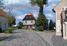
- Half-timbered houses
- Old school from 1780, a two-storey building with a half-hipped roof
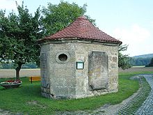
- Röhrhäusel from 1726, Hartau's landmark. A sandstone house with an octagonal floor plan that was used to collect spring water for the expanded old Zittau water pipeline from 1544 until 1864.
- Fishing boundary stone from 1565, the last one of a series of fishing boundary stones along the Neisse and Weißbach rivers, which was restored and re-erected near the old school.
- Club center in Alt-Hartau, a three-sided courtyard that was extensively renovated in the 1990s and is used for exhibitions, parties and club activities.
Hiking destinations and natural monuments
- Tri-border point
- Karlsfried castle ruins
- Fox pulpit
- Weißbachtal
- Eagle owl stones
- potter
- Scharfenstein
In Czech Republic:
- Kristýna swimming lake
- Grabštejn Castle
- Sedlecký Špičák (German Lindeberg) (544 m)
- Popova skála (German Pfaffenstein)
- Czechoslovak Wall
- Raven stones
literature
- The south-eastern Upper Lusatia with Zittau and the Zittau Mountains (= values of the German homeland . Volume 16). 1st edition. Akademie Verlag, Berlin 1970, pp. 221-223.
- Friedrich Eckarth: Chronica, or historical description of the village Hartau bey Zittau. 1734 ( digitized version )
- Carl Gottlob Moráwek : History of Hartau near Zittau . Zittau 1873 ( digitized version )
Web links
- Web presence of the city of Zittau
- CFT Rudowsky: Directory of the entire localities of the Kingdom of Saxony ... after the census on December 3, 1855. Ramming, Dresden 1857, p. 25. "Harthau"
Individual evidence
- ↑ Stadtanzeiger No. 281 (April 2016). (PDF; 2.1 MB) (No longer available online.) Zittau city administration, April 10, 2016, archived from the original on April 19, 2016 ; Retrieved April 19, 2016 . Info: The archive link was inserted automatically and has not yet been checked. Please check the original and archive link according to the instructions and then remove this notice.
- ↑ Area changes from January 1, 1999 to December 31, 1999 (PDF; 21 kB) State Statistical Office of the Free State of Saxony , p. 9 , accessed on January 2, 2013 .
- ^ Hartau in the Digital Historical Directory of Saxony
- ↑ Christopher Schmidt: Immediate community democracy in central and southern Germany during the Weimar Republic . Baden-Baden 2007, ISBN 978-3-8329-2607-6 , pp. 179 .


