Heiligenberg (Heidelberg)
| Heiligenberg | |
|---|---|
|
The Heiligenberg seen up the Neckar, Neuenheim in the foreground |
|
| height | 439.1 m above sea level NHN |
| location | Heidelberg , Baden-Württemberg ( Germany ) |
| Mountains | Odenwald |
| Coordinates | 49 ° 25 '33 " N , 8 ° 42' 22" E |
| rock | Red sandstone |
The Heiligenberg is 439.1 m above sea level. NHN high mountain in the Heidelberger districts Neuenheim and Handschuhsheim and after on the other side of the Neckars standing Koenigsstuhl ( 570.3 m ) of the lower of the two Hausberge Heidelberg.
Surname
In Carolingian times, the Holy Mountain was called Aberinsberg , before it was named " All Saints Mountain " (Latin: " mons omnium sanctorum ") after the colonies of St. Michael and St. Stephan were settled in 1265 by Premonstratensians from the All Saints Monastery in the Black Forest .
geography
location
The Heiligenberg lies on the western edge of the Odenwald to the Bergstrasse and the wide Upper Rhine Plain in front of it . It is located in the Heidelberg urban area east-northeast of Neuenheim and east-southeast of Handschuhsheim. To the south is the flat-topped Michelsberg ( 375.5 m ). The Heiligenberg drops steeply to the west into the plain and to the south into the Neckar valley , beyond which the Königstuhl rises above the old town of Heidelberg in the river valley. In the north the Kerbtal with the Rombach or Mühlbach flowing to the Kanzelbach separates the Heiligenberg from the Hohen Nistler , in the northeast a mountain saddle connects with the more distant White Stone .
Natural allocation
The Heiligenberg belongs to the natural spatial main unit group Odenwald, Spessart and Südrhön (14) and in the main unit Sandstone-Odenwald (144) to the subunit Central Sandstone Ooden Forest (144.6). The landscape falls to the southeast into the subunit Eastern Little Odenwald (144.2). To the south it descends into the Heidelberger Taltrichter subunit (226.2) and to the west into the Südliche Bergstrasse subunit (226.3), both of which belong to the Bergstrasse main unit (226) in the Northern Upper Rhine Lowland main unit group (22) .
history
Prehistoric use
Due to its prominent location, the Heiligenberg offered a wide view of the plain and the Neckar valley as well as natural protection. It was therefore settled since the early Neolithic ( linear ceramic culture around 5500-5100 BC ), which is evidence of stone axes and shards of vessels. At the time of the Urnfield Culture (around 1200 BC) there was a large closed settlement on the mountain. From the 1st half of the 1st millennium BC Celts settled here permanently. The remains of a double Celtic ring wall that once enclosed the main and the front summit still bear witness to their settlement . The Celts obtained their water from cisterns in which they collected rainwater, as well as from the contained source of the bitter fountain .
Excavations show that iron ore was smelted here as early as the early La Tène period . A shaft on the Heiligenberg extends 78 meters deep into the rock.
The settlement on the Heiligenberg was from the 5th century BC. BC up to the Roman period the political, religious and cultural center of the region. Around 200 BC BC the center of rulership shifted westward to the valley level in Roman Lopodunum , today's Ladenburg .
Roman times
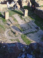
In Roman times , the summit carried a sacred area with stone buildings, of which the foundation walls of a north-facing Mercurius sanctuary with an apse in the nave of the Michael's basilica still testify today . Archaeological finds include consecration stones with Latin inscriptions, according to which they were donated to the god Mercurius Cimbrianus , the Mercurius of the Cimbri . This suggests a place of worship for the Germanic god Wodan . This summit sanctuary apparently survived until around AD 600, because graves were still being dug around the sanctuary at that time.
Occasionally the Heiligenberg is equated with the Mons Piri mentioned by Ammian , on which the troops of Emperor Valentinian I carried out excavation work in a campaign in 369, but were driven out by Teutons.
Royal court and monastery buildings
There are a few individual finds from the 4th to 5th century, and the mountain was repopulated at the end of the 6th century. Christian burials can be traced back to the 7th century at the latest. In the Carolingian period , in the 8th century, some stone buildings were built over the sanctuary. It could have been a building for the king's representative. In the 9th century, Lorsch Abbey built the first church on the main summit, including a Roman building, which was consecrated to the Archangel Michael . In the year 882 the Heiligenberg was mentioned for the first time in writing as "Aberinesberg" when Ludwig III. transferred the Heiligenberg to the Lorsch Abbey during the funeral of his father ( Ludwig the German ) in Lorsch .
The early Romanesque church building of Michael's monastery, which is still in ruins, dates from the late 10th century in the eastern part, the western parts date from around 1030. The design of the entire complex is attributed to Abbot Reginbald . Around the time the monastery was built around the year 1000, a water pipe was also built from a spring on the White Stone to near the monastery, which meant that the weaker pouring Bittersbrunnen lost its importance for the water supply on the mountain.
In 1094 the second monastery was founded on the Aberinesberg with the St. Stephen's monastery. Lady Hazecha was buried in it in 1100, her grave slab is considered the oldest medieval written monument in Heidelberg.
With the takeover of the Lorsch monastery by the Archbishop of Mainz in 1226, the Benedictine period on the Heiligenberg also ended. After a short interlude of the Cistercians, Premonstratensians from the Allerheiligen monastery in the Black Forest settled in the two monasteries. During the Mainz collegiate feud in 1460, the Michaelskloster was destroyed and then rebuilt. In 1503 the bell tower on the Heiligenberg collapsed and killed three priests. A little later the monastery must have been given up, because Jakob Micyllus describes the Michaelskloster in 1537 as a ruin.
Decay of the monastery buildings

In the course of the Reformation, the monasteries on the Heiligenberg were withdrawn in 1555 by the Count Palatine. The still intact St. Stephen's Monastery was assigned to Heidelberg University in 1589 . The university senate decided to demolish the monasteries and sell the stones. The oldest depiction of the Michaelskloster by Matthäus Merian in the Topographia Palatinatus from 1645 shows the monastery already as a ruin, but still with largely preserved walls and the crossing tower .
At the same time, the first historical preoccupation with the mountain had begun during the Renaissance. Philipp Melanchthon studied the Roman inscriptions in St. Michael's Church in 1508. In 1613, the Heidelberg professor Freher referred to a prehistoric fortress in the Origenes Palatinae on the Heiligenberg, which he, however, wrongly ascribed to the Romans.
During the Thirty Years' War and the War of the Palatinate Succession, the Heiligenberg moved into the background of the historical development, as a result of which Heidelberg was completely destroyed and rebuilt from 1697 onwards. The German Romantics had a much more representative destination with the ruins of the Heidelberg Castle , so they climbed the Heiligenberg at most because of the view of the castle.
The Philosophenweg on the southern slope of the mountain, from which the vaunted view of the old town and castle is offered to this day, was created in 1837–41 through the expansion of vineyard paths. Viticulture on the southern slope was given up a little later. The numerous dry stone walls that terraced the slope remained and that now divide house gardens and parks along the way.
Modern exploration of the mountain
Research in modern times did not begin until Karl Christ , who rediscovered the ramparts on the Heiligenberg in 1860, correctly assigned them to the Celts and carried out smaller excavations in 1881/82. The first major investigation and uncovering of the Michael's basilica in 1886 goes back to the archaeologist Wilhelm Schleuning . At about the same time, the observation tower was opened at the ruins of St. Stephen's monastery, and stones were once again broken out of the monastery ruins to build it. In 1903, the Heidelberg Bismarck Tower was built on the southern slope of the mountain .
In 1907, under conservator Karl Pfaff, new excavations took place on the ramparts, building supervisor Carl Koch dug in 1921, 1929 and 1932 at the Michaelsbasilika. Celtic finds came to light during the construction of the Waldschenke inn in 1929, and prehistoric and Roman finds during the construction of the Thingstätte in 1934. From 1936 to 1938 Paul Hans Stemmermann explored the Heidenloch .
Rehabilitation and conservation of the ruins
After the Second World War, Berndmark Heukemes in particular did research on the Heiligenberg. He succeeded in proving the Celtic smelting of iron, specifying the Roman sanctuary and rediscovering the Bitter Fountain.
Since, despite the ongoing research, the ruins on the mountain were left to decay, the first safety measures began in 1970 with the installation of a concrete core in the north-west tower of St. Michael's Basilica. In 1973 the Heiligenberg Protection Association was founded to preserve the ruins. In 1978 the city of Heidelberg and the State Monuments Office worked out a concept for further excavations and structural securing of the Michael's basilica. After gradual renovation and conservation, the former Michaelskloster was opened to the public in 1984. The Roman Temple of Mercury and the Frankish royal court were made visible with stone markings. In 1980 the reconstructed Bittersbrunnen was completed. In 1987 the Heidenloch was dug out and covered with a shelter.
With the securing and development of the ruins on the Heiligenberg, its rediscovery began as an excursion destination. The Thingstätte, used by the city only sporadically for cultural events in the post-war period, became the backdrop for an annual celebration on Walpurgis Night with up to 20,000 visitors from the 1980s.
Buildings on the Heiligenberg
Celtic ring wall
On Heiligenberg there are remains of a double Celtic ring wall from the 4th century BC. BC, who once protected an extensive settlement on the summit.
Bitter fountain
The bitter fountain was already used by the Celts to supply water and was located within the lower ring wall. The fountain was redesigned in the Romanesque period . Romanesque components were preserved until after the Second World War. Destroyed by a landslide, the fountain was restored to its present form in 1980.
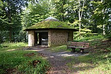
Heidenloch
The exact time and function of the 55 meter deep Heidenloch are unknown. Presumably it is a cistern or a well shaft that was built in Roman times. In 1987 the shaft was exposed and a refuge was built over it.
Michael's Monastery
The ruins of the basilica, built in 1023, and the monastery of St. Michael are located on the main summit of the mountain, where a temple had already been located in Roman times.
Stephansloster
The ruins of St. Stephen's Monastery are the remains of the second monastery on the Heiligenberg, which was built by the Benedictine monk Arnold around the year 1090 .
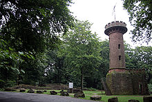
Heiligenberg Tower
The Heiligenberg Tower is a lookout tower at St. Stephen's Monastery, which was built in the 19th century from stones from this monastery.
Philosophers' Way
The Philosophenweg is a walking and hiking trail running from Neuenheim on the southern slope of the Heiligenberg, which originated from vineyard trails in 1837-41 and was expanded with numerous small parks over the years. Memorial stones along the way remember u. a. to the poet Friedrich Hölderlin or to the defunct Dagersbach settlement .
Bismarck Tower
The Heidelberg Bismarck Tower , a memorial to the first Reich Chancellor , was built in 1903 on the southern slope of the Heiligenberg above the Philosophenweg and is accessible by stairs.
Thing place
The Thingstätte is a large open-air theater that was built in 1934/35 based on a design by Hermann Alker based on the example of ancient Greek theaters. It lies on the saddle between the Heiligenberg and the Michelsberg.
Individual evidence
- ↑ a b c Map services of the Federal Agency for Nature Conservation ( information )
- ↑ Josef Schmithüsen : Geographical land survey: The natural space units on sheet 161 Karlsruhe. Federal Institute for Regional Studies, Bad Godesberg 1952. → Online map (PDF; 5.1 MB)
- ↑ a b Peter Marzolff, Uwe Gross: Between Mercury and Michael: The Heiligenberg near Heidelberg in the migration period and the early Middle Ages . In: Heiko Steuer, Volker Bierbrauer (Ed.): Hill settlements between antiquity and the Middle Ages from the Ardennes to the Adriatic Sea (= supplementary volumes to the Reallexikon der Germanischen Altertumskunde 58), de Gruyter, Berlin 2008, ISBN 978-3-110-20235-9 , Pp. 121-163
- ↑ CIL 13, 6399 , CIL 13, 6402 , AE 1921, 52 ; Another Mercury inscription from Heiligenberg: CIL 13, 6400 .
literature
- Wolfgang von Moers-Messmer: The Heiligenberg near Heidelberg. A guide through its history and ruins. Published by the Schutzgemeinschaft Heiligenberg e. V., 1987.
- Peter Marzolff : The Heiligenberg . In: Elmar Mittler (Ed.): Heidelberg. History and shape . Universitätsverlag C. Winter, Heidelberg 1996. ISBN 3-921524-46-6 , pp. 38-45.
- Renate Ludwig , Peter Marzolff: The Heiligenberg near Heidelberg . Theiss, Stuttgart 1999. 2nd edition 2008 ( Guide to archaeological monuments in Baden-Württemberg, vol. 20). ISBN 978-3-8062-2261-6 .
- Martin Schemm: The Heidenloch. 3. Edition. Regional culture publishing house, Ubstadt-Weiher / Heidelberg / Basel 2004. ISBN 3-89735-165-X
- Peter Marzolff, Uwe Gross: Between Mercury and Michael: The Heiligenberg near Heidelberg during the Migration Period and the Early Middle Ages . In: Heiko Steuer, Volker Bierbrauer (Hrsg.): Hill settlements between antiquity and the Middle Ages from the Ardennes to the Adriatic (= supplementary volumes to the Reallexikon der Germanischen Altertumskunde 58), de Gruyter, Berlin 2008, ISBN 978-3-110-20235-9 , Pp. 121-163
- Research on Heiligenberg near Heidelberg (= research and reports on the archeology of the Middle Ages in Baden-Württemberg, vol. 32). Theiss, Stuttgart 2012, ISBN 978-3-8062-2791-8
Web links
- Detailed description with many pictures by Thomas Juelch ( Memento from June 29, 2011 in the Internet Archive ), from uni-heidelberg.de
- Heiligenberg near Heidelberg - Heiligenberg ground monument , on baden-wuerttemberg.de


