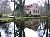
Holzhausen am Ammersee
|
Holzhausen am Ammersee
Municipality of Utting am Ammersee
Coordinates: 48 ° 0 ′ 28 ″ N , 11 ° 5 ′ 17 ″ E
|
|
|---|---|
| Height : | 565 m above sea level NN |
| Area : | 2.61 km² |
| Residents : | 282 (May 25 1987) |
| Population density : | 108 inhabitants / km² |
| Postal code : | 86919 |
| Area code : | 08806 |
|
St. Ulrich Church
|
|
Holzhausen am Ammersee is a district of Utting am Ammersee in the Upper Bavarian district of Landsberg am Lech .
geography
Holzhausen is located directly on the Ammersee -Westufer at an altitude of 559 m above sea level. NN . According to the census of May 25, 1987, the Kirchdorf Holzhausen had 282 inhabitants, there were 110 buildings or 142 residential units.
history
Holzhausen was mentioned in a document in 776, when Isanhart from the Huosi family bequeathed some of his estates, including Holzhusun (meaning: houses on wood) to Schlehdorf Monastery .
In 1226 Otto Fues von Bernried had the right of patronage . In the 14th century, the Dießen monastery already owned the so-called lower and upper courtyards .
When the St. Ulrichskirche was mentioned as a parish church in 1456, Holzhausen consisted of only four properties. This kept Placidus Braun in its history established the diocese of Augsburg. At that time the place had parish rights.
In 1652 14 properties were registered, nine of which belonged to the Dießen monastery and six to the Füssen hospital . Also in 1831 there were 14 houses with 74 inhabitants.
Holzhausen belonged to the former municipality of Rieden , which was formed in 1819 from the tax district of the same name and territorially identical . Until the community was formed in 1819, Holzhausen belonged to the Hofmark St. Georgen in the Landsberg district court , which was owned by the Dießen monastery. On July 1, 1972, Rieden was largely incorporated into Dießen , only an area of 261.21 hectares with Holzhausen came to Utting. The Rieden district was thus divided. Holzhausen is now part of the Rieden district (or part of the district) in the municipality of Utting am Ammersee.
Holzhausen artists' colony
Around 1900 artists settled here, spent weekends and holidays in studio summer houses, met and celebrated parties.
The Holzhausen painters belonged to the artist group “ Die Scholle ”, which was founded in Munich in 1899. The name "Scholle" comes from a verse by the writer Michael Georg Conrad :
"Have to plow your own clod, let the smart neighbors cackle."
Artist
- Eduard Thöny (1866–1950)
- Fritz Erler (1868–1940)
- Erich Erler (1870–1946)
- Adolf Münzer (1870–1953)
- Walter Georgi (1871-1924)
- Mathias Gasteiger (1871–1934)
- Anna Gasteiger (1877–1954)
- Clara Ewald (1859-1948)
- Paul Neu (1881–1940)
- Kurt Kühn (1880–1957)
- Reinhold Max Eichler (1872–1947)
- Leopold Durm (1878–1918)
- Franz Siegele (1885–1955)
Culture and sights
The place gained fame as an artist village. In Holzhausen, the maypole bears motifs that were modeled on Paul Neu (1881–1940). Heinz Rohrmoser, related to Neu, also let the artist be the godfather of one of the “weather investigators” who decorate the roofs of his property.
The artist's house Gasteiger with a landscape garden of the Bavarian Administration of State Palaces, Gardens and Lakes , where Anna Karolina Sophie and Mathias Gasteiger lived and worked, is located on the shore of the lake in Holzhausen . Today, civil weddings are popular in the farmer's parlor in the artist's villa.
The small museum with changing exhibitions is open in the Gasteiger House on Sundays from April to October. But even if the museum cannot be visited, a walk through the landscape park directly on the Ammersee to this artist's villa with its well-tended farm and flower garden is worthwhile.
The St. Ulrich branch church, a simple building with a Romanesque nave core and semicircular choir, has a low onion dome, the top of which was built around 1800.
- Gasteiger artist house
Soil monuments
See: List of soil monuments in Utting am Ammersee
Important facilities
- BVS training center in Holzhausen
Individual evidence
- ^ Official register of places for Bavaria, territorial status: May 25, 1987, Munich, 1991 , page 103
- ↑ Historical Atlas, page 188
- ^ Joseph Anton Eisenmann and Karl Friedrich Hohn: Topo-geographical-statistical lexicon of the Kingdom of Bavaria, Erlangen 1831
- ↑ Historical Atlas of Bavaria
- ^ Wilhelm Volkert (ed.): Handbook of Bavarian offices, communities and courts 1799–1980 . CH Beck, Munich 1983, ISBN 3-406-09669-7 , p. 507 .
- ↑ Starnberger SZ , accessed on September 16, 2015


