Horasan
| Horasan | ||||
|
||||
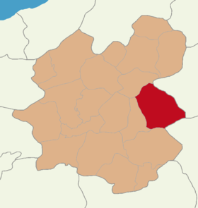
 Location of Horasan within Erzurum |
||||
| Basic data | ||||
|---|---|---|---|---|
| Province (il) : | Erzurum | |||
| Coordinates : | 40 ° 2 ' N , 42 ° 10' E | |||
| Telephone code : | (+90) 442 | |||
| Postal code : | 25 800 | |||
| License plate : | 25th | |||
| Structure and administration (as of 2019) | ||||
| Structure : | 87 Mahalles | |||
| Mayor : | Abdulkadir Aydın ( AKP ) | |||
| Postal address : | Kazım Karabekir Mahallesi Yavuz Selim Caddesi No: 48/1 25800 Horasan / ERZURUM |
|||
| Website: | ||||
| Horasan County | ||||
| Residents : | 39,445 (2018) | |||
| Surface: | 1,740 km² | |||
| Population density : | 23 inhabitants per km² | |||
| Kaymakam : | Cüneyt Caner | |||
| Website (Kaymakam): | ||||
Horasan ( Kurdish : Xuristan ) is a city in the district of the same name in the Turkish province of Erzurum and at the same time a district of the Büyükşehir belediyesi Erzurum (metropolitan municipality / metropolitan province ) created in 1993 . Horasan is located in the east of the province and borders the provinces of Ağrı and Kars .
The name Horasan was given to the city by Turkish tribes from the Khorasan area . The place was previously called Üskühat / Skuhat . Horasan was part of several empires, but since the victory of the Seljuks in 1071 it has been almost exclusively under Turkish rule. Since 1514 it was part of the Ottoman Empire . Then as now, Horasan was part of the Erzurum Vilayet. With the victory of the Russians over the Ottomans in the war in 1878 , Horasan formed the border between the Ottomans and Russians together with Sarıkamış and Eleşkirt . In 1952 Horasan received the status of a Belediye (municipality) and became an independent district on December 4, 1953 (tr: İlçe).
sons and daughters of the town
- Nurullah Genç (* 1960), Turkish poet and economist
Web links
- Mahallelere Göre Erzurum HOrasan (List of all districts from 2013, with population and gender)
- Horasan Mahalleleri Nüfusu Erzurum (List of all districts 2012–2018, with population figures )
Individual evidence
- ↑ Nufusu.com Türkiye Nüfusu , accessed October 10, 2019


